- Divide, Colorado
-
Divide, Colorado — CDP — Divide from Ute Pass
Motto: Center of the Known Universe Location within the state of Colorado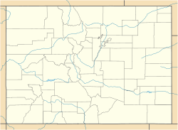
 Divide, Colorado
Coordinates: 38°56′31″N 105°09′28″W / 38.94194°N 105.15778°WCoordinates: 38°56′31″N 105°09′28″W / 38.94194°N 105.15778°W Country  United States
State  State of Colorado
County Teller County[1] Government – Type unincorporated town Elevation 9,165 ft (2,793 m) Population (2010) – Total 127 Time zone MST (UTC-7) – Summer (DST) MDT (UTC-6) ZIP code[2] 80814 Area code(s) 719 Divide is a census-designated place and a U.S. Post Office in Teller County, Colorado, United States. The population as of the 2010 Census was 127.[3] Divide sits on the north slope of Pikes Peak on U.S. Highway 24. Ute Pass is immediately west of town. The Divide Post Office has the ZIP Code 80814.[2]
Divide is a growing, planned community. Divide is planned in three areas: the town center, rural residential land parcels, and larger rural land parcels.
Contents
History
Divide was originally called Hayden's Divide after geologist Ferdinand Vandeveer Hayden, the original surveyor of the area; settlers in the 1880s shortened the name to Divide. Divide was so named because water run-offs divide to the north, south, east and west of its location.
Geography
Divide is located at 38°56′31″N 105°09′28″W / 38.94194°N 105.15778°W (38.942054,-105.157871), at the western intersection of U.S. Highway 24 and State Highway 67 (The highways overlap east to Woodland Park).
See also
- Colorado Springs Metropolitan Statistical Area
- Front Range Urban Corridor
- List of cities and towns in Colorado
References
- ^ "US Board on Geographic Names". United States Geological Survey. 2007-10-25. http://geonames.usgs.gov. Retrieved 2008-01-31.
- ^ a b "ZIP Code Lookup" (JavaScript/HTML). United States Postal Service. December 22, 2006. http://zip4.usps.com/zip4/citytown.jsp. Retrieved December 22, 2006.
- ^ Colorado Trend Report 2: State and Complete Places (Sub-state 2010 Census Data). Missouri Census Data Center. Accessed 2011-02-25.
External links
Municipalities and communities of Teller County, Colorado Cities 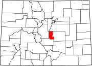
Town CDPs Divide | Florissant | Goldfield | Midland
Unincorporated
communityGhost town Footnotes ‡This populated place also has portions in an adjacent county or counties
Categories:- Populated places in Teller County, Colorado
- Census-designated places in Colorado
- Pikes Peak


Wikimedia Foundation. 2010.