- Berthoud, Colorado
Infobox Settlement
government_type = Statutory Towncite web | url = http://www.dola.state.co.us/dlg/local_governments/municipalities.html | title = Active Colorado Municipalities | format =HTML | publisher = State of Colorado, Department of Local Affairs | accessdate = 2007-09-01]
settlement_type = Town
official_name = Town of Berthoud, Colorado
nickname = The Garden Spot of Colorado
motto =
postal_code_type = ZIP Code
postal_code = 80513cite web | url = http://zip4.usps.com/zip4/citytown.jsp | title = ZIP Code Lookup| format =JavaScript /HTML | publisher =United States Postal Service | accessdate = September 3 | accessyear = 2007]
imagesize =
image_caption =
image_
imagesize =
image_caption =
image_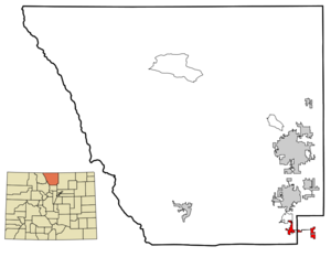
mapsize = 250x200px
map_caption = Location of Berthoud shown within theState of Colorado
mapsize1 =
map_caption1 =
subdivision_type = Country
subdivision_name = USA
subdivision_type1 = State
subdivision_name1 = flag|Colorado|name=State of Colorado
subdivision_type2 = Counties
subdivision_name2 = Larimer County Weld County
leader_title = Mayor
leader_name = Tom Patterson
leader_title1 = Mayor "pro tem"
leader_name1 = David Gregg
established_title =
established_date =
established_title2 = Incorporated
established_date2 =August 28 ,1888 cite web | url = http://www.colorado.gov/dpa/doit/archives/muninc.html | title = Colorado Municipal Incorporations | format =HTML | publisher = State of Colorado, Department of Personnel & Administration, Colorado State Archives | date =2004-12-01 | accessdate = 2007-09-02]
named_for =Edward L. Berthoud
area_magnitude =
area_total_km2 = 10.5
area_total_sq_mi = 4.1
area_land_km2 = 10.3
area_land_sq_mi = 4.0
area_water_km2 = 0.2
area_water_sq_mi = 0.1
area_water_percent = 2.22
area_urban_km2 =
area_urban_sq_mi =
area_metro_km2 =
area_metro_sq_mi =
population_as_of = 2000
population_note =
population_total = 4,839
population_density_km2 = 470.6
population_density_sq_mi = 1,219.7
population_metro =
population_density_metro_km2 =
population_density_metro_sq_mi =
population_urban =
timezone = MST
utc_offset = -7
timezone_DST = MDT
utc_offset_DST = -6
latd = 40 |latm = 18 |lats = 25 |latNS = N
longd = 105 |longm = 4 |longs = 30 |longEW = W
elevation_m = 1533
elevation_ft = 5030
website = [http://www.ci.berthoud.co.us/ Town of Berthoud]
area_code = 970
blank_name = FIPS code
blank_info = 08-06255
blank1_name = GNIS feature ID
blank1_info = 0178065
footnotes =The Town of Berthoud is a Statutory Town located in Larimer County and Weld County,
Colorado ,United States . Berthoud is situated north of theLittle Thompson River , approximately halfway between the cities ofFort Collins, Colorado andDenver, Colorado along theFront Range Urban Corridor . The population of Berthoud was 4,839 at the 2000 census.Geography
Berthoud is located at coor dms|40|18|25|N|105|4|30|W|city (40.306899, -105.075136)GR|1.
According to the
United States Census Bureau , the town has a total area of 4.1square mile s (10.5km² ), of which, 4.0 square miles (10.3 km²) of it is land and 0.1 square miles (0.2 km²) of it (2.22%) is water.Demographics
As of the
census GR|2 of 2000, there were 4,839 people, 1,821 households, and 1,331 families residing in the town. Thepopulation density was 1,219.7 people per square mile (470.6/km²). There were 1,883 housing units at an average density of 474.6/sq mi (183.1/km²). The racial makeup of the town was 93.18% White, 0.23% African American, 0.56% Native American, 0.60% Asian, 0.06% Pacific Islander, 3.86% from other races, and 1.51% from two or more races. Hispanic or Latino of any race were 8.06% of the population.There were 1,821 households out of which 42.0% had children under the age of 18 living with them, 60.0% were married couples living together, 9.4% had a female householder with no husband present, and 26.9% were non-families. 22.1% of all households were made up of individuals and 7.9% had someone living alone who was 65 years of age or older. The average household size was 2.65 and the average family size was 3.12.
In the town the population was spread out with 29.4% under the age of 18, 7.0% from 18 to 24, 33.7% from 25 to 44, 21.3% from 45 to 64, and 8.6% who were 65 years of age or older. The median age was 36 years. For every 100 females there were 101.0 males. For every 100 females age 18 and over, there were 96.7 males.
The median income for a household in the town was $52,672, and the median income for a family was $58,491. Males had a median income of $43,676 versus $29,861 for females. The
per capita income for the town was $25,037. About 1.7% of families and 3.1% of the population were below thepoverty line , including 2.8% of those under age 18 and 9.4% of those age 65 or over.Community
Berthoud is a small town surrounded largely by farmland, nicknamed the "Garden Spot of Colorado." In many parts of town, trees overarch the city streets. There is an annual community parade on "Berthoud Day", which occurs in early June and ends in Berthoud Park, where families gather and enjoy music in a picnic-like atmosphere. Another community event held annually in June is "Berthoud Outdoor Quilt Show", in which quilters display their works in Fickel Park. Through the summer, the town also plays host to its farmers' market which occurs every Thursday and is sponsored by the town's main street organization. The town also has several parks, including Berthoud Park (which has an outdoor swimming pool, playground and tennis court), Fickel Park (which also has a tennis court), and Roberts Lake Park. Berthoud plays host to a burgeoning arts community that includes the Berthoud Dance Company, the Berthoud Arts and Humanities Alliance and the Wildfire Community Arts Center, which includes the
Wildfire Theater Company .History
White settlers first came to the present-day Berthoud area in the early 1860s, following the
Colorado Gold Rush . Many settlers filed homestead claims, but most bellied up and left the valley to hardier souls who ranched and farmed the arid prairie that straddled the river bottom.In 1872, a miner-turned-rancher from
Central City, Colorado , Lewis Cross, staked the first homestead claim where theColorado Central Railroad planned to cross Little Thompson creek. When the tracks were laid through the valley in 1877 a depot, section house, and water tank were installed at this strategic site. The tiny settlement known as Little Thompson was renamed Berthoud in honor ofEdward L. Berthoud , who had surveyed the rail route through the valley.Over the next few years the settlement grew to include a handful of homes, a blacksmith shop, a mercantile store, a small
grain elevator , and a log cabin that served as school and church for the community.In the early 1880s, the Colorado Central Railroad recognized that Berthoud's location on the river bottom caused their steam-powered locomotives to labor excessively to ascend the grade out of the valley. At their urging, during the winter of 1883-84, the buildings of the town were loaded on skids and pulled by teams of draft animals to the town's present-day location on the bluff one mile north of the river.
Agriculture in the Berthoud area flourished. Farmers diverted water from the Little and
Big Thompson River s into a network of reservoirs and ditches that allowed the arid uplands to be irrigated. Harvests of alfalfa, sugar beets, wheat, corn, and barley were sold on the open market or used to fatten pens of sheep and cattle. The town grew as merchants and shopkeepers set up businesses to serve farmers and ranchers from the nearby countryside.In 1886, the Welch Addition doubled the size of the Berthoud as town boundaries extended south beyond present-day Mountain Avenue for the first time. A year later a hose company was hastily formed to protect the town from fire after the Davis & Hartford Mercantile store burned to the ground. In 1888 a town board was elected and within a short time they hired a marshal to keep the peace and light the street lamps. By the early 1900s, Berthoud sported a business district on Third Street and Massachusetts and Mountain Avenues.
In the 1920s Mountain Avenue became part of a paved state highway system which would become
U.S. Route 287 connecting the larger towns of northern Colorado. In 2007, Highway 287 was rerouted to the north and west of Berthoud, bypassing downtown Berthoud and eliminating Mountain Avenue from the highway route.Schools & Education
Students from the area attend the four public schools which are part of the
Thompson School District : two elementary schools (Berthoud Elementary and Ivy Stockwell), a centrally located middle school (Turner Middle School), and a high school (Berthoud High School). There is also aHead Start preschool and several private preschools such as Little "t" Preschool, and the 5th Street College.In June, 2007,
Aims Community College purchased approximately 40 acres of land in Berthoud atInterstate 25 and Colorado State Highway 56, announcing plans to build a state-of-the-art regional campus. [ [http://www.berthoud.org/aimscc.php The Official Web Site of the Town of Berthoud, Colorado ] ] , [ [http://www.aims.edu/about/president.htm Aims Community College: Mission Statement ] ]News and Media
The town has two weekly newspapers, The Old Berthoud Recorder and The Berthoud Weekly Surveyor. Daily newspaper coverage is provided by the Loveland Daily Reporter Herald and the Longmont Times Call.
ee also
*
Colorado municipalities
*Denver-Aurora-Boulder Combined Statistical Area
*Fort Collins-Loveland Metropolitan Statistical Area
*Front Range Urban Corridor
*Greeley Metropolitan Statistical Area
*Larimer County, Colorado
*State of Colorado
*Weld County, Colorado References
External links
* [http://www.berthoud.org/ Town of Berthoud website]
** [http://www.dot.state.co.us/App_DTD_DataAccess/Downloads/CityMaps/Berthoud.pdf CDOT map of the Town of Berthoud]
* [http://www.berthoudcolorado.com/ Chamber of Commerce]
* [http://www.berthoudmainstreet.org/ Berthoud Main Street Organization]
* [http://www.berthoudfire.org/ Town Fire Department]
* [http://www.berthoudhabitat.org/ The Town's Habitat For Humanity Organization]
* [http://www.starkids.org/ The Little Thompson Observatory]
* [http://www.berthoudhistoricalsociety.org/ The Little Thompson Valley Pioneer Museum] operated by the Berthoud Historical SocietyNews and media links
* [http://www.berthoudrecorder.com/ The Berthoud Recorder]
* [http://www.berthoudsurveyor.com/ The Berthoud Weekly Surveyor]
* [http://www.lovelandfyi.com/ The Loveland Daily Reporter Herald]
* [http://www.longmontfyi.com/ The Longmont Times Call]
Wikimedia Foundation. 2010.