- Jamestown, Colorado
Infobox Settlement
official_name = Town of Jamestown, Colorado
other_name =
native_name =
nickname =
settlement_type =Town
motto =
imagesize =
image_caption =
flag_size =
image_
seal_size =
image_shield =
shield_size =
image_blank_emblem =
blank_emblem_type =
blank_emblem_size =
imagesize =
image_caption =
flag_size =
image_
seal_size =
image_shield =
shield_size =
image_blank_emblem =
blank_emblem_type =
blank_emblem_size =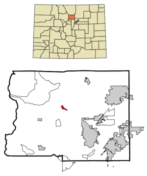
mapsize = 250x200px
map_caption = Location in Boulder County and the state ofColorado
mapsize1 =
map_caption1 =
image_dot_
dot_mapsize =
dot_map_caption =
dot_x =
dot_y =
pushpin_
pushpin_label_position =
pushpin_map_caption =
pushpin_mapsize =
subdivision_type = Country
subdivision_name = USA
subdivision_type1 = State
subdivision_name1 = flag|Colorado
subdivision_type2 = Countycite web | url = http://www.dola.state.co.us/dlg/local_governments/municipalities.html | title = Active Colorado Municipalities | format =HTML | publisher = State of Colorado, Department of Local Affairs | accessdate = 2007-09-01]
subdivision_name2 = Boulder
subdivision_type3 =
subdivision_name3 =
subdivision_type4 =
subdivision_name4 =
government_footnotes =
government_type = Statutory Town
leader_title =
leader_name =
leader_title1 =
leader_name1 =
leader_title2 =
leader_name2 =
leader_title3 =
leader_name3 =
leader_title4 =
leader_name4 =
established_title =
established_date =
established_title2 = Incorporated (town)
established_date2 =June 22 ,1883 cite web | url = http://www.colorado.gov/dpa/doit/archives/muninc.html | title = Colorado Municipal Incorporations | format =HTML | publisher = State of Colorado, Department of Personnel & Administration, Colorado State Archives | date =2004-12-01 | accessdate = 2007-09-02]
established_title3 =
established_date3 =
area_magnitude =
unit_pref = Imperial
area_footnotes =
area_total_km2 = 1.7
area_land_km2 = 1.7
area_water_km2 = 0
area_total_sq_mi = 0.7
area_land_sq_mi = 0.7
area_water_sq_mi = 0
area_water_percent =
area_urban_km2 =
area_urban_sq_mi =
area_metro_km2 =
area_metro_sq_mi =
area_blank1_title =
area_blank1_km2 =
area_blank1_sq_mi =
population_as_of = 2000
population_footnotes =
population_note =
population_total = 205
population_density_km2 = 120.6
population_density_sq_mi = 292.9
population_metro =
population_density_metro_km2 =
population_density_metro_sq_mi =
population_urban =
population_density_urban_km2 =
population_density_urban_sq_mi =
population_blank1_title =
population_blank1 =
population_density_blank1_km2 =
population_density_blank1_sq_mi =
timezone = Mountain (MST)
utc_offset = -7
timezone_DST = MDT
utc_offset_DST = -6
latd = 40 |latm = 6 |lats = 56 |latNS = N
longd = 105 |longm = 23 |longs = 15 |longEW = W
elevation_footnotes = GR|3
elevation_m = 2111
elevation_ft = 6926
postal_code_type =ZIP code cite web | url = http://zip4.usps.com/zip4/citytown.jsp | title = ZIP Code Lookup| format =JavaScript /HTML | publisher =United States Postal Service | accessdate = 2007-10-14]
postal_code = 80455
area_code = 303
blank_name = FIPS code
blank_info = 08-39195
blank1_name = GNIS feature ID
blank1_info = [http://geonames.usgs.gov/pls/gnispublic/f?p=gnispq:3:::NO::P3_FID:0204677 0204677]
blank2_name = Highways
blank2_info = none
website =
footnotes =The Town of Jamestown is a Statutory Town located in Boulder County,
Colorado ,United States . The population was 205 at the 2000 census. It was named for James Smith, an early discoverer ofgold . [ [http://www.fs.fed.us/r2/arnf/about/history/Boulder/index.shtml US Forest Service: "On the name "Jamestown""] Retrieved on2008 -2-21]Geography
Jamestown is located at coor dms|40|6|56|N|105|23|15|W|city (40.115485, -105.387531)GR|1.
According to the
United States Census Bureau , the town has a total area of 0.6square mile s (1.7km² ), all of it land.The only restaurant in Jamestown is the Jamestown Mercantile. The locals call it the Merc. The Merc serves meals and has live music on some nights. Across the street from the Merc is a public park. There is a group of people who meet there daily to play horseshoes.
Demographics
As of the
census GR|2 of 2000, there were 205 people, 96 households, and 52 families residing in the town. Thepopulation density was 314.2 people per square mile (121.8/km²). There were 102 housing units at an average density of 156.3/sq mi (60.6/km²). The racial makeup of the town was 97.56% White, 0.98% Asian, 0.49% Pacific Islander, and 0.98% from two or more races. Hispanic or Latino of any race were 0.49% of the population.There were 96 households out of which 26.0% had children under the age of 18 living with them, 47.9% were married couples living together, 3.1% had a female householder with no husband present, and 44.8% were non-families. 30.2% of all households were made up of individuals and 5.2% had someone living alone who was 65 years of age or older. The average household size was 2.14 and the average family size was 2.74.
In the town the population was spread out with 19.0% under the age of 18, 2.0% from 18 to 24, 46.3% from 25 to 44, 26.8% from 45 to 64, and 5.9% who were 65 years of age or older. The median age was 39 years. For every 100 females there were 101.0 males. For every 100 females age 18 and over, there were 100.0 males.
The median income for a household in the town was $67,500, and the median income for a family was $73,250. Males had a median income of $46,042 versus $31,875 for females. The
per capita income for the town was $29,904. About 5.9% of families and 5.4% of the population were below thepoverty line , including none of those under the age of eighteen and 46.7% of those sixty five or over.ee also
*
State of Colorado
**Colorado cities and towns
***Colorado municipalities
**Colorado counties
***Boulder County, Colorado
**Colorado metropolitan areas
***Boulder Metropolitan Statistical Area
***Denver-Aurora-Boulder Combined Statistical Area
***North Central Colorado Urban Area
***Front Range Urban Corridor
*United States Forest Service
**Roosevelt National Forest References
External links
* [http://www.dot.state.co.us/App_DTD_DataAccess/Downloads/CityMaps/Jamestown.pdf CDOT map of the Town of Jamestown]
Wikimedia Foundation. 2010.