- Mead, Colorado
-
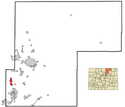
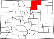
Town of Mead, Colorado — Town — Motto: A little town with a big future Location in Weld County and the state of Colorado Coordinates: 40°13′29″N 104°59′19″W / 40.22472°N 104.98861°WCoordinates: 40°13′29″N 104°59′19″W / 40.22472°N 104.98861°W Country  United States
State  Colorado
County[1] Weld Platted February 16, 1906 Incorporated (town) March 17, 1908[2] Government - Type Statutory Town[1] Area - Total 4.4 sq mi (11.5 km2) - Land 4.3 sq mi (11.2 km2) - Water 0.1 sq mi (0.3 km2) Elevation[3] 5,003 ft (1,525 m) Population (2010) - Total 3,405 - Density 458.4/sq mi (175.4/km2) Time zone Mountain (MST) (UTC-7) - Summer (DST) MDT (UTC-6) ZIP code[4] 80542 Area code(s) 970 FIPS code 08-49600 GNIS feature ID 0202568 Website Town of Mead Mead is a Statutory Town in Weld County, Colorado, United States. The population was 2,017 at the 2000 census.
Mead was mentioned as the origin of a silver dolphin pendant in Bones, Season 2, Episode 11. Some outside scenes from the movie Die Hard 2 starring Bruce Willis were filmed at the Highlandlake Church near Mead (Of note is that "Highlandlake" is spelled as one word as opposed to two words, e.g., "Highland Lake"). As of 2011, there are no traffic signal lights in the town of Mead. The telephone central office for Mead (exchange 535) was recently upgraded to provide more advanced calling features, including DSL. Another upgrade of note is that the "all volunteer" fire department now has a full-time staff. Also of note is that Mead High School opened south of the town of Mead in 2009. There had previously been a high school in Mead, but it closed in the early 1960s. The motto of the town has been "the little town that could" although this has not been ubiquitously used in all literature or signage. Alternatively, and on the Mead web site the motto is, "A little town with a big future".
Contents
History
The Town of Mead was platted on February 16, 1906 and incorporated on March 17, 1908. The Town of Mead was named for Dr. Martin Luther Mead by his son, Paul Martin Mead, who founded the town. Dr. Mead was the first medical doctor in this area and a brother of "Deacon" Loren C. Mead, who founded the nearby community of Highlandlake, CO. The founder of the Town of Mead, was the nephew of Highlandlake founder, "Deacon” L. C. Mead, who had emigrated from Chicago and built his homestead at what is now Highlandlake. L. C. Mead was well known locally for his work with the Highland Ditch Company while that Company was surveying and building Highland Lake on his property. The Highland Ditch and its reservoir system was one of the first farm irrigation systems in the country and was, at that time, a subject of wide agricultural study at many of the country’s agricultural education institutions. The small unincorporated community of Highlandlake is still in existence and is located approximately 1 ½ miles northwest of Mead.Page text.[5]
In 1905 the Great Western Railroad built a feeder line from Longmont to Johnstown to gather and take the sugar beet harvest to their refinery in Longmont. The railway passed directly through Paul Mead’s property. It was decided by the businesses at Highlandlake to relocate to this railway siding, which led Paul to plat a new town adjacent to the tracks. For the next two decades the Town prospered as farmers used this siding to get their crops to the market.
In her memorial tribute to her mother, Areit Palmer Mead (wife of Paul Mead), Paul and Aret's oldest daughter, MyraImogene Mead Cope wrote,"I can remember the founding of the little town of Mead, Colorado in 1906, on one corner of the farm. The Great Western Sugar company was putting in a railroad for the transporting beets to the sugar mill, and had located a beet dump where the tracks cut across a corner of the farm. With all of the farmers coming there with their crop, it seemed the logical site for a town, and Mead, the logical name for it, as the land had been originally homesteaded by Grandpa Mead (Dr. Martin Luther Mead). Mother and father laid out the plans for the town, named the streets, and were active in developing the new community, as they had been in the older one (Highlandlake). They wanted it to be a good town, with no "evil element," and had it stipulated in the titles to all of the lots that they sold, that liquor was not to be sold on any of the property, ever."[6]
At its peak, Mead had three general stores, a hotel, a combination grocery store and meat market, two saloons, a butcher shop, a filling station, two auto garages, an implement company, two livery stables, a lumberyard, a blacksmith shop, a drug store, a hoe and harness repair shop, a post office, two doctors’ offices, two banks, a bank (Mead First National and Farmer's) and a newspaper (Mead Messenger). Two of the churches in existence then are still active today. There was also a pickle factory, a hay mill and a pea-hulling factory on the outskirts of the community.[5]
There are indications a pickle plant existed before the Great Depression.[7] The pickle plant was part of the Empson canning factory in Longmont. In Mead, cucumbers were sorted and cleaned before being sent to Longmont to be canned.
An additional note: The Church of Christ - Congregational of Highlandlake, is the official name of the church building where some outside scenes of the church in DieHard II with Bruce Willis were filmed. Originally built in 1896, the church is owned by Historic Highlandlake, Inc, the local historical society for the Highlandlake/Mead area, and is listed on the National Registry of Historic Places. The building has been maintained by members of the Highlandlake community as a community center since 1917, after the church closed its doors.
Guardian Angels Roman Catholic Church celebrates its centennial year in 2011. Artists and photographers frequently stop to capture Guardian Angels Church in their work. It is easily seen when driving from Interstate 25 west into Mead.
The Highlandlake community was the original town site of what later became the Town of Mead, CO. For more information on the history of Highlandlake and Mead, visit Historic Highlandlake's website at. www.HistoricHighlandlake.org
Geography
Mead is located at 40°13′29″N 104°59′19″W / 40.22472°N 104.98861°W (40.224781, -104.988573)[8]. It sits approximately 35 miles north of the State Capitol in Denver.
According to the United States Census Bureau, the town has a total area of 4.4 square miles (11 km2), of which, 4.3 square miles (11 km2) of it is land and 0.1 square miles (0.26 km2) of it (2.71%) is water.
Demographics
As of the census[9] of 2010, there were 3,405 people, 1,215 housing units (1,164 occupied), and 573 families residing in the town. The population density was 468.2 people per square mile (180.7/km²). There were 663 housing units at an average density of 153.9 per square mile (59.4/km²). The racial makeup of the town was 95.69% White, 0.15% African American, 0.59% Native American, 0.50% Asian, 1.83% from other races, and 1.24% from two or more races. Hispanic or Latino of any race were 6.94% of the population.
There were 641 households out of which 52.4% had children under the age of 18 living with them, 82.2% were married couples living together, 5.0% had a female householder with no husband present, and 10.5% were non-families. 7.5% of all households were made up of individuals and 2.2% had someone living alone who was 65 years of age or older. The average household size was 3.15 and the average family size was 3.31.
In the town the population was spread out with 34.8% under the age of 18, 4.9% from 18 to 24, 35.7% from 25 to 44, 20.3% from 45 to 64, and 4.3% who were 65 years of age or older. The median age was 34 years. For every 100 females there were 101.5 males. For every 100 females age 18 and over, there were 96.7 males.
The median income for a household in the town was $79,298, and the median income for a family was $81,433. Males had a median income of $55,455 versus $32,596 for females. The per capita income for the town was $31,483. About 0.7% of families and 2.0% of the population were below the poverty line, including 2.6% of those under age 18 and 5.2% of those age 65 or over.
See also
- Colorado municipalities
- Denver-Aurora-Boulder Combined Statistical Area
- Front Range Urban Corridor
- Greeley Metropolitan Statistical Area
- State of Colorado
- Weld County, Colorado
References
- ^ a b "Active Colorado Municipalities". State of Colorado, Department of Local Affairs. http://www.dola.state.co.us/dlg/local_governments/municipalities.html. Retrieved 2007-09-01.
- ^ "Colorado Municipal Incorporations". State of Colorado, Department of Personnel & Administration, Colorado State Archives. 2004-12-01. http://www.colorado.gov/dpa/doit/archives/muninc.html. Retrieved 2007-09-02.
- ^ "US Board on Geographic Names". United States Geological Survey. 2007-10-25. http://geonames.usgs.gov. Retrieved 2008-01-31.
- ^ "ZIP Code Lookup" (JavaScript/HTML). United States Postal Service. http://zip4.usps.com/zip4/citytown.jsp. Retrieved November 22, 2007.
- ^ a b [1], additional text.
- ^ "Remembrance of Things Past"-by Myrogene (Mead) Cope. May 15, 1969. Record in the Highlandlake Historical Society Archives
- ^ This information comes from a 2003 submission by Marvin Hubenthal to the historichighlandlake.org website.
- ^ "US Gazetteer files: 2010, 2000, and 1990". United States Census Bureau. 2011-02-12. http://www.census.gov/geo/www/gazetteer/gazette.html. Retrieved 2011-04-23.
- ^ "American FactFinder". United States Census Bureau. http://factfinder.census.gov. Retrieved 2008-01-31.
External links
"Mead Colorado's Weather Station since 1997"
Municipalities and communities of Weld County, Colorado County seat: Greeley Cities Brighton‡ | Dacono | Evans | Fort Lupton | Greeley | Longmont‡ | Northglenn‡ | Thornton‡
Towns CDP Unincorporated
communitiesAdna | Auburn | Briggsdale | Carr | Galeton | Gill | Hereford | Highlandlake | Lucerne | Prospect Valley | Roggen | Stoneham | Tampa | Wattenburg
Ghost towns Footnotes ‡This populated place also has portions in an adjacent county or counties
Categories:- Populated places in Weld County, Colorado
- Towns in Colorado
Wikimedia Foundation. 2010.


