- Aristocrat Ranchettes, Colorado
Infobox Settlement
name = Aristocrat Ranchettes, Colorado
other_name =
native_name =
nickname =
settlement_type =census-designated place
motto =
imagesize =
image_caption =
flag_size =
image_
seal_size =
image_shield =
shield_size =
image_blank_emblem =
blank_emblem_type =
blank_emblem_size =
imagesize =
image_caption =
flag_size =
image_
seal_size =
image_shield =
shield_size =
image_blank_emblem =
blank_emblem_type =
blank_emblem_size =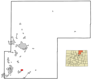
mapsize = 250x200px
map_caption = Location in Weld County and theState of Colorado
mapsize1 =
map_caption1 =
image_dot_
dot_mapsize =
dot_map_caption =
dot_x =
dot_y =
pushpin_
pushpin_label_position =
pushpin_map_caption =
pushpin_mapsize =
subdivision_type = Country
subdivision_name = USA
subdivision_type1 = State
subdivision_name1 = flag|Colorado|name=Colorado
subdivision_type2 = County
subdivision_name2 = Weld CountyGR|3
subdivision_type3 =
subdivision_name3 =
subdivision_type4 =
subdivision_name4 =
government_footnotes =
government_type =unincorporated community
leader_title =
leader_name =
leader_title1 =
leader_name1 =
leader_title2 =
leader_name2 =
leader_title3 =
leader_name3 =
leader_title4 =
leader_name4 =
established_title =
established_date =
established_title2 =
established_date2 =
established_title3 =
established_date3 =
area_magnitude =
unit_pref = Imperial
area_footnotes =
area_total_km2 = 4.8
area_land_km2 = 4.8
area_water_km2 = 0
area_total_sq_mi = 1.9
area_land_sq_mi = 1.9
area_water_sq_mi = 0
area_water_percent =
area_urban_km2 =
area_urban_sq_mi =
area_metro_km2 =
area_metro_sq_mi =
area_blank1_title =
area_blank1_km2 =
area_blank1_sq_mi =
population_as_of = 2000
population_footnotes =
population_note =
population_total = 1254
population_density_km2 = 261.3
population_density_sq_mi = 660
population_metro =
population_density_metro_km2 =
population_density_metro_sq_mi =
population_urban =
population_density_urban_km2 =
population_density_urban_sq_mi =
population_blank1_title =
population_blank1 =
population_density_blank1_km2 =
population_density_blank1_sq_mi =
timezone = MST
utc_offset = -7
timezone_DST = MDT
utc_offset_DST = -6
latd = 40 |latm = 6 |lats = 33 |latNS = N
longd = 104 |longm = 45 |longs = 38 |longEW = W
elevation_footnotes = GR|3
elevation_m = 1525
elevation_ft = 5003
postal_code_type =ZIP code
postal_code = 80621
area_code =
blank_name = FIPS code
blank_info = 08-03015
blank1_name = GNIS feature ID
blank1_info = [http://geonames.usgs.gov/pls/gnispublic/f?p=gnispq:3:::NO::P3_FID:1852836 1852836]
website =
footnotes =Aristocrat Ranchettes is a
census-designated place (CDP) in Weld County,Colorado ,United States . The population was 1,254 at the 2000 census.Geography
Aristocrat Ranchettes is located at coor dms|40|6|33|N|104|45|38|W|city (40.109229, -104.760555)GR|1.
According to the
United States Census Bureau , the CDP has a total area of 1.9square mile s (4.8km² ), all of it land.Demographics
As of the
census GR|2 of 2000, there were 1,254 people, 398 households, and 310 families residing in the CDP. Thepopulation density was 672.2 people per square mile (258.9/km²). There were 412 housing units at an average density of 220.9/sq mi (85.1/km²). The racial makeup of the CDP was 80.78% White, 0.08% African American, 1.36% Native American, 0.56% Asian, 15.31% from other races, and 1.91% from two or more races. Hispanic or Latino of any race were 28.71% of the population.There were 398 households out of which 37.4% had children under the age of 18 living with them, 64.6% were married couples living together, 6.0% had a female householder with no husband present, and 22.1% were non-families. 15.8% of all households were made up of individuals and 5.3% had someone living alone who was 65 years of age or older. The average household size was 3.15 and the average family size was 3.49.
In the CDP the population was spread out with 31.0% under the age of 18, 8.2% from 18 to 24, 29.2% from 25 to 44, 24.8% from 45 to 64, and 6.8% who were 65 years of age or older. The median age was 34 years. For every 100 females there were 114.4 males. For every 100 females age 18 and over, there were 108.4 males.
The median income for a household in the CDP was $39,213, and the median income for a family was $39,063. Males had a median income of $29,464 versus $30,806 for females. The
per capita income for the CDP was $15,273. About 8.6% of families and 10.5% of the population were below thepoverty line , including 13.2% of those under age 18 and 21.8% of those age 65 or over.ee also
*
Denver-Aurora-Boulder Combined Statistical Area
*Front Range Urban Corridor
*Greeley Metropolitan Statistical Area
*North Central Colorado Urban Area
*List of cities and towns in Colorado References
External links
Wikimedia Foundation. 2010.