- Black Forest, Colorado
Infobox Settlement
official_name = Black Forest, Colorado Springs, Colorado
other_name =
native_name =
nickname =
settlement_type = CDP
motto =
imagesize =
image_caption =
flag_size =
image_
seal_size =
image_shield =
shield_size =
image_blank_emblem =
blank_emblem_type =
blank_emblem_size =
imagesize =
image_caption =
flag_size =
image_
seal_size =
image_shield =
shield_size =
image_blank_emblem =
blank_emblem_type =
blank_emblem_size =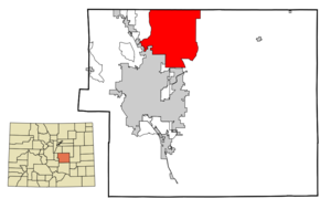
mapsize = 250px
map_caption = Location in El Paso County and theState of Colorado
mapsize1 =
map_caption1 =
image_dot_
dot_mapsize =
dot_map_caption =
dot_x =
dot_y =
pushpin_
pushpin_label_position =
pushpin_map_caption =
pushpin_mapsize =
subdivision_type = Country
subdivision_name = USA
subdivision_type1 = State
subdivision_name1 = flag|Colorado|name=State of Colorado
subdivision_type2 = County
subdivision_name2 = El Paso County
subdivision_type3 =
subdivision_name3 =
subdivision_type4 =
subdivision_name4 =
government_footnotes =
government_type =unincorporated community
leader_title =
leader_name =
leader_title1 =
leader_name1 =
leader_title2 =
leader_name2 =
leader_title3 =
leader_name3 =
leader_title4 =
leader_name4 =
established_title =
established_date =
established_title2 =
established_date2 =
established_title3 =
established_date3 =
area_magnitude =
unit_pref = Imperial
area_footnotes =
area_total_km2 = 330.3
area_land_km2 = 330.1
area_water_km2 = 0.2
area_total_sq_mi = 127.6
area_land_sq_mi = 127.5
area_water_sq_mi = 0.1
area_water_percent =
area_urban_km2 =
area_urban_sq_mi =
area_metro_km2 =
area_metro_sq_mi =
area_blank1_title =
area_blank1_km2 =
area_blank1_sq_mi =
population_as_of = 2000
population_footnotes =
population_note =
population_total = 13247
population_density_km2 = 40.1
population_density_sq_mi = 103.8
population_metro =
population_density_metro_km2 =
population_density_metro_sq_mi =
population_urban =
population_density_urban_km2 =
population_density_urban_sq_mi =
population_blank1_title =
population_blank1 =
population_density_blank1_km2 =
population_density_blank1_sq_mi =
timezone = MST
utc_offset = -7
timezone_DST = MDT
utc_offset_DST = -6
latd = 39 |latm = 2 |lats = 12 |latNS = N
longd = 104 |longm = 40 |longs = 40 |longEW = W
elevation_footnotes =
elevation_m = 2246
elevation_ft = 7369
postal_code_type =ZIP code s
postal_code = 80106, 80908
area_code = 719
blank_name = FIPS code
blank_info = 08-06970
blank1_name = GNIS feature ID
blank1_info = 0193282
website =
footnotes =Black Forest is a
census-designated place (CDP) inColorado Springs ,Colorado ,United States [{http://zip4.usps.com/zip4/zcl_3_results.jsp] ] . The population was 13,247 at the 2000 census. Black Forest is named such for the high density of Ponderosa Pines located in a generally small area. In 2006, residents voted against a proposal to incorporate as acity .Geography
Black Forest is located at coor dms|39|2|12|N|104|40|40|W|city (39.036632, -104.677697)GR|1.According to the
United States Census Bureau , the CDP has a total area of 127.5square mile s (330.3km² ), of which, 127.5 square miles (330.1 km²) of it is land and 0.1 square miles (0.2 km²) of it (0.05%) is water.Demographics
As of the
census GR|2 of 2000, there were 13,247 people, 4,494 households, and 3,851 families residing in the CDP. Thepopulation density was 103.9 people per square mile (40.1/km²). There were 4,639 housing units at an average density of 36.4/sq mi (14.1/km²). The racial makeup of the CDP was 95.08% White, 0.85% African American, 0.66% Native American, 0.71% Asian, 0.04% Pacific Islander, 0.88% from other races, and 1.77% from two or more races. Hispanic or Latino of any race were 3.31% of the population.There were 4,494 households out of which 41.1% had children under the age of 18 living with them, 78.9% were married couples living together, 4.5% had a female householder with no husband present, and 14.3% were non-families. 10.7% of all households were made up of individuals and 2.2% had someone living alone who was 65 years of age or older. The average household size was 2.94 and the average family size was 3.17.
In the CDP the population was spread out with 29.5% under the age of 18, 5.1% from 18 to 24, 29.0% from 25 to 44, 30.2% from 45 to 64, and 6.2% who were 65 years of age or older. The median age was 40 years. For every 100 females there were 102.6 males. For every 100 females age 18 and over, there were 99.5 males.
The median income for a household in the CDP was $77,085, and the median income for a family was $80,556. Males had a median income of $59,568 versus $32,043 for females. The
per capita income for the CDP was $30,786. About 1.9% of families and 2.9% of the population were below thepoverty line , including 3.9% of those under age 18 and 2.3% of those age 65 or over.ee also
*
Colorado Springs Metropolitan Statistical Area
*Front Range Urban Corridor
*List of cities and towns in Colorado References
External links
Wikimedia Foundation. 2010.