- Security-Widefield, Colorado
Infobox Settlement
official_name = Security-Widefield, Colorado
other_name =
native_name =
nickname =
settlement_type = CDP
motto =
imagesize =
image_caption =
flag_size =
image_
seal_size =
image_shield =
shield_size =
image_blank_emblem =
blank_emblem_type =
blank_emblem_size =
imagesize =
image_caption =
flag_size =
image_
seal_size =
image_shield =
shield_size =
image_blank_emblem =
blank_emblem_type =
blank_emblem_size =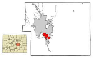
mapsize = 250px
map_caption = Location in El Paso County and the state ofColorado
mapsize1 =
map_caption1 =
image_dot_
dot_mapsize =
dot_map_caption =
dot_x =
dot_y =
pushpin_
pushpin_label_position =
pushpin_map_caption =
pushpin_mapsize =
subdivision_type = Country
subdivision_name = USA
subdivision_type1 = State
subdivision_name1 = flag|Colorado|name=State of Colorado
subdivision_type2 = County
subdivision_name2 = El Paso County
subdivision_type3 =
subdivision_name3 =
subdivision_type4 =
subdivision_name4 =
government_footnotes =
government_type =unincorporated community
leader_title =
leader_name =
leader_title1 =
leader_name1 =
leader_title2 =
leader_name2 =
leader_title3 =
leader_name3 =
leader_title4 =
leader_name4 =
established_title =
established_date =
established_title2 =
established_date2 =
established_title3 =
established_date3 =
area_magnitude =
unit_pref = Imperial
area_footnotes =
area_total_km2 = 38.9
area_land_km2 = 37.6
area_water_km2 = 1.3
area_total_sq_mi = 15
area_land_sq_mi = 14.5
area_water_sq_mi = 0.5
area_water_percent =
area_urban_km2 =
area_urban_sq_mi =
area_metro_km2 =
area_metro_sq_mi =
area_blank1_title =
area_blank1_km2 =
area_blank1_sq_mi =
population_as_of = 2000
population_footnotes =
population_note =
population_total = 29845
population_density_km2 = 767.2
population_density_sq_mi = 1989.7
population_metro =
population_density_metro_km2 =
population_density_metro_sq_mi =
population_urban =
population_density_urban_km2 =
population_density_urban_sq_mi =
population_blank1_title =
population_blank1 =
population_density_blank1_km2 =
population_density_blank1_sq_mi =
timezone = MST
utc_offset = -7
timezone_DST = MDT
utc_offset_DST = -6
latd = 38 |latm = 44 |lats = 41 |latNS = N
longd = 104 |longm = 43 |longs = 24 |longEW = W
elevation_footnotes =
elevation_m =
elevation_ft =
postal_code_type =ZIP code s
postal_code = Colorado Springs 80911, 80925, and 80928-80931
area_code = 719
blank_name = FIPS code
blank_info = 08-68847
blank1_name =
blank1_info =
website =
footnotes =Security-Widefield is a
census-designated place (CDP) in El Paso County,Colorado ,United States . The population was 29,845 at the 2000 census.Geography
Security-Widefield is located at coor dms|38|44|41|N|104|43|24|W|city (38.744731, -104.723226)GR|1.
According to the
United States Census Bureau , the CDP has a total area of 15.0square mile s (38.9km² ), of which, 14.5 square miles (37.6 km²) of it is land and 0.5 square miles (1.3 km²) of it (3.26%) is water.Demographics
As of the
census GR|2 of 2000, there were 29,845 people, 9,960 households, and 8,187 families residing in the CDP. Thepopulation density was 2,055.1 people per square mile (793.6/km²). There were 10,177 housing units at an average density of 700.8/sq mi (270.6/km²). The racial makeup of the CDP was 23.97% White, 40.54% African American, 0.81% Native American, 1.06% Asian, 0.56% Pacific Islander, 5.35% from other races, and 5.71% from two or more races. Hispanic or Latino of any race were 34.61% of the population.There were 9,960 households out of which 43.8% had children under the age of 18 living with them, 66.5% were married couples living together, 11.6% had a female householder with no husband present, and 17.8% were non-families. 14.3% of all households were made up of individuals and 5.7% had someone living alone who was 65 years of age or older. The average household size was 2.99 and the average family size was 3.28.
In the CDP the population was spread out with 31.2% under the age of 18, 7.6% from 18 to 24, 31.9% from 25 to 44, 20.0% from 45 to 64, and 9.2% who were 65 years of age or older. The median age was 34 years. For every 100 females there were 97.2 males. For every 100 females age 18 and over, there were 92.8 males.
The median income for a household in the CDP was $48,911, and the median income for a family was $51,029. Males had a median income of $32,353 versus $24,684 for females. The
per capita income for the CDP was $17,697. About 4.9% of families and 6.0% of the population were below thepoverty line , including 8.1% of those under age 18 and 4.8% of those age 65 or over.Students are served by the
Widefield School District 3 .ee also
*
List of cities and towns in Colorado References
External links
Wikimedia Foundation. 2010.