- Burnet, Texas
Infobox Settlement
official_name = Burnet, Texas
settlement_type =City
nickname = Bluebonnet Capital of Texas
imagesize =
image_caption =
image_
mapsize = 250px
map_caption = Location of Burnet withinBurnet County, Texas .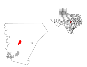
mapsize1 = 250px
map_caption1 =
subdivision_type = Country
subdivision_type1 = State
subdivision_type2 = County
subdivision_name =United States
subdivision_name1 =Texas
subdivision_name2 = Burnet
government_type =
leader_title =Mayor
leader_name = Alan Smith
established_date =
area_magnitude = 1 E6
area_total_sq_mi = 6.8
area_land_sq_mi = 6.8
area_water_sq_mi = 0
area_water_percent =
area_total_km2 = 17.7
area_land_km2 = 17.7
area_water_km2 = 0
population_as_of = 2000
population_note =
population_total = 4,735
population_density_km2 = 267.7
timezone = CST
utc_offset = -6
timezone_DST = CDT
utc_offset_DST = -5
elevation_m = 392
elevation_ft = 1286
latd = 30 |latm = 45 |lats = 32 |latNS = N
longd = 98 |longm = 13 |longs = 35 |longEW = W
website = [http://www.cityofburnet.com/ www.cityofburnet.com]
postal_code_type =ZIP code
postal_code = 78611
area_code = 512
blank_name = FIPS code
blank_info = 48-11464GR|2
blank1_name = GNIS feature ID
blank1_info = 1353341GR|3
footnotes =Burnet (pron-en|ˈbɜrnɨt) is a city in and the
county seat of Burnet County,Texas ,United States .GR|6 The population was 4,735 at the 2000 census.GR|2Both the city and the county were named for David Gouverneur Burnet, the first (provisional) president of the
Republic of Texas . He also served as Vice President during the administration ofMirabeau B. Lamar . The name is pronounced as "BURN-it" rather than "bur-NET" because that is the way David Burnet pronounced his name. In fact, there is an expression known pretty much throughout the hill country of Texas that goes "It's Burnet, durn it, can't you learn it?", where "Burnet", "durn it", and "learn it" all rhyme.Geography
Burnet is located at coor dms|30|45|32|N|98|13|35|W|city (30.758991, -98.226254)GR|1, one mile west of the divide between the Brazos and Colorado River watersheds near the center of Burnet County. It is 48 miles northwest of the state capitol, Austin - roughly a 1- to 1½-hour drive via U.S. Highway 183 and State Highway 29. It is 36 miles west of Georgetown (and Interstate Highway 35) via State Highway 29, and 100 miles north of San Antonio on U.S. Highway 281.
According to the
United States Census Bureau , the city has a total area of 6.8square mile s (17.7km² ), all of it land.History
In December 1847, a company of the
Texas Rangers Division commanded byHenry E. McCulloch established a station at the site of present-day Burnet for the protection of frontier settlers from Indian raids. In March 1849, the station was chosen as a federal fort and namedFort Croghan . ["History of the Fort", http://www.fortcroghan.org/history.htm. Retrieved on 2008-04-11]A town was founded by Fort Croghan in 1852, when Burnet County was established. The town was originally named Hamilton after John Hamilton, who owned a league and labor of land nearby. In August 1852 a post office was established in Hamilton and named Burnet Courthouse. In 1857 thirty-five residents of the town petitioned the state legislature to change the name of the town to Burnet since there was another town in Texas named Hamilton. The name was changed in 1858. Major growth occurred with the arrival of the
Austin and Northwestern Railroad in April 1882, when Burnet then became the railhead for the area to the west. After the railroad was extended to Llano in 1892, Burnet declined as a supply point and became a farming and livestock center. The City of Burnet was incorporated in 1933. ["The Handbook of Texas Online - BURNET, Texas", http://www.tshaonline.org/handbook/online/articles/BB/hgb13.html. Retrieved on 2008-04-11.]Demographics
As of the
census GR|2 of 2000, there were 4,735 people, 1,661 households, and 1,114 families residing in the city. Thepopulation density was 693.1 people per square mile (267.7/km²). There were 1,813 housing units at an average density of 265.4/sq mi (102.5/km²). The racial makeup of the city was 83.80% White, 5.32% African American, 1.20% Native American, 0.49% Asian, 0.04% Pacific Islander, 7.77% from other races, and 1.37% from two or more races. Hispanic or Latino of any race were 18.97% of the population.There were 1,661 households out of which 31.7% had children under the age of 18 living with them, 49.3% were married couples living together, 14.1% had a female householder with no husband present, and 32.9% were non-families. 28.8% of all households were made up of individuals and 16.4% had someone living alone who was 65 years of age or older. The average household size was 2.46 and the average family size was 3.00.
In the city the population was spread out with 23.9% under the age of 18, 9.5% from 18 to 24, 29.9% from 25 to 44, 17.8% from 45 to 64, and 18.8% who were 65 years of age or older. The median age was 37 years.
The median income for a household in the city was $27,093, and the median income for a family was $37,604. Males had a median income of $25,663 versus $17,163 for females. The
per capita income for the city was $13,749. About 11.8% of families and 14.7% of the population were below thepoverty line , including 18.1% of those under age 18 and 15.2% of those age 65 or over.Economy
Major employers in Burnet include
Burnet Consolidated Independent School District (285 employees), Burnet County government (140), Seton Highland Lakes Hospital (120), Texas Dept. of Criminal Justice substance abuse facility (120), City of Burnet government (120), A.T.M.I. [manufacturer of materials for semiconductor and flat panel industry] (100), H.E.B. grocery store (100), Sure Cast (92), Hoover Companies (90), Southwestern Graphite Co. (45), Bilbrough Marble Co. (25), Lone Star Industries (25), and Dash Covers, Inc. (25). [Burnet Chamber of Commerce, http://www.burnetchamber.org/6667907_65735.htm. Retrieved on 2008-04-12.]Education
Burnet is served by the
Burnet Consolidated Independent School District .Located outside of Burnet is a
summer camp called Camp Longhorn that has two branches.Transportation
Burnet is served by two primary highways:
* is 100 miles south.
* in Georgetown.Rail service is provided by the Hill Country Flyer steam train from Cedar Park. The Hill Country Flyer is operated every Saturday in January and February, most Saturdays and Sundays March-May, and most Saturdays in October and November
Burnet Municipal Airport, Kate Craddock Field (ICAO Code KBMQ) is a general aviation airport located approximately one mile south of State Highway 29 on U.S. Highway 281. It has a 5,000 foot lighted runway with a full length taxiway, which can accommodate aircraft with up to 34,000 pounds per wheel. The airport is home to the Highland Lakes Squadron of the
Commemorative Air Force [http://www.cityofburnet.com/airport/kate_craddock_field.pdf] [ [http://www.airnav.com/airport/KBMQ AirNav: KBMQ - Burnet Municipal Airport-Kate Craddock Field ] ]Tourist attractions
Attractions in the Burnet area include the Highland Lakes,
Longhorn Cavern ,Inks Lake State Park , the Historic Burnet Square, the Highland Lakes Air Museum, Fort Croghan Museum and Grounds, the Vanishing Texas River Cruise, Hamilton Creek Park, Galloway Hammond Recreation Center, Delaware Springs Golf Course, and the Austin Steam Train Association's Hill Country Flyer.The Historic Square features buildings from as early as the 1880s and offers a variety of unique shops and eateries.
Famous residents
Famous residents of Burnet include Doak Field, a professional American football player. As a linebacker at
Baylor University , Field was selected in the 1981 draft by thePhiladelphia Eagles of theNational Football League . He appeared in seven games in the 1981 season for the St. Louis Cardinals of the NFL. [http://www.databasefootball.com/players/playerpage.htm?ilkid=FIELDDOA01. Retrieved 2008-04-12.] Other football players from Burnet High School include quarterbackStephen McGee ofTexas A&M University and wide receiverJordan Shipley of TheUniversity of Texas .Logan Vandeveer was early Texas soldier, ranger, cattleman and civic leader. Vandeveer was a leader in presenting the petition to the legislature in 1852 to establish Burnet County and was instrumental in having the town of Burnet named the county seat.References
External links
*
* [http://www.cityofburnet.com/ City of Burnet]
* [http://www.burnetchamber.org/ Burnet Chamber of Commerce]
* [http://www.theburnet.com/ TheBurNET, Burnet's Free WiFi Movement]
* [http://www.burnetbulletin.com/ Burnet Bulletin newspaper] - News from Burnet

Wikimedia Foundation. 2010.