- St. Hedwig, Texas
Infobox Settlement
official_name = St. Hedwig, Texas
settlement_type =Town
nickname =
motto =
imagesize =
image_caption =
image_
mapsize = 250x200px
map_caption = Location of St. Hedwig, Texas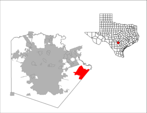
mapsize1 = 250px
map_caption1 =subdivision_type = Country
subdivision_name =United States
subdivision_type1 = State
subdivision_name1 =Texas
subdivision_type2 = County
subdivision_name2 = Bexargovernment_footnotes =
government_type =
leader_title =
leader_name =
leader_title1 =
leader_name1 =
established_title =
established_date =unit_pref = Imperial
area_footnotes =area_magnitude =
area_total_km2 = 77.9
area_land_km2 = 77.9
area_water_km2 = 0.0
area_total_sq_mi = 30.1
area_land_sq_mi = 30.1
area_water_sq_mi = 0.0population_as_of = 2000
population_footnotes =
population_total = 1875
population_density_km2 = 24.1
population_density_sq_mi = 62.3timezone = Central (CST)
utc_offset = -6
timezone_DST = CDT
utc_offset_DST = -5
elevation_footnotes =
elevation_m = 176
elevation_ft = 577
latd = 29 |latm = 25 |lats = 28 |latNS = N
longd = 98 |longm = 12 |longs = 52 |longEW = Wpostal_code_type = ZIP Code
postal_code = 78152
area_code = 210
blank_name = FIPS code
blank_info = 48-64172GR|2
blank1_name = GNIS feature ID
blank1_info = 1345901GR|3
website = http://sainthedwigcity.com/
footnotes =St. Hedwig is a town in Bexar County,
Texas ,United States . The population was 1,875 at the 2000 census.History
The town was founded by John Demmer in
1852 when he moved here from his nativeSilesia . In 1856 four more Silesians immigrated to the area and built the site's first Catholic Church, Annunciation [http://www.pgst.org/churches.htm] (under theRoman Catholic Archdiocese of San Antonio ). In 1860 a post office called Cottage Hill opened, but was later renamed St. Hedwig after the patron saint of Poland. By 1868 the community had built a stone church, and in 1897 the town boasted 200 families mainly from Poland and Germany and their black tenants.Geography
St. Hedwig is located at coor dms|29|25|28|N|98|12|52|W|city (29.424484, -98.214357)GR|1.
According to the
United States Census Bureau , the town has a total area of 30.1square mile s (77.9km² ), all of it land.Demographics
As of the
census GR|2 of 2000, there were 1,875 people, 653 households, and 543 families residing in the town. Thepopulation density was 62.3 people per square mile (24.1/km²). There were 687 housing units at an average density of 22.8/sq mi (8.8/km²). The racial makeup of the town was 91.95% White, 2.88% African American, 0.32% Native American, 0.21% Asian, 0.05% Pacific Islander, 2.67% from other races, and 1.92% from two or more races. Hispanic or Latino of any race were 10.35% of the population.There were 653 households out of which 40.0% had children under the age of 18 living with them, 73.0% were married couples living together, 6.3% had a female householder with no husband present, and 16.7% were non-families. 13.6% of all households were made up of individuals and 7.5% had someone living alone who was 65 years of age or older. The average household size was 2.87 and the average family size was 3.17.
In the town the population was spread out with 27.2% under the age of 18, 6.1% from 18 to 24, 30.2% from 25 to 44, 25.9% from 45 to 64, and 10.5% who were 65 years of age or older. The median age was 38 years. For every 100 females there were 105.8 males. For every 100 females age 18 and over, there were 101.6 males.
The median income for a household in the town was $55,481, and the median income for a family was $58,603. Males had a median income of $34,615 versus $27,700 for females. The
per capita income for the town was $19,477. About 4.1% of families and 6.7% of the population were below thepoverty line , including 9.3% of those under age 18 and 11.4% of those age 65 or over.References
The Handbook of Texas - [http://www.tsha.utexas.edu/handbook/online/articles/SS/hls76.html] External links

Wikimedia Foundation. 2010.