- Sonora, Texas
Infobox Settlement
official_name = Sonora, Texas
settlement_type =City
nickname = Home of the "Caverns of Sonora"
postal_code_type =ZIP code
postal_code = 76950
area_code = 915
blank_name = FIPS code
blank_info = 48-68756GR|2
blank1_name = GNIS feature ID
blank1_info = 1368606GR|3
footnotes =
website = [http://www.sonoratx-chamber.com/]
imagesize =
image_caption =
mapsize = 250px
map_caption = Location in the state ofTexas 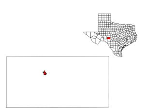
mapsize1 = 250px
map_caption1 =
subdivision_type = Country
subdivision_name =United States
subdivision_type1 = State
subdivision_name1 =Texas
subdivision_type2 = County
subdivision_name2 = Sutton
government_type =
leader_title =Mayor
leader_name =Margaret Cascadden
area_land_km2 = 5.1
area_water_km2 = 0.0
area_total_sq_mi = 2
area_land_sq_mi = 2.0
area_water_sq_mi = 0.0
area_water_percent =
established_date =
area_magnitude =
area_total_km2 = 5.1
elevation_m = 649
elevation_ft = 2129
latd = 30 |latm = 34 |lats = 5 |latNS = N
longd = 100 |longm = 38 |longs = 39 |longEW = W
population_as_of = July 2005
population_total = 3008
population_density_sq_mi = 1488.8
population_density_km2 = 576.0
timezone_CST = Central Standard Time
timezone = CST
utc_offset = -7
timezone_DST = CDT
utc_offset_DST = -6Sonora is a city in and the
county seat of Sutton County,Texas ,United States .GR|6 The population was 2,924 at the 2000 census. It is also one of the leadingspeed trap cities inWest Texas , averaging more than 48,000 citations per year (over 10 per year per capita).Geography and Climate
Sonora is located at coor dms|30|34|5|N|100|38|39|W|city (30.568166, -100.644163)GR|1.
According to the
United States Census Bureau , the city has a total area of 2.0square mile s (5.1km² ), all of it land.The area lies in the western portions of the Texas Hill Country, a region of limestone outcrops and rolling terrain dotted with areas of live oaks (
Quercus fusiformis ) and Juniper (Juniperus ashei ) in the form of a woodland or savanna, alternating with a blend of various grasses and other shrubs and cacti.Sonora's climate is sub-humid, subtropical, though periods of long drought are not uncommon due to the proximity of deserts and steppes nearby, to the west. The upland location allows some of the periodic Gulf of Mexico moisture to interact with frontal systems and elevated terrain to create more clouds and precipitation than locations in the brush country to the south, or the steppes and deserts to the west and northwest. Thunderstorms with heavy rainfall are most frequent during spring and fall months, though some lighter, steady precipitation and low clouds can occur during the winter, due in large part to frontal systems originating on the plains and prairies to the north.
Summers are long and hot, often with higher humidity, though a good breeze often moderates the heat. Fall through spring months are often pleasant, though winter can experience brief periods of cold or cloudy weather.
Demographics
As of the
census GR|2 of 2000, there were 2,924 people, 1,043 households, and 808 families residing in the city. Thepopulation density was 1,488.8 people per square mile (576.0/km²). There were 1,264 housing units at an average density of 643.6/sq mi (249.0/km²). The racial makeup of the city was 74.18% White, 0.34% African American, 0.34% Native American, 0.24% Asian, 23.36% from other races, and 1.54% from two or more races. Hispanic or Latino of any race were 53.35% of the population.There were 1,043 households out of which 42.9% had children under the age of 18 living with them, 64.0% were married couples living together, 8.5% had a female householder with no husband present, and 22.5% were non-families. 20.6% of all households were made up of individuals and 8.5% had someone living alone who was 65 years of age or older. The average household size was 2.77 and the average family size was 3.23.
In the city the population was spread out with 31.1% under the age of 18, 7.4% from 18 to 24, 28.7% from 25 to 44, 22.2% from 45 to 64, and 10.7% who were 65 years of age or older. The median age was 34 years. For every 100 females there were 98.8 males. For every 100 females age 18 and over, there were 95.2 males.
The median income for a household in the city was $36,272, and the median income for a family was $38,106. Males had a median income of $31,728 versus $17,935 for females. The
per capita income for the city was $16,128. About 13.0% of families and 16.7% of the population were below thepoverty line , including 23.9% of those under age 18 and 11.2% of those age 65 or over.Education
The City of Sonora is served by the
Sonora Independent School District .Attractions
*
*Eaton Hill Wildlife Sanctuary - Contains twoGeocaching sites
*Historic Downtown Sonora
*Sonora Golf Course External links
* [http://www.sonora-texas.com/ City of Sonora website]
* [http://www.swtexaslive.com Southwest Texas LIVE! news about Sonora and region]
* [http://www.sonoratx-chamber.com/Eaton%20Hill.htm Eaton Hill Wildlife Sanctuary] - Contains two [http://www.geocaching.com Geocaching] sites

Wikimedia Foundation. 2010.