- Castle Hills, Texas
Infobox Settlement
official_name = Castle Hills, Texas
settlement_type =City
nickname =
motto =
imagesize =
image_caption =
image_
mapsize = 250x200px
map_caption = Location of Castle Hills, Texas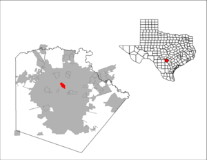
mapsize1 = 250px
map_caption1 =subdivision_type = Country
subdivision_name =United States
subdivision_type1 = State
subdivision_name1 =Texas
subdivision_type2 = County
subdivision_name2 = Bexarunit_pref = Imperial
area_footnotes =area_magnitude =
area_total_km2 = 6.4
area_land_km2 = 6.4
area_water_km2 = 0.0
area_total_sq_mi = 2.5
area_land_sq_mi = 2.5
area_water_sq_mi = 0.0population_as_of = 2000
population_footnotes =
population_total = 4202
population_density_km2 = 654.1
population_density_sq_mi = 1694.1timezone = Central (CST)
utc_offset = -6
timezone_DST = CDT
utc_offset_DST = -5
elevation_footnotes =
elevation_m = 256
elevation_ft = 840
latd = 29 |latm = 31 |lats = 18 |latNS = N
longd = 98 |longm = 31 |longs = 0 |longEW = Wpostal_code_type =
ZIP code
postal_code = 78213
area_code = 210
blank_name = FIPS code
blank_info = 48-13276GR|2
blank1_name = GNIS feature ID
blank1_info = 1332298GR|3
website =
footnotes =Castle Hills is a city located in Bexar County,
Texas ,United States . As of the2000 census, the city had a total population of 4,202. It is a suburb of San Antonio.Geography
Castle Hills is located at 29°31'18" North, 98°30'60" West (29.521762, -98.516601)GR|1.
According to the
United States Census Bureau , the city has a total area of 2.5square mile s (6.4km² ), of which, 2.5 square miles (6.4 km²) of it is land and none of the area is covered with water.Castle Hills is an independent city, completely surrounded by the city of San Antonio. It is bisected into a northern and southern half by interstate highway loop I-410. It is located at the southern end of Northwest Military Highway, the northern end being located at U.S. Army Camp Bullis.
Demographics
As of the
census GR|2 of2000 , there are 4,202 people, 1,866 households, and 1,218 families residing in the city. Thepopulation density is 1,694.1 people per square mile (654.2/km²). There are 1,930 housing units at an average density of 778.1/sq mi (300.5/km²). The racial makeup of the city is 91.98% White, 0.64% African American, 0.19% Native American, 1.76% Asian, 0.02% Pacific Islander, 3.64% from other races, and 1.76% from two or more races. 28.70% of the population are Hispanic or Latino of any race.There are 1,866 households out of which 21.0% have children under the age of 18 living with them, 54.3% are married couples living together, 8.7% have a female householder with no husband present, and 34.7% are non-families. 31.5% of all households are made up of individuals and 24.3% have someone living alone who is 65 years of age or older. The average household size is 2.25 and the average family size is 2.82.
In the city the population is spread out with 19.4% under the age of 18, 4.4% from 18 to 24, 18.0% from 25 to 44, 24.0% from 45 to 64, and 34.3% who are 65 years of age or older. The median age is 51 years. For every 100 females there are 82.9 males. For every 100 females age 18 and over, there are 80.2 males.
The median income for a household in the city is $53,688, and the median income for a family is $71,065. Males have a median income of $54,833 versus $31,593 for females. The
per capita income for the city is $38,909. 5.8% of the population and 3.8% of families are below thepoverty line . Out of the total population, 7.7% of those under the age of 18 and 3.2% of those 65 and older are living below the poverty line.Education
The city is served by
North East Independent School District . There are two public schools located within Castle Hills. Castle Hills Elementary School, which is located outside Loop 410; and Jackson Keller Elementary School, which is located inside Loop 410. Both are part of theNorth East Independent School District . The city also has a wide range of private schools that include St George Episcopal School, Holy Spirit Catholic School, Cornerstone Christian School, Mount Sacred Heart School andCastle Hills First Baptist School .Churches
Castle Hills also has a wide range of religious institutions as well. These institutions include
Castle Hills First Baptist Church , Castle Hills Christian Church, St. George Episcopal Church, Wayside Chapel, and All SaintsAnglican Church .Famous People/Families
Debora Daniels Big J. Hamilton City Government
Currently, the City of Castle Hills is served by five Alderpersons: Tom Davis, Bruce Smiley, Tim Howell, Douglas Gregory, and Marcella Huff, all elected by the people of Castle Hills, as well as the Mayor of Castle Hills, Marcy Harper. The Mayor cannot vote, but does play a deciding role on many issues.
Miscellaneous Facts
Castle Hills has its own Police, Fire, and Public Works departments. The Fire Department also has a medical response vehicle and EMTs. The City of Castle Hills also has a small green-space, known as the Castle Hills Commons, located on Lemonwood Drive between the Fire Department and City Hall. City Hall is located in a building formerly used as a church. Drinking water is provided to residents of the city by the Bexar Metropolitan Water Company. Most of the properties in Castle Hills are single family residences, many located on large lots. Many were built in the early 1950's. Ranch style architecture is predominant. There are several retail establishments in Castle Hills, mostly located along Military Highway. Also located within Castle Hills is the McGimsey Boy Scout Camp, a 140 acre park for
BSA use.References
External links
* [http://home.flash.net/~ctycastl/ Castle Hills official website]

Wikimedia Foundation. 2010.