- Zapata, Texas
Infobox Settlement
official_name = Zapata, Texas
settlement_type = CDP
nickname =
motto =
imagesize =
image_caption =
image_
mapsize = 250px
map_caption = Location of Zapata, Texas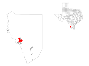
mapsize1 = 250px
map_caption1 =subdivision_type = Country
subdivision_name =United States
subdivision_type1 = State
subdivision_name1 =Texas
subdivision_type2 = County
subdivision_name2 = Zapatagovernment_footnotes =
government_type =
leader_title =
leader_name =
leader_title1 =
leader_name1 =
established_title =
established_date =unit_pref = Imperial
area_footnotes =area_magnitude =
area_total_km2 = 20.0
area_land_km2 = 20.0
area_water_km2 = 0.0
area_total_sq_mi = 7.7
area_land_sq_mi = 7.7
area_water_sq_mi = 0.0population_as_of = 2000
population_footnotes =
population_total = 4856
population_density_km2 = 243.2
population_density_sq_mi = 629.9timezone = Central (CST)
utc_offset = -6
timezone_DST = CDT
utc_offset_DST = -5
elevation_footnotes =
elevation_m = 120
elevation_ft = 394
latd = 26 |latm = 54 |lats = 22 |latNS = N
longd = 99 |longm = 16 |longs = 12 |longEW = Wpostal_code_type =
ZIP code
postal_code = 78076
area_code = 956
blank_name = FIPS code
blank_info = 48-80716GR|2
blank1_name = GNIS feature ID
blank1_info = 1350720GR|3
website =
footnotes =Zapata is a
census-designated place (CDP) in Zapata County,Texas ,United States . The population was 4,856 at the 2000 census. It is thecounty seat of Zapata CountyGR|6. Zapata was named forColonel Jose Antonio de Zapata , the revolutionary commander who served in the cavalry of theRepublic of the Rio Grande , of which the town was a part.Geography
Zapata is located at coor dms|26|54|22|N|99|16|12|W|city (26.906244, -99.270007)GR|1.
According to the
United States Census Bureau , the CDP has a total area of 7.7square mile s (20.0km² ), all of it land.Demographics
As of the
census GR|2 of 2000, there were 4,856 people, 1,574 households, and 1,265 families residing in the CDP. Thepopulation density was 629.9 people per square mile (243.2/km²). There were 2,239 housing units at an average density of 290.4/sq mi (112.1/km²). The racial makeup of the CDP was 83.92% White, 0.25% African American, 0.29% Native American, 0.06% Asian, 0.02% Pacific Islander, 12.40% from other races, and 3.07% from two or more races. Hispanic or Latino of any race were 89.11% of the population.There were 1,574 households out of which 41.7% had children under the age of 18 living with them, 61.7% were married couples living together, 15.0% had a female householder with no husband present, and 19.6% were non-families. 18.2% of all households were made up of individuals and 11.4% had someone living alone who was 65 years of age or older. The average household size was 3.07 and the average family size was 3.50.
In the CDP the population was spread out with 31.7% under the age of 18, 9.7% from 18 to 24, 24.0% from 25 to 44, 19.6% from 45 to 64, and 15.0% who were 65 years of age or older. The median age was 32 years. For every 100 females there were 92.2 males. For every 100 females age 18 and over, there were 89.8 males.
The median income for a household in the CDP was $24,136, and the median income for a family was $27,708. Males had a median income of $30,833 versus $12,604 for females. The
per capita income for the CDP was $11,863. About 29.1% of families and 33.5% of the population were below thepoverty line , including 45.1% of those under the age of 18 and 27.0% of those ages 65 and older.Education
All of Zapata County is a part of the
Zapata County Independent School District .Public Library
Olga V. Figueroa Zapata County Public Library
The Olga V. Figueroa Zapata County Public Library is located on 901 Kennedy Street in Zapata Texas.Contact Aida R. Garcia - Library Director. The Library is famous for being one of the best places to see the
White-collared Seedeater in the United States. This small bird draws thousands of birders to the library grouds every year.Hang Gliding
More Hang Gliding World Records have been set from Zapata, Texas than any other location in the world. The World Record Encampment has been taking place at the Zapata County Airport since 2000, and the first hang glider flights to break the 308 mile barrier took place there the first year. The current distance record is 438 miles set by Mike Barber in 2002. Three new world records were set in 2005. [ [http://ozreport.com/search.php?domains=OzReport.com&sitesearch=OzReport.com&client=pub-2925268477293988&forid=1&ie=ISO-8859-1&oe=ISO-8859-1&hl=en&q=Zapata&sa.x=0&sa.y=0&sa=Search "Zapata" at The Oz Report] , retrieved
2008-05-14 ] [ [http://records.fai.org/hang_gliding Hang Gliding and Paragliding World Records] ,Fédération Aéronautique Internationale (FAI), retrieved2008-05-14 ]Bass Fishing
Falcon International Reservoir located in Zapata is becoming well know for its excellent bass fishing
References
External links

Wikimedia Foundation. 2010.