- Ozona, Texas
-
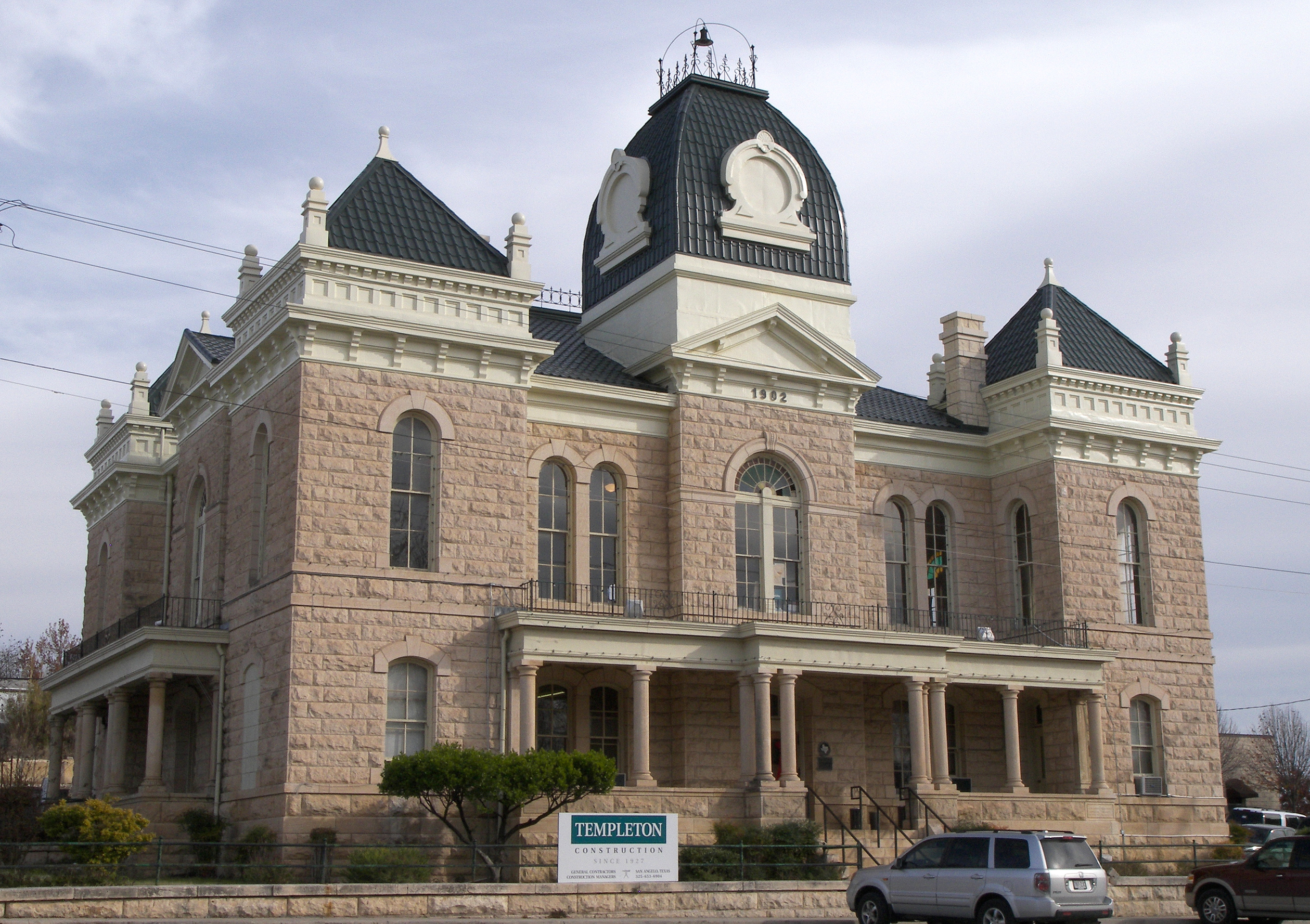
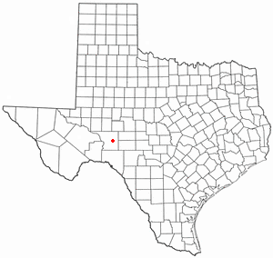
Ozona, Texas — CDP — Crockett county courthouse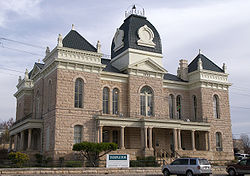
Motto: L Location of Ozona, Texas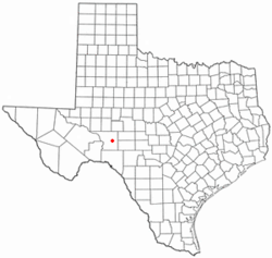

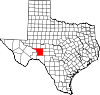
Coordinates: 30°42′32″N 101°12′15″W / 30.70889°N 101.20417°WCoordinates: 30°42′32″N 101°12′15″W / 30.70889°N 101.20417°W Country United States State Texas County Crockett Area - Total 4.7 sq mi (12.1 km2) - Land 4.7 sq mi (12.1 km2) - Water 0.0 sq mi (0.0 km2) Elevation 2,349 ft (716 m) Population (2000) - Total 3,436 - Density 734.6/sq mi (283.6/km2) Time zone Central (CST) (UTC-6) - Summer (DST) CDT (UTC-5) ZIP code 76943 Area code(s) 915 FIPS code 48-54552[1] GNIS feature ID 1364666[2] Website http://www.ozona.com/ Ozona is a census-designated place (CDP) in and the county seat of Crockett County, Texas, United States.[3] The population was 3,436 at the 2000 census. It is the only Census Bureau-recognized community in Crockett County, which is named for Colonel Davy Crockett, a hero of the Alamo.[4]
Ozona is called the "Biggest Little Town in the World." It is located on Interstate 10 some eighty-two miles southwest of San Angelo. Crockett County is one of the nation's leading producers of wool and mohair. It is situated in the Edwards Plateau region in the western edge of the Texas Hill Country. Hunters come to Ozona in search of white-tailed deer, javelina, and game birds.[4]
The county was organized in 1891 under a giant oak tree, which still stands and shades the historical marker describing the event. The Davy Crockett Monument is a large statue in the City Park on the town square.[4]
Ozona was known as Powell Well, after land surveyor E.M. Powell, when it was founded in 1891. In 1897 it was renamed Ozona for the high quantity of its open air, or "ozone".[4] A flood in 1954 killed sixteen people and destroyed about half of the homes in the town.
Texas also has a "Heritage Appreciation Monument" which honors pioneer families who came to settle the land. There is a three-story Crockett County Museum at 404 11th Street, which features a blacksmith shop, ranching artifacts, and a wool/mohair room. A scenic drive from Ozona to Lancaster Hill, west on Texas State Highway 290, provides a panoramic view of the Pecos River Valley.[4]
Contents
Geography
Ozona is located at 30°42′32″N 101°12′15″W / 30.70889°N 101.20417°W (30.708972, -101.204069)[5].
According to the United States Census Bureau, the CDP has a total area of 4.7 square miles (12 km2), all of it land.
Demographics
As of the census[1] of 2000, there were 3,436 people, 1,255 households, and 919 families residing in the CDP. The population density was 734.6 people per square mile (283.5/km²). There were 1,514 housing units at an average density of 323.7/sq mi (124.9/km²). The racial makeup of the CDP was 74.62% White, 0.81% African American, 0.67% Native American, 0.32% Asian, 0.03% Pacific Islander, 20.93% from other races, and 2.62% from two or more races. Hispanic or Latino of any race were 60.13% of the population.
There were 1,255 households out of which 38.4% had children under the age of 18 living with them, 58.7% were married couples living together, 10.7% had a female householder with no husband present, and 26.7% were non-families. 24.8% of all households were made up of individuals and 12.7% had someone living alone who was 65 years of age or older. The average household size was 2.71 and the average family size was 3.25.
In the CDP the population was spread out with 30.3% under the age of 18, 7.4% from 18 to 24, 26.8% from 25 to 44, 23.1% from 45 to 64, and 12.4% who were 65 years of age or older. The median age was 36 years. For every 100 females there were 94.8 males. For every 100 females age 18 and over, there were 93.8 males.
The median income for a household in the CDP was $28,565, and the median income for a family was $33,017. Males had a median income of $30,988 versus $14,024 for females. The per capita income for the CDP was $13,152. About 16.8% of families and 21.5% of the population were below the poverty line, including 27.0% of those under age 18 and 20.5% of those age 65 or over.
Education
Ozona is served by the Crockett County Consolidated Common School District. Crockett County Consolidated Common School District is designated as Class 2A, and its students participate in most of the UIL scholastic and athletic activities available in that classification. Students may participate in more than one sport including football, basketball, track, cross country, tennis, baseball, and golf, as well as other extracurricular activities that are concurrently running.
Ozona High School students have won or placed in the top three at state competition in debate, speaking events, and journalism. The Ozona High School Band also has been awarded numerous honors at both the regional and state levels.[1] Ozona Lady Lions have been Class 2A State Champions in 1995 and 1996 in Basketball and in 1997 in Golf. The Ozona Lions were Class 2A State Champions in Cross Country in 2004.
Popular Culture
In the Criminal Minds Season 2 episode of "Boogeyman". The BAU goes to Ozona, Texas during a murder investigation involving a boy who was killed in the woods on the outskirts of Ozona.
References
- ^ a b "American FactFinder". United States Census Bureau. http://factfinder.census.gov. Retrieved 2008-01-31.
- ^ "US Board on Geographic Names". United States Geological Survey. 2007-10-25. http://geonames.usgs.gov. Retrieved 2008-01-31.
- ^ "Find a County". National Association of Counties. http://www.naco.org/Counties/Pages/FindACounty.aspx. Retrieved 2011-06-07.
- ^ a b c d e Texas Transportation Commission, Texas State Travel Guide, 2007, p. 98
- ^ "US Gazetteer files: 2010, 2000, and 1990". United States Census Bureau. 2011-02-12. http://www.census.gov/geo/www/gazetteer/gazette.html. Retrieved 2011-04-23.
Municipalities and communities of Crockett County, Texas County seat: Ozona CDP Ozona
Unincorporated
communityCounty seats of Texas A B Baird · Ballinger · Bandera · Bastrop · Bay City · Beaumont · Beeville · Bellville · Belton · Benjamin · Big Lake · Big Spring · Boerne · Bonham · Boston · Brackettville · Brady · Breckenridge · Brenham · Brownfield · Brownsville · Brownwood · Bryan · BurnetC Caldwell · Cameron · Canadian · Canton · Canyon · Carrizo Springs · Carthage · Center · Centerville · Channing · Childress · Clarendon · Clarksville · Claude · Cleburne · Coldspring · Coleman · Colorado City · Columbus · Comanche · Conroe · Cooper · Corpus Christi · Corsicana · Cotulla · Crane · Crockett · Crosbyton · Crowell · Crystal City · CueroD E F Fairfield · Falfurrias · Farwell · Floresville · Floydada · Fort Davis · Fort Stockton · Fort Worth · Franklin · FredericksburgG Gail · Gainesville · Galveston · Garden City · Gatesville · George West · Georgetown · Giddings · Gilmer · Glen Rose · Goldthwaite · Goliad · Gonzales · Graham · Granbury · Greenville · Groesbeck · Groveton · GuthrieH Hallettsville · Hamilton · Haskell · Hebbronville · Hemphill · Hempstead · Henderson · Henrietta · Hereford · Hillsboro · Hondo · Houston · HuntsvilleJ K L M N O P Paducah · Paint Rock · Palestine · Palo Pinto · Panhandle · Paris · Pearsall · Pecos · Perryton · Pittsburg · Plains · Plainview · Port Lavaca · PostQ R Rankin · Raymondville · Refugio · Richmond · Rio Grande City · Robert Lee · Roby · Rockport · Rocksprings · Rockwall · RuskS San Angelo · San Antonio · San Augustine · San Diego · San Marcos · San Saba · Sanderson · Sarita · Seguin · Seminole · Seymour · Sherman · Sierra Blanca · Silverton · Sinton · Snyder · Sonora · Spearman · Stanton · Stephenville · Sterling City · Stinnett · Stratford · Sulphur Springs · SweetwaterT, U V, W, Z Van Horn · Vega · Vernon · Victoria · Waco · Waxahachie · Weatherford · Wellington · Wharton · Wheeler · Wichita Falls · Woodville · ZapataCategories:- Census-designated places in Texas
- County seats in Texas
- Populated places in Texas with Hispanic majority populations
- Populated places in Crockett County, Texas


Wikimedia Foundation. 2010.