- Alamo Heights, Texas
Infobox Settlement
official_name = Alamo Heights, Texas
settlement_type =City
nickname =
motto =
imagesize =
image_caption =
image_
mapsize = 250x200px
map_caption = Location of Alamo Heights, Texas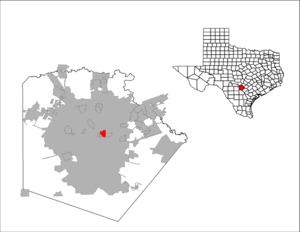
mapsize1 = 250px
map_caption1 =subdivision_type = Country
subdivision_name =United States
subdivision_type1 = State
subdivision_name1 =Texas
subdivision_type2 = County
subdivision_name2 = Bexargovernment_footnotes =
government_type =
leader_title =
leader_name =
leader_title1 =
leader_name1 =
established_title =
established_date =unit_pref = Imperial
area_footnotes =area_magnitude =
area_total_km2 = 4.8
area_land_km2 = 4.8
area_water_km2 = 0.0
area_total_sq_mi = 1.8
area_land_sq_mi = 1.8
area_water_sq_mi = 0.0population_as_of = 2000
population_footnotes =
population_total = 7319
population_density_km2 = 1530.8
population_density_sq_mi = 3964.9timezone = Central (CST)
utc_offset = -6
timezone_DST = CDT
utc_offset_DST = -5
elevation_footnotes =
elevation_m = 244
elevation_ft = 801
latd = 29 |latm = 28 |lats = 58 |latNS = N
longd = 98 |longm = 28 |longs = 2 |longEW = Wpostal_code_type =
ZIP code
postal_code = 78209
area_code = 210
blank_name = FIPS code
blank_info = 48-01600GR|2
blank1_name = GNIS feature ID
blank1_info = 1329300GR|3
website =
footnotes =Alamo Heights is a city surrounded by San Antonio,
Texas , U.S. in Bexar County. As of the 2000 census, the city population was 7,319. However, its immediate proximity to San Antonio causes it to appear as part of much larger San Antonio.Geography
Alamo Heights is located at coor dms|29|28|58|N|98|28|2|W|city (29.482881, -98.467271)GR|1.
According to the
United States Census Bureau , the city has a total area of 1.9square mile s (4.8km² ), all of it land.Demographics
As of the
census GR|2 of 2000, there were 7,319 people, 3,197 households, and 1,819 families residing in the city. Thepopulation density was 3,964.9 people per square mile (1,527.5/km²). There were 3,460 housing units at an average density of 1,874.4/sq mi (722.1/km²). The racial makeup of the city was 93.80% White, 0.56% African American, 0.33% Native American, 0.85% Asian, 0.01% Pacific Islander, 2.81% from other races, and 1.64% from two or more races. Hispanic or Latino of any race were 13.55% of the population.There were 3,197 households out of which 28.1% had children under the age of 18 living with them, 46.5% were married couples living together, 7.9% had a female householder with no husband present, and 43.1% were non-families. 38.3% of all households were made up of individuals and 12.9% had someone living alone who was 65 years of age or older. The average household size was 2.16 and the average family size was 2.91.
In the city the population was spread out with 22.3% under the age of 18, 6.2% from 18 to 24, 29.2% from 25 to 44, 25.1% from 45 to 64, and 17.2% who were 65 years of age or older. The median age was 40 years. For every 100 females there were 82.5 males. For every 100 females age 18 and over, there were 75.0 males.
Alamo Heights' residents are usually in the middle class.The median income for a household in the city was $64,688, and the median income for a family was $86,897. Males had a median income of $60,527 versus $37,089 for females. The
per capita income for the city was $45,640. About 1.6% of families and 3.5% of the population were below thepoverty line , including 3.7% of those under age 18 and 6.4% of those age 65 or over. The median home value in Alamo Heights was $198,800.Education
Alamo Heights is served by the
Alamo Heights Independent School District , which includesAlamo Heights High School . The elementary schools are Howard Early Childhood Learning Center, Cambridge, and Woodridge. The middle school is the newly remodelled Alamo Heights Junior School. The district's high school is Alamo Heights High School, located at 6900 Broadway.Notable alumni include
singer andsong writer Christopher Cross ,fashion designer Marisol Deluna ,TV host Dayna Devon andactor Peter Weller to mention a few.Colleges - The only college or university in Alamo Heights is the University of the Incarnate Word (a small portion of the UIW campus is situated in the City of Alamo Heights while the majority of the campus is located in the City of San Antonio [Burr Road is the dividing line between Alamo Heights and San Antonio] ). Other nearby universities are Trinity University (less than 2 miles from Alamo Heights), San Antonio College, St. Mary's University and the University of Texas at San Antonio (UTSA).
References
External links
* [http://www.ci.alamo-heights.tx.us/ City of Alamo Heights official website]
* [http://www.MyAlamoHeights.com/AHNA Alamo Heights Neighborhood Association (AHNA) website]
* [http://www.ahisd.net/ Alamo Heights Independent School District (AHISD) official website]
* [http://www.tsha.utexas.edu/handbook/online/articles/view/AA/hfa2.html Alamo Heights in the "Handbook of Texas Online"] at the University of Texas

Wikimedia Foundation. 2010.