- California State Route 211
Infobox road
state=CA
type=SR
route=211
section=511
alternate_name=Main Street, Fernbridge Drive
maint=Caltrans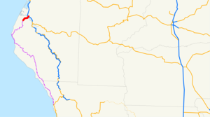
length_mi=5.395
length_round=3
length_ref=
direction_a=South
terminus_a=Ocean Avenue in Ferndale
direction_b=North
terminus_b=jct|state=CA|US|101 at Fernbridge
previous_type=SR
previous_route=210
next_type=SR
next_route=213State Route 211 is a California
state highway in Humboldt County that connects Ferndale with U.S. Route 101. This route was originally planned to be part of State Route 1, but was renumbered as SR 211 after plans to extend SR 1 from Rockport in Mendocino County to Ferndale fell through. The current routing is unconstructed from Route 1 to Ferndale and is not signed. The portion of the route between the Ferndale city limits and US 101 is signed. The traversable route in northern Mendocino and southern Humboldt counties is Chemise Mountain Road, Wilder Ridge Road, and Mattole Road. The highway appears to end at the intersection of Main Street and Ocean Avenue in Ferndale. Only five miles of this route is constructed, while the remaining convert|103|mi|km will probably never be constructed.This route is part of the
California Freeway and Expressway System [http://www.leginfo.ca.gov/cgi-bin/displaycode?section=shc&group=00001-01000&file=250-257 CA Codes (shc:250-257)] ] .Major intersections
:"Note: Except where prefixed with a letter,
postmile s were measured in 1964, based on the alignment as it existed at that time, and do not necessarily reflect current mileage."The entire route is in Humboldt County.External links
* [http://www.cahighways.org/209-216.html#211 California Highways: SR 211]
References

Wikimedia Foundation. 2010.