- Ferndale, California
-
City of Ferndale — City — Main Street in Ferndale Location in Humboldt County and the state of California
Coordinates: 40°34′34″N 124°15′50″W / 40.57611°N 124.26389°WCoordinates: 40°34′34″N 124°15′50″W / 40.57611°N 124.26389°W Country  United States
State  California
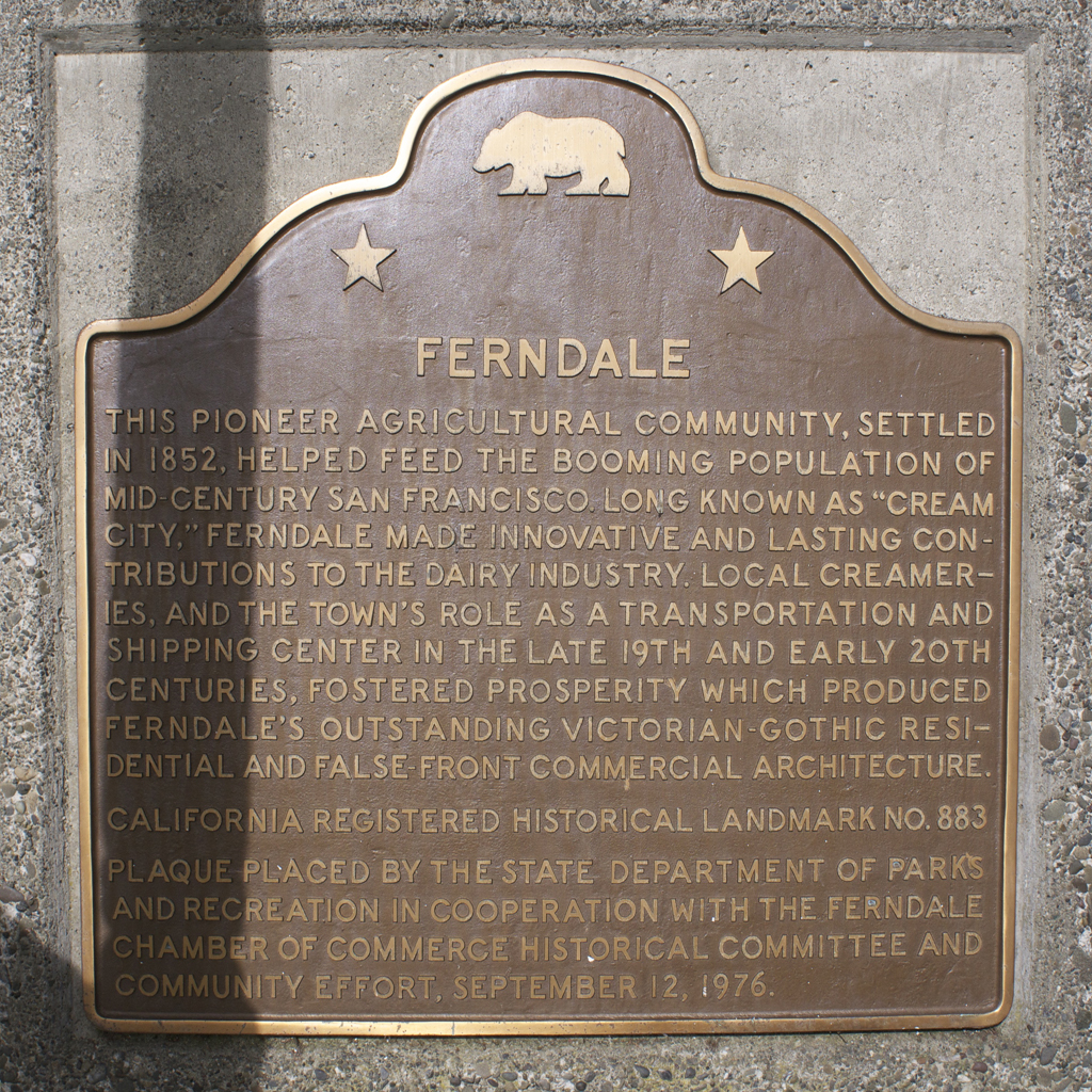
County Humboldt Area[1] – Total 1.027 sq mi (2.659 km2) – Land 1.027 sq mi (2.659 km2) – Water 0 sq mi (0 km2) 0% Elevation[2] 56 ft (17 m) Population (2010) – Total 1,371 – Density 1,335/sq mi (515.6/km2) Time zone Pacific (PST) (UTC-8) – Summer (DST) PDT (UTC-7) ZIP Code 95536 Area code(s) 707 FIPS code 06-23910 GNIS feature ID 0277513 Website ci.ferndale.ca.us Reference #: 883 Ferndale is a city in Humboldt County, California, United States. Known for its well-preserved Victorian buildings, the city's population was 1,371 at the 2010 census, down from 1,382 at the 2000 census. It is very near the Lost Coast and towering Coast Redwoods.
Contents
Culture and events
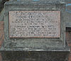
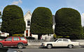
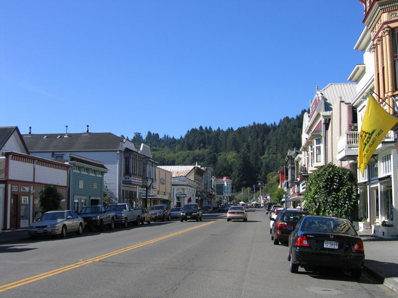
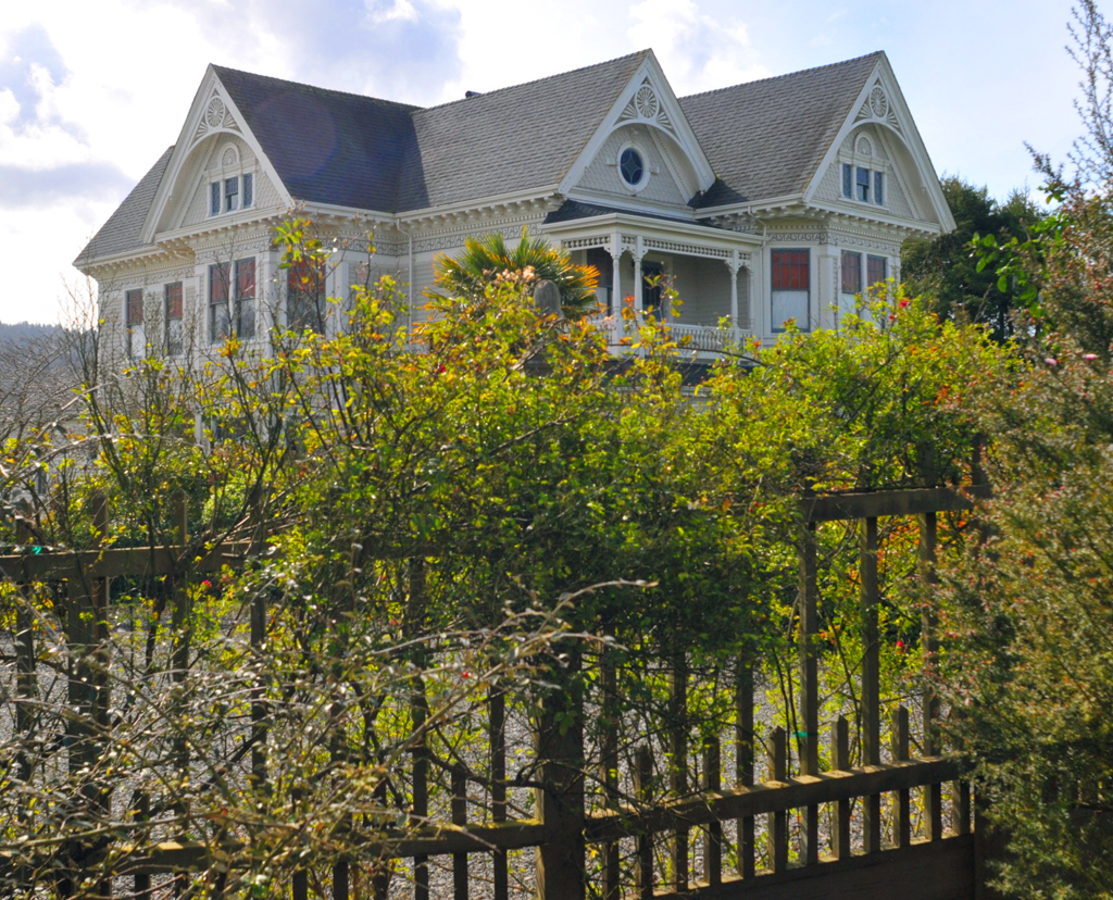
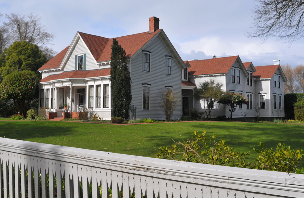
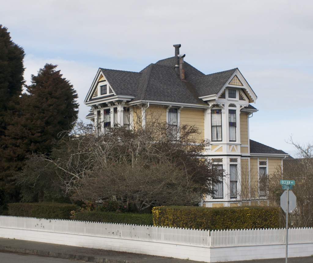
Ferndale is known for well-preserved Victorian buildings, which are also known as "Butterfat Palaces" due to their construction during an epoch wherein considerable wealth was generated in the dairy industry, especially during the 1880s. The entire town is an historical landmark (see California Historical Landmark No. 883).[3]

Each May Ferndale is been the finish line of the annual Kinetic sculpture race The first ever race began in Ferndale when Hobart Brown was challenged to race his odd-looking five-wheeled bike down Main Street on Mother's Day, 1969 by local sculptor Jack Mays.
Every February since 1997, Ferndale has hosted 'The Ferndale Fray,' a slot car race with the highest attendance of this type of event anywhere in the world. More than 100 racers on sixteen teams arrive to compete on eight-custom built tables.[4][5]
The Humboldt County Fair is held every August at the county fairgrounds on the edge of Ferndale, and feature the only horse-racing events in the county along with the standard fare of agricultural, pastoral and artistic contests, carnival games, carnival amusement rides, and commercial or non-profit booths.
In early December each year since 1934, local volunteer fire fighters climb and light an approximately 150 foot spruce, one of America's tallest living Christmas trees, during a celebration of song held at the Fireman's Park.[6]
Ferndale is a popular film location and is featured in movies like The Majestic with Jim Carrey, Outbreak starring Dustin Hoffman, Salem’s Lot starring David Soul and James Mason. It was also used as a location twice by the Star Trek franchise, once in Star Trek: The Next Generation and once in Star Trek: Deep Space Nine.
Ferndale is also the hometown of Chef, Restaurateur and Food network star Guy Fieri.
History
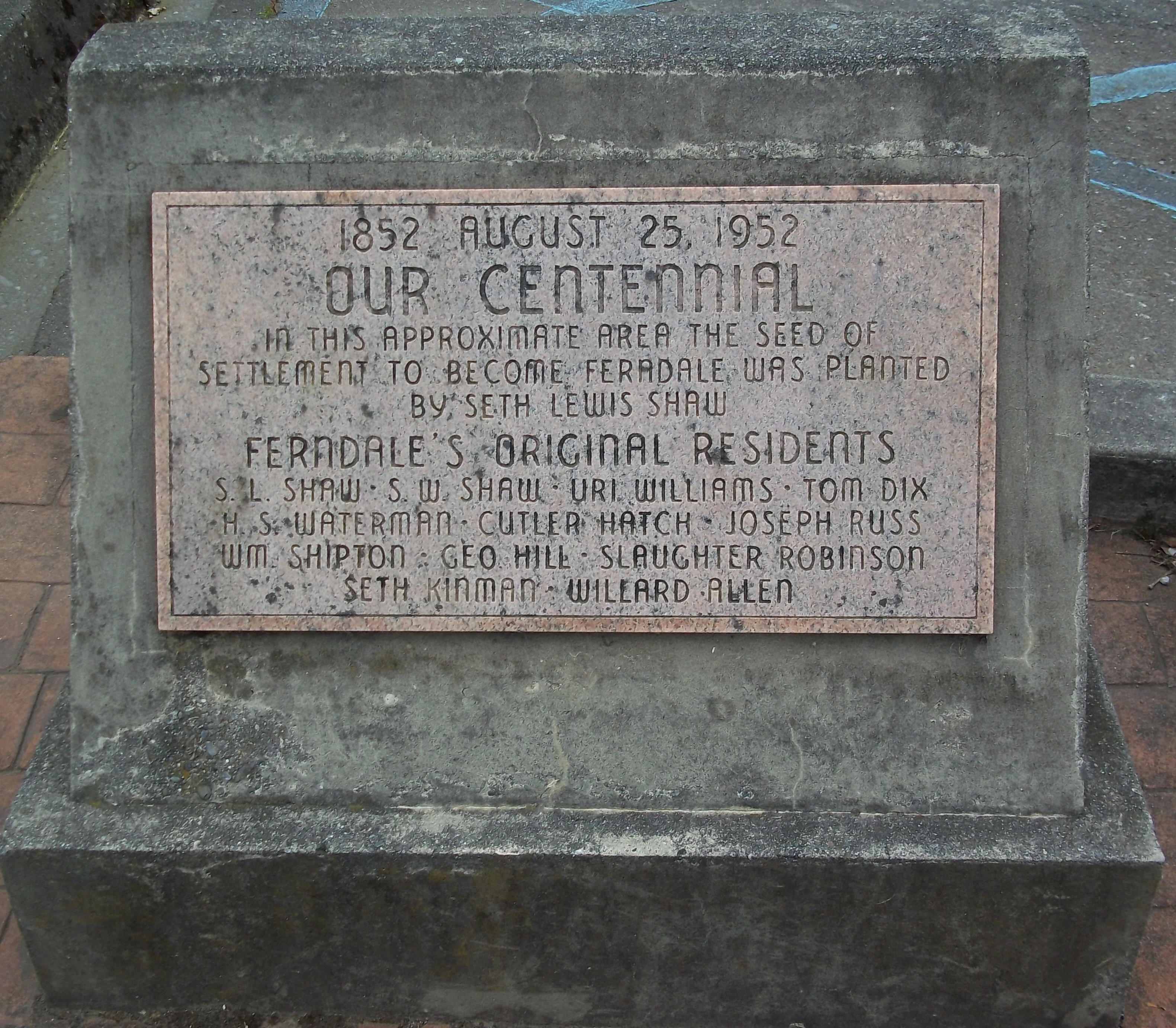
Seth Lewis Shaw built the now-historic Shaw House on his property in 1854. The first post office at Ferndale opened in 1860.[7] Ferndale was incorporated in 1893.[7]
Geography

Ferndale is located at 40°34′34″N 124°15′50″W / 40.57611°N 124.26389°W.[2] Its location south of US 101, is very close to the mouth of the Eel River as it enters the Pacific Ocean. By car, Ferndale is 265 miles (426 km) north of San Francisco and just 12 miles (19 km) south of Eureka. According to the United States Census Bureau, the city has a total area of 1.0 square mile (2.6 km2), all of it land.
Climate
Ferndale Climate chart (explanation) J F M A M J J A S O N D 8.557407.758417.459423.462441.764470.667500.170520.371520.872502.868466.961438.35639Average max. and min. temperatures in °F Precipitation totals in inches Metric conversion J F M A M J J A S O N D 21514419614518815686177441881419102.821118.6221121221071208174166211134Average max. and min. temperatures in °C Precipitation totals in mm Ferndale's climate is moderated by being close the Pacific Ocean and in the lee of the Wildcat Hills. Winter temperatures rarely go below freezing and summer days are rarely over 80 °F (27 °C). Ferndale receives most of its nearly 50 inches (130 cm) of rain from November to May, with lesser amounts in the summer months. Local microclimates are varied and support tropical palm trees[8] and Sitka spruce,[9] including a mature Sitka forest in Russ Park,[10][11] and the over 150 feet (46 m) tall spruce lighted every year for Christmas.[12] Morning fogs are common year round.
Climate data for Ferndale, California Month Jan Feb Mar Apr May Jun Jul Aug Sep Oct Nov Dec Year Record high °F 43.9 49.6 56.6 68.5 74.1 85.7 91.8 92.6 84.6 74.8 53.8 46.5 92.6 Average high °F 57 58 59 62 64 67 70 71 72 68 61 56 63.8 Daily mean °F 26.4 31.9 36.8 43.5 51.3 60.1 68.2 66.6 57 47.3 35.6 27.7 46.03 Average low °F 40 41 42 44 47 50 52 52 50 46 43 39 46 Record low °F 26 25 30 30 35 37 41 40 35 29 29 19 19 Rainfall inches 8.45 7.7 7.4 3.38 1.73 0.55 0.11 0.34 0.82 2.81 6.87 8.31 48.47 Record high °C 6.6 9.8 13.7 20.3 23.4 29.8 33.2 33.7 29.2 23.8 12.1 8.1 33.7 Average high °C 14 14 15 17 18 19 21 22 22 20 16 13 17.6 Daily mean °C −3.1 −0.1 2.7 6.4 10.7 15.6 20.1 19.2 14 8.5 2.0 −2.4 7.80 Average low °C 4 5 6 7 8 10 11 11 10 8 6 4 7.5 Record low °C −3 −4 −1 −1 2 3 5 4 2 −2 −2 −7 −7 Rainfall mm 214.6 196 188 85.9 43.9 14 2.8 8.6 20.8 71.4 174.5 211.1 1,231.1 Avg. precipitation days 20 12 14 12 6 6 4 6 5 11 17 17 130 Avg. rainy days 20 12 14 12 6 6 4 6 5 11 17 17 130 Source no. 1: Weatherbase[13] Source no. 2: Weather.com[14] Earthquakes
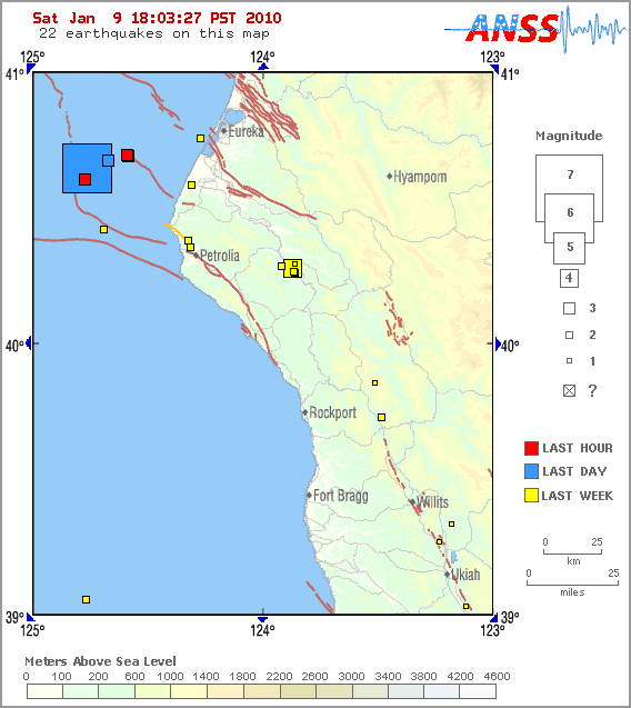
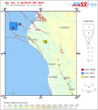 Ferndale earthquake chart. Click here for current "live" map for this region
On January 9, 2010 Eureka Earthquake a Richter magnitude 6.5 earthquake occurred about 25 miles offshore of Ferndale. Occurring within a subduction fault associated with the interaction of three tectonic plates (Pacific, North American, and Juan de Fuca), it was the largest local earthquake since the 1992 Cape Mendocino Earthquakes, a series of magnitude 7.2, 6.5, and 6.7 earthquakes which occurred over an 18 hour period, severely damaging some buildings.[15]
Demographics
Historical populations Census Pop. %± 1900 846 — 1910 905 7.0% 1920 919 1.5% 1930 889 −3.3% 1940 901 1.3% 1950 1,032 14.5% 1960 1,371 32.8% 1970 1,352 −1.4% 1980 1,367 1.1% 1990 1,331 −2.6% 2000 1,382 3.8% 2010 1,371 −0.8% source:[16] 2010
The 2010 United States Census[17] reported that Ferndale had a population of 1,371. The population density was 1,335.5 people per square mile (515.6/km²). The racial makeup of Ferndale was 1,281 (93.4%) White, 1 (0.1%) African American, 22 (1.6%) Native American, 20 (1.5%) Asian, 2 (0.1%) Pacific Islander, 17 (1.2%) from other races, and 28 (2.0%) from two or more races. Hispanic or Latino of any race were 77 persons (5.6%).
The Census reported that 1,371 people (100% of the population) lived in households, 0 (0%) lived in non-institutionalized group quarters, and 0 (0%) were institutionalized.
There were 611 households, out of which 149 (24.4%) had children under the age of 18 living in them, 294 (48.1%) were opposite-sex married couples living together, 55 (9.0%) had a female householder with no husband present, 27 (4.4%) had a male householder with no wife present. There were 38 (6.2%) unmarried opposite-sex partnerships, and 6 (1.0%) same-sex married couples or partnerships. 194 households (31.8%) were made up of individuals and 91 (14.9%) had someone living alone who was 65 years of age or older. The average household size was 2.24. There were 376 families (61.5% of all households); the average family size was 2.84.
The population was spread out with 283 people (20.6%) under the age of 18, 75 people (5.5%) aged 18 to 24, 283 people (20.6%) aged 25 to 44, 422 people (30.8%) aged 45 to 64, and 308 people (22.5%) who were 65 years of age or older. The median age was 47.2 years. For every 100 females there were 89.6 males. For every 100 females age 18 and over, there were 84.1 males.
There were 717 housing units at an average density of 698.4 per square mile (269.7/km²), of which 388 (63.5%) were owner-occupied, and 223 (36.5%) were occupied by renters. The homeowner vacancy rate was 1.8%; the rental vacancy rate was 3.0%. 926 people (67.5% of the population) lived in owner-occupied housing units and 445 people (32.5%) lived in rental housing units.
2000
As of the census[18] of 2000, there were 1,382 people, 611 households, and 392 families residing in the city. The population density was 1,343.2 people per square mile (518.1/km²). There were 663 housing units at an average density of 644.4 per square mile (248.5/km²). The racial makeup of the city was 93.34% White, 0.29% Black or African American, 0.51% Native American, 0.58% Asian, 0.07% Pacific Islander, 1.30% from other races, and 3.91% from two or more races. 4.27% of the population were Hispanic or Latino of any race.
There were 611 households out of which 25.7% had children under the age of 18 living with them, 53.0% were married couples living together, 9.3% had a female householder with no husband present, and 35.8% were non-families. 30.1% of all households were made up of individuals and 14.9% had someone living alone who was 65 years of age or older. The average household size was 2.26 and the average family size was 2.83.
In the city the population was spread out with 22.8% under the age of 18, 6.9% from 18 to 24, 24.2% from 25 to 44, 29.5% from 45 to 64, and 16.6% who were 65 years of age or older. The median age was 43 years. For every 100 females there were 86.5 males. For every 100 females age 18 and over, there were 81.8 males.
The median income for a household in the city was $37,955, and the median income for a family was $49,706. Males had a median income of $32,404 versus $29,808 for females. The per capita income for the city was $21,727. About 4.5% of families and 7.1% of the population were below the poverty line, including 9.9% of those under age 18 and 3.6% of those age 65 or over.
Politics
Local
Ferndale was incorporated in 1893 and is governed by a four-member City Council and a Mayor, all of whom serve four-year terms chosen in the general election of even-numbered years. The current Mayor is Jeff Farley, elected in November 2006. Councilmembers include Niels Lorenzen, Michael Moreland, Ken Mierzwa and Stuart Titus.
In 2004 the City Council placed Measure O on the municipal ballot to eliminate the elective office of Mayor, which would have then reverted to an appointive office, to be filled by a person chosen by the City Council from amongst its own members. The measure was resoundingly defeated, with 78.8% voting against. Interestingly, when the Mayor's seat was open for election in 2006, all of the mayoral candidates were write-ins. Jeff Farley won the election, and now holds office as Mayor for the second time in Ferndale history.
State and Federal
In the state legislature Ferndale is located in the 2nd Senate District, represented by Democrat Noreen Evans, and in the 1st Assembly District, represented by Democrat Wesley Chesbro. Federally, Ferndale is located in California's 1st congressional district.
Media
Ferndale is home to the longest living newspaper under a single name in Humboldt County, the Ferndale Enterprise.[19] Commercial radio station KHUM operates in a joint studio with KSLG-FM and KWPT under the ownership of Lost Coast Communications. Ferndale is also home to the North Coast's oldest theatre company, The Ferndale Repertory Theatre which has been in operation since 1972.[20]
Notables born in Ferndale
- Len Casanova, athlete and coach
- Donald Clausen, Congressman
- Sam Dungan, professional baseball player
- Frank Ferguson, character actor
- Thomas E. Leavey, businessman
- Edward L. Wilson, civil engineer
Notable residents of Ferndale
- Seth Kinman, pioneer
- Stephen W. Shaw, pioneer
- Peter Buckley, Oregon politician
- Hobart Brown, artist
- Joe Oeschger, major league pitcher
- Elaine "Spanky" McFarlane, musician
- Guy Fieri, chef
Points of interest
Several buildings and two Historic Districts in and around Ferndale are listed on the National Register of Historic Places.
-

Andreasen-Rossen House
-
A. Berding House, "Gum Drop Tree House"
-

Fern Cottage Historical District
-

Main Street Historical District
-
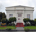
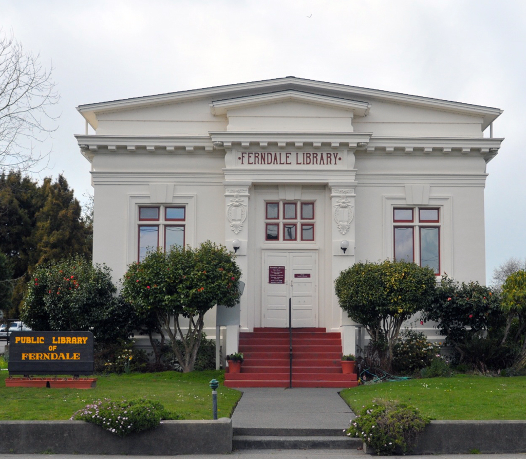
Ferndale Public Library
-

Former Rectory, Church of the Assumption
The 1891 Eastlake-Stick Style Russ-Williams Bank Building (currently the Victorian Inn), corner of Ocean and Main, was designed by noted architect J. Frost, with a millinery store, a haberdashery and the Ferndale Enterprise newspaper on the ground floor, as well as business and professional offices on the upper floors.Model Replica
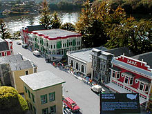 Some of Ferndale's historic buildings at Legoland, California. Left to right top: Abraxas Building, Victorian Inn, NVB Bank Building, Hobart Galleries, and the IOOF hall. The order of the buildings is not the same in reality.
Many of Ferndale's buildings have been recreated at the Legoland California theme park - the only American small town represented alongside New York, San Francisco, Las Vegas and other nationally known locations. Ferndale was settled by many Danes, and Lego is a Danish company. In 1995, Legoland staff took hundreds of photos in Ferndale, and used over 1 million Lego bricks to recreate the town in the Miniland section of the park.[21]
Wastewater Treatment
Ferndale's first sewage treatment facility and combined sewer system was built in 1953 and upgraded in 1973, 1994 and 2001.[22] Improvements were made to the sewers in 1989 under a $400,000 project funded by the California State Water Resources Control Board to improve the collection system and reduce inflow and infiltration.[22] El Niño storms in April 1998 caused Williams Creek to change course due to debris blockage.[23] This creek had been the major tributary of the Salt River near the treatment plant, so diversion lowered the volume of water available and caused the dilution ratios at the plant to exceed permitted levels.[23] Record stormwater flows damaged the plant and the city applied for assistance[23] under the FEMA-1203-DR-CA El Niño storm Presidential disaster declaration.[24] On 15 May 2003, the Regional Water Board (RWB) placed a Cease and Desist order on Ferndale due to discharges of treated wastewater which exceeded 1 percent of the flow of Francis Creek / Salt River stream system.[25] The City paid a $48,000 penalty to the RWB and agreed to complete an environmental project instead of paying $78,000 more in penalties to the RWB[25] and began replacing the old plant in 2009.[25]
The new plant was completed in 2011 and provides tertiary wastewater treatment for nearly 1,500 commercial and residential users.[25] The only other wastewater facility like Ferndale's in California is in Colfax.[26]
See also
- California State Route 211
- Eel River (California)
- Centerville Beach Cross
References
- ^ U.S. Census
- ^ a b U.S. Geological Survey Geographic Names Information System: Ferndale, California
- ^ "Humboldt Historic Landmarks". California Office of Historic Preservation. http://ohp.parks.ca.gov/default.asp?page_id=21420. Retrieved 02 August 2011.
- ^ Mickey, R. "So, what is this thing called The Fray?". Inland Empire HO Raceway - Purveyors of fine fray racing. http://www.inlandempirehoraceway.itgo.com/index_2.html. Retrieved 16 August 2011.
- ^ Phillis, Richard. "It happens at the Ferndale Fairgrounds". The Fray In Ferndale. http://www.thefrayinferndale.com/. Retrieved 16 August 2011.
- ^ Humboldt County Convention & Visitors Bureau. "Lighting of America's Tallest Living Christmas Tree". Humboldt County Convention & Visitors Bureau. http://redwoods.info/showrecord.asp?id=3714. Retrieved 16 August 2011.
- ^ a b Durham, David L. (1998). California's Geographic Names: A Gazetteer of Historic and Modern Names of the State. Quill Driver Books. p. 59. ISBN 9781884995149.
- ^ Corwin, Diane (2011). "Palm Tree Toupee". Sense of Place. National Geographic. http://travel.nationalgeographic.com/travel/traveler-magazine/photo-contest/entries/65633/view/. Retrieved 01 October 2011.
- ^ "Ferndale Series". Soil Series of California. United States Department of Agriculture. https://soilseries.sc.egov.usda.gov/OSD_Docs/F/FERNDALE.html. Retrieved 01 October 2011.
- ^ Sawyer, J.O.; T. Keeler-Wolf (1995). A Manual of California Vegetation. Sacramento, California: California Native Plant Society. pp. 471.
- ^ "Russ Park". California's Redwood Coast. Humboldt County Convention & Visitors Bureau. http://redwoods.info/showrecord.asp?id=1721. Retrieved 01 October 2011.
- ^ Hasslinger, Tom (January 9, 2011). "Tall tree tale". Coeur d’Alene Press. http://www.cdapress.com/news/local_news/article_a427d57c-44eb-5abf-adf5-63024c2a049a.html. Retrieved 01 October 2011.
- ^ "Weatherbase: Historical Weather for Ferndale California, United States of America". http://www.weatherbase.com/weather/weather.php3?s=30341&refer=&units=us&cityname=Ferndale-California-United-States-of-America. Retrieved 01 August 2011.
- ^ "Ferndale California, United States of America". http://www.weather.com/weather/wxclimatology/monthly/graph/95536. Retrieved 01 August 2011.
- ^ USGS. "Cape Mendocino, California Earthquakes". http://earthquake.usgs.gov/regional/states/events/1992_04_25_26.php. Retrieved 2009-10-21.
- ^ "Historical Census Populations of Places, Towns, and Cities in California, 1850-2000". California Dept. of Finance. http://http://www.dof.ca.gov/research/demographic/state_census_data_center/historical_census_1850-2010/view.php. Retrieved 2011-11-12.
- ^ All data are derived from the United States Census Bureau reports from the 2010 United States Census, and are accessible on-line here. The data on unmarried partnerships and same-sex married couples are from the Census report DEC_10_SF1_PCT15. All other housing and population data are from Census report DEC_10_DP_DPDP1. Both reports are viewable online or downloadable in a zip file containing a comma-delimited data file. The area data, from which densities are calculated, are available on-line here. Percentage totals may not add to 100% due to rounding. The Census Bureau defines families as a household containing one or more people related to the householder by birth, opposite-sex marriage, or adoption. People living in group quarters are tabulated by the Census Bureau as neither owners nor renters. For further details, see the text files accompanying the data files containing the Census reports mentioned above.
- ^ "American FactFinder". United States Census Bureau. http://factfinder.census.gov. Retrieved 2008-01-31.
- ^ Wilke, Lorraine Devon. "Women Of the News: Ferndale's Enterprising Editor, Caroline Titus". 15 June 2011. Huffington Post. http://www.huffingtonpost.com/lorraine-devon-wilke/ferndales-enterprising-ed_b_876184.html. Retrieved 02 August 2011.
- ^ "Ferndale Repertory Theatre". http://www.ferndale-rep.org/. Retrieved 02 August 2011.
- ^ Ringwald, George (29 July 1999). "Ferndale's Dan Rather". North Coast Journal. http://www.northcoastjournal.com/072999/cover0729.html. Retrieved 04 April 2011.
- ^ a b Spencer Engineering and Construction Management (14 September 2004). City of Ferndale, USDA Rural Utilities Service Wastewater System Improvements Financial Assistance Grant Preliminary Engineering Report. Ferndale, California: City of Ferndale. pp. 115. http://ci.ferndale.ca.us/pdf/Preliminary-Engineering-Report.pdf.
- ^ a b c Spencer Engineering and Construction Management (10 December 2003). Wastewater Treament Corrective Action Report City of Ferndale. City of Ferndale, California. pp. 100. http://ci.ferndale.ca.us/pdf/Corrective-Action-Report.pdf.
- ^ FEMA (9 February 1998). "California Severe Winter Storms and Flooding Major Disaster Declared February 9, 1998 (DR-1203)". 1998 Federal Disaster Declarations. Federal Emergency Management Agency. http://www.fema.gov/news/eventcounties.fema?id=525. Retrieved 13 November 2011.
- ^ a b c d California Regional Water Quality Control Board North Coast Region (23 July 2009). Waste Discharge Requirements for The City of Ferndale, Wastewater Treament Facility ORDER NO. R1-2009-0034. State of California. pp. 124. http://www.waterboards.ca.gov/northcoast/board_info/board_meetings/07_2009/pdf/ferndale/09_0034_FerndaleNPDES.pdf.
- ^ Bullwinkel, Mary (29 April 2011). "Construction continues at the Wastewater Treatment facility". Humboldt Beacon. http://www.humboldtbeacon.com/ci_17952233. Retrieved 12 November 2011.
External links
- City of Ferndale The official city website.
- Ferndale Chamber of Commerce site has an event calendar, history of town and much more information
- Ferndale History Museum An active research institution
- Ferndale's Carnegie Library
- Virtual Walk on Main Street A building-by-building description of Historic Main Street
- The 1906 Earthquake More famous for its devastation of San Francisco, California
Municipalities and communities of Humboldt County, California Cities 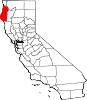
CDPs Alderpoint | Bayview | Benbow | Big Lagoon | Cutten | Fieldbrook | Fields Landing | Garberville | Humboldt Hill | Hydesville | Indianola | Loleta | McKinleyville | Manila | Miranda | Myers Flat | Myrtletown | Orick | Phillipsville | Pine Hills | Redcrest | Redway | Samoa | Scotia | Shelter Cove | Weott | Westhaven-Moonstone | Willow Creek
Unincorporated
communitiesAlton | Bayside | Blocksburg | Bracut | Brainard | Briceland | Bridgeville | Bucksport | Calville | Carlotta | Crannell | Dinsmore | Elk River | Englewood | Fairhaven | Fernbridge | Fort Seward | Freshwater | Freshwater Corners | Fruitland | Glendale | Holmes | Honeydew | Hoopa | Johnsons | King Salmon | Kneeland | Korbel | Maple Creek | Metropolitan | Moonstone | Orleans | Patricks Point | Pepperwood | Petrolia | Pine Hill | Port Kenyon | Ridgewoods Heights | Riverside Park | Rohnerville | Rosewood | Shively | Stafford | Sunny Brae | Weitchpec | Westhaven | Whitethorn
Indian
reservationsBig Lagoon Rancheria | Blue Lake Rancheria | Hoopa Valley Indian Reservation | Yurok Indian Reservation
Ghost towns Acorn | Albeeville | Apyu | Aranimokw | Arekw | Atsepar | Bald Hills | Blaine | Brock Creek | Bryan | Bryant | Buck's Port | Camp 4 Flat | Camp 19 | Camp Grant | Centerville | Chinits | Cleveland | Daby's Ferry | Dark Canyon | Dinty | Dyer Place | Eddyville | Elinor | Elk Grove | Elk Prairie | Erner | Ertlerger | Eshpeu | Frank | Gans | Hadley | Hartsook | Honsading | Humboldt City | Iaqua | Kokaman | Kworatem | Lippitt | Lockharts | Lone Star | Loolego | Luffenholtz | Mandala | Martins Ferry | McDuff | Meridian | Mountain View | Mower | Myrtle Grove | Northern Redwood Camp | Oketo | Opegoi | Ore'q | Panamenik | Pasara | Pekwan | Pekwuteu | Robinson's Ferry | Scribner | Shanamkarak | Showers Pass | Shregegon | Shumig | Skelly | Smith | Tanoak | Three Cabins | Tsofkara | Tsurau | West Humboldt | Wilder
Categories:- California Historical Landmarks
- Incorporated cities and towns in California
- Populated coastal places in California
- Cities in Humboldt County, California
- Populated places established in 1893


Wikimedia Foundation. 2010.