- Westhaven-Moonstone, California
Infobox Settlement
official_name = Westhaven-Moonstone, California
other_name =
native_name =
nickname =
settlement_type = CDP
motto =
imagesize =
image_caption =
flag_size =
image_
seal_size =
image_shield =
shield_size =
image_blank_emblem =
blank_emblem_type =
blank_emblem_size =
imagesize =
image_caption =
flag_size =
image_
seal_size =
image_shield =
shield_size =
image_blank_emblem =
blank_emblem_type =
blank_emblem_size =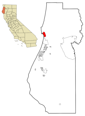
mapsize = 250x200px
map_caption = Location in Humboldt County and the state ofCalifornia
mapsize1 =
map_caption1 =
image_dot_
dot_mapsize =
dot_map_caption =
dot_x =
dot_y =
pushpin_
pushpin_label_position =
pushpin_map_caption =
pushpin_mapsize =
subdivision_type = Country
subdivision_name =United States
subdivision_type1 = State
subdivision_name1 =California
subdivision_type2 = County
subdivision_name2 = Humboldt
subdivision_type3 =
subdivision_name3 =
subdivision_type4 =
subdivision_name4 =
government_footnotes =
government_type =
leader_title =
leader_name =
leader_title1 =
leader_name1 =
leader_title2 =
leader_name2 =
leader_title3 =
leader_name3 =
leader_title4 =
leader_name4 =
established_title =
established_date =
established_title2 =
established_date2 =
established_title3 =
established_date3 =
area_magnitude =
unit_pref =
area_footnotes =
area_total_km2 = 20.9
area_land_km2 = 20.9
area_water_km2 = 0
area_total_sq_mi = 8.1
area_land_sq_mi = 8.1
area_water_sq_mi = 0
area_water_percent =
area_urban_km2 =
area_urban_sq_mi =
area_metro_km2 =
area_metro_sq_mi =
area_blank1_title =
area_blank1_km2 =
area_blank1_sq_mi =
population_as_of = 2000
population_footnotes =
population_note =
population_total = 1044
population_density_km2 = 50
population_density_sq_mi = 128.9
population_metro =
population_density_metro_km2 =
population_density_metro_sq_mi =
population_urban =
population_density_urban_km2 =
population_density_urban_sq_mi =
population_blank1_title =
population_blank1 =
population_density_blank1_km2 =
population_density_blank1_sq_mi =
timezone = Pacific (PST)
utc_offset = -8
timezone_DST = PDT
utc_offset_DST = -7
latd = 41 |latm = 2 |lats = 22 |latNS = N
longd = 124 |longm = 6 |longs = 40 |longEW = W
elevation_footnotes =
elevation_m =
elevation_ft =
postal_code_type =ZIP code
postal_code = 95570
area_code = 707
blank_name = FIPS code
blank_info = 06-84385
blank1_name =
blank1_info =
website =
footnotes =Westhaven-Moonstone is a
census-designated place located inHumboldt County, California . As of the2000 census, the CDP had a total population of 1,044.Geography
Westhaven-Moonstone is located at 41°2'22" North, 124°6'40" West (41.039522, -124.111170)GR|1.
According to the
United States Census Bureau , the CDP has a total area of 8.1 square miles (20.9 km²), of which, 8.1 square miles (20.9 km²) of it is land and none of it is covered by water.Demographics
As of the
census GR|2 of2000 , there are 1,044 people, 453 households, and 269 families residing in the CDP. Thepopulation density is 129.2 people per square mile (49.9/km²). There are 498 housing units at an average density of 61.6/sq mi (23.8/km²). The racial makeup of the CDP is 88.98% White, 0.00% Black or African American, 5.08% Native American, 0.86% Asian, 0.00% Pacific Islander, 0.67% from other races, and 4.41% from two or more races. 4.02% of the population are Hispanic or Latino of any race.There are 453 households out of which 28.3% have children under the age of 18 living with them, 46.8% are married couples living together, 9.3% have a female householder with no husband present, and 40.6% are non-families. 28.5% of all households are made up of individuals and 5.5% have someone living alone who is 65 years of age or older. The average household size is 2.30 and the average family size is 2.80.
In the CDP the population is spread out with 19.7% under the age of 18, 8.0% from 18 to 24, 26.9% from 25 to 44, 35.9% from 45 to 64, and 9.4% who are 65 years of age or older. The median age is 42 years. For every 100 females there are 101.5 males. For every 100 females age 18 and over, there are 97.2 males.
The median income for a household in the CDP is $36,000, and the median income for a family is $34,615. Males have a median income of $37,000 versus $21,964 for females. The
per capita income for the CDP is $21,493. 14.1% of the population and 11.8% of families are below thepoverty line . Out of the total population, 16.9% of those under the age of 18 and 0.0% of those 65 and older are living below the poverty line.Politics
In the state legislature Westhaven-Moonstone is located in the 2nd Senate District, represented by Democrat
Pat Wiggins , and in the 1st Assembly District, represented by Democrat Patty Berg. Federally, Westhaven-Moonstone is located inCalifornia's 1st congressional district .References
External links
Wikimedia Foundation. 2010.