- Manila, California
-
Manila — census-designated place — Location in California
 Manila
Coordinates: 40°51′06″N 124°09′44″W / 40.85167°N 124.16222°WCoordinates: 40°51′06″N 124°09′44″W / 40.85167°N 124.16222°W Country  United States
State  California
County Humboldt County Area[1] - Total 0.704 sq mi (1.823 km2) - Land 0.654 sq mi (1.695 km2) - Water 0.050 sq mi (0.128 km2) 7.0% Elevation[2] 13 ft (4 m) Population (2010) - Total 784 - Density 1,113.9/sq mi (430.1/km2) Time zone Pacific (PST) (UTC-8) - Summer (DST) PDT (UTC-7) ZIP Code 95521 Area code(s) 707 GNIS feature IDs 228014; 2628755 U.S. Geological Survey Geographic Names Information System: Manila, California; U.S. Geological Survey Geographic Names Information System: Manila, California Manila is a census-designated place[3] in Humboldt County, California.[2] It is located 3.25 miles (5.2 km) north of downtown Eureka,[4] at an elevation of 13 feet (4 m).[2] The ZIP Code is 95521.[5] The population was 784 at the 2010 census.
History
The town was founded at the end of World War II, and named after Manila in the Philippines.[4]
Demographics
The 2010 United States Census[6] reported that Manila had a population of 784. The population density was 1,113.9 people per square mile (430.1/km²). The racial makeup of Manila was 686 (87.5%) White, 14 (1.8%) African American, 25 (3.2%) Native American, 5 (0.6%) Asian, 0 (0.0%) Pacific Islander, 12 (1.5%) from other races, and 42 (5.4%) from two or more races. Hispanic or Latino of any race were 30 persons (3.8%).
The Census reported that 777 people (99.1% of the population) lived in households, 7 (0.9%) lived in non-institutionalized group quarters, and 0 (0%) were institutionalized.
There were 368 households, out of which 86 (23.4%) had children under the age of 18 living in them, 94 (25.5%) were opposite-sex married couples living together, 40 (10.9%) had a female householder with no husband present, 25 (6.8%) had a male householder with no wife present. There were 34 (9.2%) unmarried opposite-sex partnerships, and 4 (1.1%) same-sex married couples or partnerships. 150 households (40.8%) were made up of individuals and 28 (7.6%) had someone living alone who was 65 years of age or older. The average household size was 2.11. There were 159 families (43.2% of all households); the average family size was 2.91.
The population was spread out with 152 people (19.4%) under the age of 18, 47 people (6.0%) aged 18 to 24, 259 people (33.0%) aged 25 to 44, 259 people (33.0%) aged 45 to 64, and 67 people (8.5%) who were 65 years of age or older. The median age was 38.1 years. For every 100 females there were 117.2 males. For every 100 females age 18 and over, there were 122.5 males.
There were 411 housing units at an average density of 583.9 per square mile (225.5/km²), of which 160 (43.5%) were owner-occupied, and 208 (56.5%) were occupied by renters. The homeowner vacancy rate was 1.2%; the rental vacancy rate was 3.6%. 335 people (42.7% of the population) lived in owner-occupied housing units and 442 people (56.4%) lived in rental housing units.
References
- ^ U.S. Census
- ^ a b c U.S. Geological Survey Geographic Names Information System: Manila, California
- ^ U.S. Geological Survey Geographic Names Information System: Manila, California
- ^ a b Durham, David L. (1998). California's Geographic Names: A Gazetteer of Historic and Modern Names of the State. Quill Driver Books. p. 101. ISBN 9781884995149.
- ^ USPS ZIP Code lookup tool
- ^ All data are derived from the United States Census Bureau reports from the 2010 United States Census, and are accessible on-line here. The data on unmarried partnerships and same-sex married couples are from the Census report DEC_10_SF1_PCT15. All other housing and population data are from Census report DEC_10_DP_DPDP1. Both reports are viewable online or downloadable in a zip file containing a comma-delimited data file. The area data, from which densities are calculated, are available on-line here. Percentage totals may not add to 100% due to rounding. The Census Bureau defines families as a household containing one or more people related to the householder by birth, opposite-sex marriage, or adoption. People living in group quarters are tabulated by the Census Bureau as neither owners nor renters. For further details, see the text files accompanying the data files containing the Census reports mentioned above.
Municipalities and communities of Humboldt County, California Cities 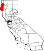
CDPs Alderpoint | Bayview | Benbow | Big Lagoon | Cutten | Fieldbrook | Fields Landing | Garberville | Humboldt Hill | Hydesville | Indianola | Loleta | McKinleyville | Manila | Miranda | Myers Flat | Myrtletown | Orick | Phillipsville | Pine Hills | Redcrest | Redway | Samoa | Scotia | Shelter Cove | Weott | Westhaven-Moonstone | Willow Creek
Unincorporated
communitiesAlton | Bayside | Blocksburg | Bracut | Brainard | Briceland | Bridgeville | Bucksport | Calville | Carlotta | Crannell | Dinsmore | Elk River | Englewood | Fairhaven | Fernbridge | Fort Seward | Freshwater | Freshwater Corners | Fruitland | Glendale | Holmes | Honeydew | Hoopa | Johnsons | King Salmon | Kneeland | Korbel | Maple Creek | Metropolitan | Moonstone | Orleans | Patricks Point | Pepperwood | Petrolia | Pine Hill | Port Kenyon | Ridgewoods Heights | Riverside Park | Rohnerville | Rosewood | Shively | Stafford | Sunny Brae | Weitchpec | Westhaven | Whitethorn
Indian
reservationsBig Lagoon Rancheria | Blue Lake Rancheria | Hoopa Valley Indian Reservation | Yurok Indian Reservation
Ghost towns Acorn | Albeeville | Apyu | Aranimokw | Arekw | Atsepar | Bald Hills | Blaine | Brock Creek | Bryan | Bryant | Buck's Port | Camp 4 Flat | Camp 19 | Camp Grant | Centerville | Chinits | Cleveland | Daby's Ferry | Dark Canyon | Dinty | Dyer Place | Eddyville | Elinor | Elk Grove | Elk Prairie | Erner | Ertlerger | Eshpeu | Frank | Gans | Hadley | Hartsook | Honsading | Humboldt City | Iaqua | Kokaman | Kworatem | Lippitt | Lockharts | Lone Star | Loolego | Luffenholtz | Mandala | Martins Ferry | McDuff | Meridian | Mountain View | Mower | Myrtle Grove | Northern Redwood Camp | Oketo | Opegoi | Ore'q | Panamenik | Pasara | Pekwan | Pekwuteu | Robinson's Ferry | Scribner | Shanamkarak | Showers Pass | Shregegon | Shumig | Skelly | Smith | Tanoak | Three Cabins | Tsofkara | Tsurau | West Humboldt | Wilder
Categories:- Census-designated places in Humboldt County, California
- Unincorporated communities in California
- Populated places established in 1945
- Humboldt County, California geography stubs


Wikimedia Foundation. 2010.