- McKinleyville, California
-
McKinleyville — census-designated place — Location in Humboldt County and the state of California
Coordinates: 40°56′47″N 124°06′02″W / 40.94639°N 124.10056°WCoordinates: 40°56′47″N 124°06′02″W / 40.94639°N 124.10056°W Country  United States
State  California
County Humboldt Area[1] – Total 21.014 sq mi (54.426 km2) – Land 20.796 sq mi (53.862 km2) – Water 0.218 sq mi (0.564 km2) 1.2% Elevation 141 ft (43 m) Population (2010) – Total 15,177 – Density 722.2/sq mi (278.9/km2) Time zone Pacific (PST) (UTC-8) – Summer (DST) PDT (UTC-7) ZIP codes 95519, 95521 Area code(s) 707 FIPS code 06-44910 GNIS feature ID 1659090 U.S. Geological Survey Geographic Names Information System: McKinleyville, California McKinleyville (formerly, Minorsville)[2] is a census-designated place (CDP) in Humboldt County, California, United States. McKinleyville is located 5.25 miles (8.4 km) north of Arcata,[3] at an elevation of 141 feet (43 m).[2] The population was 15,177 at the 2010 census, up from 13,599 at the 2000 census. This unincorporated community is the third largest community, after Eureka and Arcata, on the far North Coast. It is also the location of the Arcata-Eureka Airport.
Contents
Geography
According to the United States Census Bureau, the CDP has a total area of 21.0 square miles (54 km2), of which 20.8 square miles (54 km2) is land and 0.2 square miles (0.52 km2), or 1.2%, is water.
McKinleyville consists of several watershed areas. The north bank of the Mad River is the farthest watershed to the south. The next watershed to the north is Mill Creek, then Widow White Creek, Norton Creek, Strawberry Creek, Patrick Creek and finally the farthest watershed to the north is the south bank of the Little River. To the west lies the Pacific Ocean.
History
First Nation
The Wiyot and Yurok people lived in this area prior to European settlement. Both native groups still have a role in the local scene.
European settlement
McKinleyville is a community made up of a combination of smaller settlements. Joe Dow settled in the general area in the 1860s and that area was known as Dow's Prairie. Slightly south was a small community called Minor (also known as Minorville). Minor was first settled in the late-19th century. Just south of Minor was Calville. Calville was settled by the employees of the California Barrel Company. After President William McKinley was assassinated in 1901 the community of Minor changed its name in his honor. All three areas are collectively considered to be what is now known as McKinleyville. Dow's Prairie continues to be known by the original place name and, although it is considered part of McKinleyville, local residents further refine location by this neighborhood name. [1], [2]
The first post office at McKinleyville opened in 1903, closed in 1921, and was re-opened in 1955.[3]
Post timber boom
The area had several nicknames. Derogatory names such as "Oklahoma by the Sea", "MACK Town", "McHickleyville" and "McKinleymobile" came from the area historically having lower property values, and a larger concentration of mobile homes.
Current history
McKinleyville is now a bedroom community with mainly retail and professional businesses to serve its residents. Major entertainment, county services, educational facilities and local industry can be found in nearby Arcata and Eureka. Property values increased dramatically in the late 1990s and the early first decade of the 21st century, and the larger McKinleyville community has experienced gentrification. The community has discussed incorporating into a city in the past, but long term plans have not materialized.
Demographics
2010
The 2010 United States Census[4] reported that McKinleyville had a population of 15,177. The population density was 722.2 people per square mile (278.9/km²). The racial makeup of McKinleyville was 13,010 (85.7%) White, 103 (0.7%) African American, 700 (4.6%) Native American, 211 (1.4%) Asian, 17 (0.1%) Pacific Islander, 338 (2.2%) from other races, and 798 (5.3%) from two or more races. Hispanic or Latino of any race were 1,081 persons (7.1%).
The Census reported that 15,098 people (99.5% of the population) lived in households, 79 (0.5%) lived in non-institutionalized group quarters, and 0 (0%) were institutionalized.
There were 6,283 households, out of which 1,979 (31.5%) had children under the age of 18 living in them, 2,784 (44.3%) were opposite-sex married couples living together, 691 (11.0%) had a female householder with no husband present, 386 (6.1%) had a male householder with no wife present. There were 619 (9.9%) unmarried opposite-sex partnerships, and 58 (0.9%) same-sex married couples or partnerships. 1,731 households (27.6%) were made up of individuals and 515 (8.2%) had someone living alone who was 65 years of age or older. The average household size was 2.40. There were 3,861 families (61.5% of all households); the average family size was 2.94.
The population was spread out with 3,452 people (22.7%) under the age of 18, 1,349 people (8.9%) aged 18 to 24, 4,306 people (28.4%) aged 25 to 44, 4,189 people (27.6%) aged 45 to 64, and 1,881 people (12.4%) who were 65 years of age or older. The median age was 36.3 years. For every 100 females there were 95.9 males. For every 100 females age 18 and over, there were 93.6 males.
There were 6,565 housing units at an average density of 312.4 per square mile (120.6/km²), of which 3,770 (60.0%) were owner-occupied, and 2,513 (40.0%) were occupied by renters. The homeowner vacancy rate was 1.1%; the rental vacancy rate was 2.7%. 9,459 people (62.3% of the population) lived in owner-occupied housing units and 5,639 people (37.2%) lived in rental housing units.
2000
As of the census[5] of 2000, there were 13,599 people, 5,277 households, and 3,604 families residing in the CDP. The population density was 651.4 people per square mile (251.5/km²). There were 5,494 housing units at an average density of 263.2 per square mile (101.6/km²). The racial makeup of the CDP was 87.64% White, 0.38% Black or African American, 4.56% Native American, 1.07% Asian, 0.06% Pacific Islander, 1.66% from other races, and 4.63% from two or more races. 4.33% of the population were Hispanic or Latino of any race.
There were 5,277 households out of which 34.5% had children under the age of 18 living with them, 50.9% were married couples living together, 12.1% had a female householder with no husband present, and 31.7% were non-families. 21.7% of all households were made up of individuals and 7.0% had someone living alone who was 65 years of age or older. The average household size was 2.58 and the average family size was 3.01.
In the CDP the population was spread out with 26.4% under the age of 18, 9.5% from 18 to 24, 30.9% from 25 to 44, 22.5% from 45 to 64, and 10.8% who were 65 years of age or older. The median age was 35 years. For every 100 females there were 95.9 males. For every 100 females age 18 and over, there were 90.4 males.
The median income for a household in the CDP was $38,047, and the median income for a family was $42,926. Males had a median income of $35,395 versus $24,385 for females. The per capita income for the CDP was $17,870. About 11.7% of families and 14.9% of the population were below the poverty line, including 15.9% of those under age 18 and 5.1% of those age 65 or over.
Politics
In the state legislature McKinleyville is located in the 2nd Senate District, represented by Democrat Noreen Evans, and in the 1st Assembly District, represented by Democrat Wesley Chesbro. Federally, McKinleyville is located in California's 1st congressional district. McKinleyville is an unincorporated community served by the County of Humboldt and the McKinleyville Community Services District.
Transportation
Land
U.S. Route 101 extends north and south through the community. The route lies to the west of the majority of the community and bisects a small portion of the area. State Route 299 connects to U.S. Route 101 at the northern end of the nearby city of Arcata. SR 299 begins at that point and extends easterly to serve as the major traffic artery to the east for the community of McKinleyville.
Humboldt Transit Authority (HTA) is the major provider of public bus transportation in McKinleyville and the county. HTA has several stops in McKinleyville.[3] Dial-A-Ride service is available from Humboldt Senior Resource Center through an application process.
At times, vehicle traffic into and out of McKinleyville has been restricted due to landslides on the U.S. routes. A 7.0 magnitude earthquake on November 8, 1980, caused an over-crossing at Tompkins Hill, just south of Eureka, to collapse.[6]
Hammond Trail
The Hammond Trail consists of over 5 miles (8.0 km) of hiking, biking, and equestrian trails linking Arcata, McKinleyville, and the surrounding areas. Following the historic Hammond Lumber Company railroad grade, the trail begins at the Hammond Bridge – which crosses the Mad River near the Mad River County Park – and extends north to Clam Beach County Park just south of Little River State Beach. There is an overnight campground at Clam Beach County Park.
The Hammond Trail is also a recreation and transportation corridor traveling through rural and suburban areas of Humboldt County and is a part of both the California Coastal Trail (CCT) and the Pacific Coast Bike Route (PCBR).
Air
The Arcata-Eureka Airport is a full service airport located in McKinleyville. The name of the airport comes from the names of the primary population centers that it serves. The location of this airport was chosen to serve as an experimental field to test landing during heavy fog conditions. Due to weather patterns and geographic conditions the area is one of the foggiest in Northern California.[7]
Murray Field is a commuter airport for private and charter air service. Murray Field is located at the northern end of Eureka, roughly 15 miles (24 km) to the south.
Water
A deepwater port is located roughly 18 miles (29 km) to the south, across the bay from the city of Eureka. The port is serviced in the community of Samoa.
Several small marinas in Eureka are available for private use.
Climate
McKinleyville's climate is characterized by mild, rainy winters and cool, humid, and dry summers, with an average temperature of 55°F (13 °C). The area experiences coastal influence fog all year round.
Events
- Clam Beach Run
- Pony Express Days (known temporarily as the Azalea Festival from 2005 to 2008)
- Robert McManus Remembrance Walk/Run
Parks
Azalea State Reserve, Pierson Park, Hiller Park, and Clam Beach County Park.
References
- ^ U.S. Census
- ^ a b U.S. Geological Survey Geographic Names Information System: McKinleyville, California
- ^ a b Durham, David L. (1998). California's Geographic Names: A Gazetteer of Historic and Modern Names of the State. Quill Driver Books. p. 104. ISBN 9781884995149.
- ^ All data are derived from the United States Census Bureau reports from the 2010 United States Census, and are accessible on-line here. The data on unmarried partnerships and same-sex married couples are from the Census report DEC_10_SF1_PCT15. All other housing and population data are from Census report DEC_10_DP_DPDP1. Both reports are viewable online or downloadable in a zip file containing a comma-delimited data file. The area data, from which densities are calculated, are available on-line here. Percentage totals may not add to 100% due to rounding. The Census Bureau defines families as a household containing one or more people related to the householder by birth, opposite-sex marriage, or adoption. People living in group quarters are tabulated by the Census Bureau as neither owners nor renters. For further details, see the text files accompanying the data files containing the Census reports mentioned above.
- ^ "American FactFinder". United States Census Bureau. http://factfinder.census.gov. Retrieved 2008-01-31.
- ^ http://www.johnmartin.com/earthquakes/eqpapers/00000050.htm johnmartin.com
- ^ http://www.nxtbook.com/nxtbooks/rvp/101things-humboldt/index.php nxtbook.com
External links
Municipalities and communities of Humboldt County, California Cities 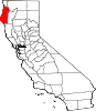
CDPs Alderpoint | Bayview | Benbow | Big Lagoon | Cutten | Fieldbrook | Fields Landing | Garberville | Humboldt Hill | Hydesville | Indianola | Loleta | McKinleyville | Manila | Miranda | Myers Flat | Myrtletown | Orick | Phillipsville | Pine Hills | Redcrest | Redway | Samoa | Scotia | Shelter Cove | Weott | Westhaven-Moonstone | Willow Creek
Unincorporated
communitiesAlton | Bayside | Blocksburg | Bracut | Brainard | Briceland | Bridgeville | Bucksport | Calville | Carlotta | Crannell | Dinsmore | Elk River | Englewood | Fairhaven | Fernbridge | Fort Seward | Freshwater | Freshwater Corners | Fruitland | Glendale | Holmes | Honeydew | Hoopa | Johnsons | King Salmon | Kneeland | Korbel | Maple Creek | Metropolitan | Moonstone | Orleans | Patricks Point | Pepperwood | Petrolia | Pine Hill | Port Kenyon | Ridgewoods Heights | Riverside Park | Rohnerville | Rosewood | Shively | Stafford | Sunny Brae | Weitchpec | Westhaven | Whitethorn
Indian
reservationsBig Lagoon Rancheria | Blue Lake Rancheria | Hoopa Valley Indian Reservation | Yurok Indian Reservation
Ghost towns Acorn | Albeeville | Apyu | Aranimokw | Arekw | Atsepar | Bald Hills | Blaine | Brock Creek | Bryan | Bryant | Buck's Port | Camp 4 Flat | Camp 19 | Camp Grant | Centerville | Chinits | Cleveland | Daby's Ferry | Dark Canyon | Dinty | Dyer Place | Eddyville | Elinor | Elk Grove | Elk Prairie | Erner | Ertlerger | Eshpeu | Frank | Gans | Hadley | Hartsook | Honsading | Humboldt City | Iaqua | Kokaman | Kworatem | Lippitt | Lockharts | Lone Star | Loolego | Luffenholtz | Mandala | Martins Ferry | McDuff | Meridian | Mountain View | Mower | Myrtle Grove | Northern Redwood Camp | Oketo | Opegoi | Ore'q | Panamenik | Pasara | Pekwan | Pekwuteu | Robinson's Ferry | Scribner | Shanamkarak | Showers Pass | Shregegon | Shumig | Skelly | Smith | Tanoak | Three Cabins | Tsofkara | Tsurau | West Humboldt | Wilder
Categories:- Populated coastal places in California
- Census-designated places in Humboldt County, California


Wikimedia Foundation. 2010.