- Fernley, Nevada
Infobox Settlement
official_name = Fernley, Nevada
settlement_type = CDP
nickname =
motto =
imagesize =
image_caption =
image_
imagesize =
image_caption =
image_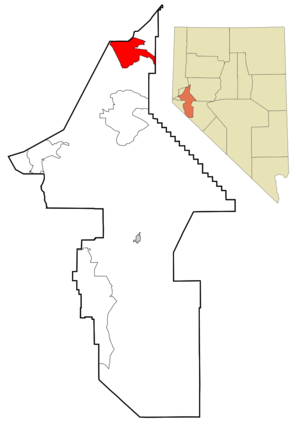
mapsize = 250px
map_caption = Location of Fernley, Nevada
mapsize1 =
map_caption1 =subdivision_type = Country
subdivision_name =United States
subdivision_type1 = State
subdivision_name1 =Nevada
subdivision_type2 = County
subdivision_name2 = Lyon, Washoecite web | url = http://www.census.gov/popest/cities/files/SUB-EST2006_32.csv | title = Subcounty population estimates: Nevada 2000-2006| format = CSV | publisher =United States Census Bureau , Population Division | date =2007-06-28 | accessdate = 2008-05-28]
government_footnotes =
government_type =
leader_title =
leader_name =
leader_title1 =
leader_name1 =
established_title =
established_date =unit_pref = Imperial
area_footnotes =area_magnitude =
area_total_km2 = 91.7
area_land_km2 = 91.7
area_water_km2 = 0.0
area_total_sq_mi = 35.4
area_land_sq_mi = 35.4
area_water_sq_mi = 0.0population_as_of = 2000
population_footnotes =
population_total = 8543
population_density_km2 = 93.1
population_density_sq_mi = 241.2timezone = Pacific (PST)
utc_offset = -8
timezone_DST = PDT
utc_offset_DST = -7
elevation_footnotes =
elevation_m = 1268
elevation_ft = 4160
latd = 39 |latm = 35 |lats = 55 |latNS = N
longd = 119 |longm = 12 |longs = 54 |longEW = Wpostal_code_type =
ZIP code
postal_code = 89408
area_code = 775
blank_name = FIPS code
blank_info = 32-24900
blank1_name = GNIS feature ID
blank1_info = 0840446
website =
footnotes =Fernley is a city in Lyon and Washoe counties in the
U.S. state ofNevada . The city incorporated in 2001; prior to that it was acensus-designated place (CDP). The population of the CDP was 8,543 at the 2000 census; the city itself had an estimated population of 12,093 in 2006, almost all of whom lived in Lyon County. In recent years Fernley has seen rapid growth and as of 2006 is the fastest-growing city in Nevada, partly because of investments from Seattle. Its location approximately 30 miles east of the Reno-Sparks area and its affordable housing relative to the rest of the metro area have been responsible for the building boom. Fernley is home to a largeAmazon.com fulfillment center.Geography
Fernley is located at coor dms|39|35|55|N|119|12|54|W|city (39.598706, -119.215030)GR|1.
According to the
United States Census Bureau , the CDP has a total area of 35.4square mile s (91.7km² ), all of it land.Climate
The climate for Fernley is typical of high desert environments. The winter may bring cold temperatures and some snow, but nothing extreme is normally experienced. Summers are generally hot and very dry. Fernley's average annual rainfall is 5 inches per year.
Demographics
As of the
census GR|2 of 2000, there were 8,543 people, 3,151 households, and 2,366 families residing in the CDP. Thepopulation density was 241.2 people per square mile (93.2/km²). There were 3,432 housing units at an average density of 96.9/sq mi (37.4/km²). The racial makeup of the CDP was 87.11% White, 1.00% African American, 1.53% Native American, 0.68% Asian, 0.20% Pacific Islander, 3.59% from other races, and 0.43% from two or more races. Hispanic or Latino of any race were 13.87% of the population.There were 3,151 households out of which 38.5% had children under the age of 18 living with them, 59.5% were married couples living together, 10.2% had a female householder with no husband present, and 24.9% were non-families. 18.9% of all households were made up of individuals and 6.5% had someone living alone who was 65 years of age or older. The average household size was 2.71 and the average family size was 3.08.
In the CDP the population was spread out with 29.2% under the age of 18, 7.7% from 18 to 24, 29.9% from 25 to 44, 23.7% from 45 to 64, and 9.6% who were 65 years of age or older. The median age was 35 years. For every 100 females there were 100.7 males. For every 100 females age 18 and over, there were 98.4 males.
The median income for a household in the CDP was $44,695, and the median income for a family was $49,596. Males had a median income of $37,480 versus $26,938 for females. The
per capita income for the CDP was $18,622. About 4.9% of families and 6.3% of the population were below thepoverty line , including 7.3% of those under age 18 and 5.5% of those age 65 or over.History
Fernley was established in 1904 developed as primarily an
agricultural andranching community in proximity to Reno-Sparks-Lake Tahoe metropolitan. Early in its history Fernley established its first schoolhouse. The one room school house is still in use today as the home of the FernleyChamber of Commerce .Much of the farmland in the Fernley area was developed through the Newlands Irrigation Project which was a result of the
Newlands Reclamation Act of 1902. The project established an irrigation system that delivers water to an area stretching fromDerby Dam , along theTruckee River , to theLahontan Reservoir nearFallon, Nevada . Construction and expansion of the system took place from the inception through the 1960's. Many of the concrete irrigation headgates, still in use today, are embossed with the CCC (Civilian Conservation Corps )stamp and date of construction. In addition to the irrigation system in the Fernley, a drainage system was also constructed to carry away excess water and mineral salts from the farmlands. This system consists of channels (5 to 15 feet deep) dug adjacent to fields and eventually terminates in the sink northeast of Fernley. The irrigation system is administered and maintained through theTruckee-Carson Irrigation District .In 1965, the Nevada Cement Company [ [http://www.nevadacement.com/ Untitled Document ] ] started operation in a new plant built on the north side of the city between Fernley and Wadsworth. This was the first significant non-agricultural/ranching business to come to Fernley, aside from the railroad. Primary employment in Fernley began a steady transition to an industrial and commuter base continuing through to the present time. Beginning in the 1970’s, parts of the formerly agricultural and ranching based lands were transitioning to housing subdivisions to support the growing population, much of which was spilling over from rapid growth in the Reno-Sparks area. Close proximity to Interstate 80 and abundant land for housing made Fernley an attractive alternative to the increasingly congested and expensive Truckee Meadows housing market. Beginning near the established parts of the town, growth moved to the Fremont Street area in the mid to late 1970’s, nearer farming areas in the 1980’s, and has continued along the Farm District Road areas to the present. Numerous subdivisions now exist along the Farm District Road including an 18-hole golf course and a new elementary school.
In 1999, Amazon.com opened a 750,000 square foot order fulfillment center in the industrial park located in the northeast side of the city. Since that time, more companies have opened facilities in the park including Trex Inc., Allied Signal, UPS Worldwide Logistics (Honeywell), ARE Campers, Johns Manville, and Sherwin Williams Paint [ [http://www.cityoffernley.org/ Fernley, NV - Official Website ] ] .
On
July 1 ,2001 , the city of Fernley was incorporated.Fernley is home to Fernley High School [ [http://www.fhs.lyon.k12.nv.us/ Welcome to Fernley High School ] ] , Vaqueros. The school is currently located off of U.S. 95 on the south side of town. Prior to 1980, the High School was located at the current Fernley Intermediate School on Hardie Lane. The original High School was demolished in the early 1960's and was located on the block now occupied by the In-Town Park near the old downtown area between U.S. 95 and Center Street.
On
January 5 ,2008 , a levee along the Truckee Canal broke, forcing the rescue and evacuation of 3,500 from the town as 3-6 feet of water filled houses [ [http://www.foxnews.com/story/0,2933,320496,00.html FOXNews.com - Nevada Levee Breaks; 3,500 Being Rescued - Local News | News Articles | National News | US News ] ] [ [http://www.kolotv.com/home/headlines/13286002.html Hundreds Of Homes Flooded By Ruptured Levee ] ] .References
External links
* [http://www.cityoffernley.org Official Website]
* [http://www.interment.net/data/us/nv/lyon/vets/ Veterans Cemetery, Fernley, NV]
Wikimedia Foundation. 2010.