- Cheaha State Park
-
Cheaha State Park 
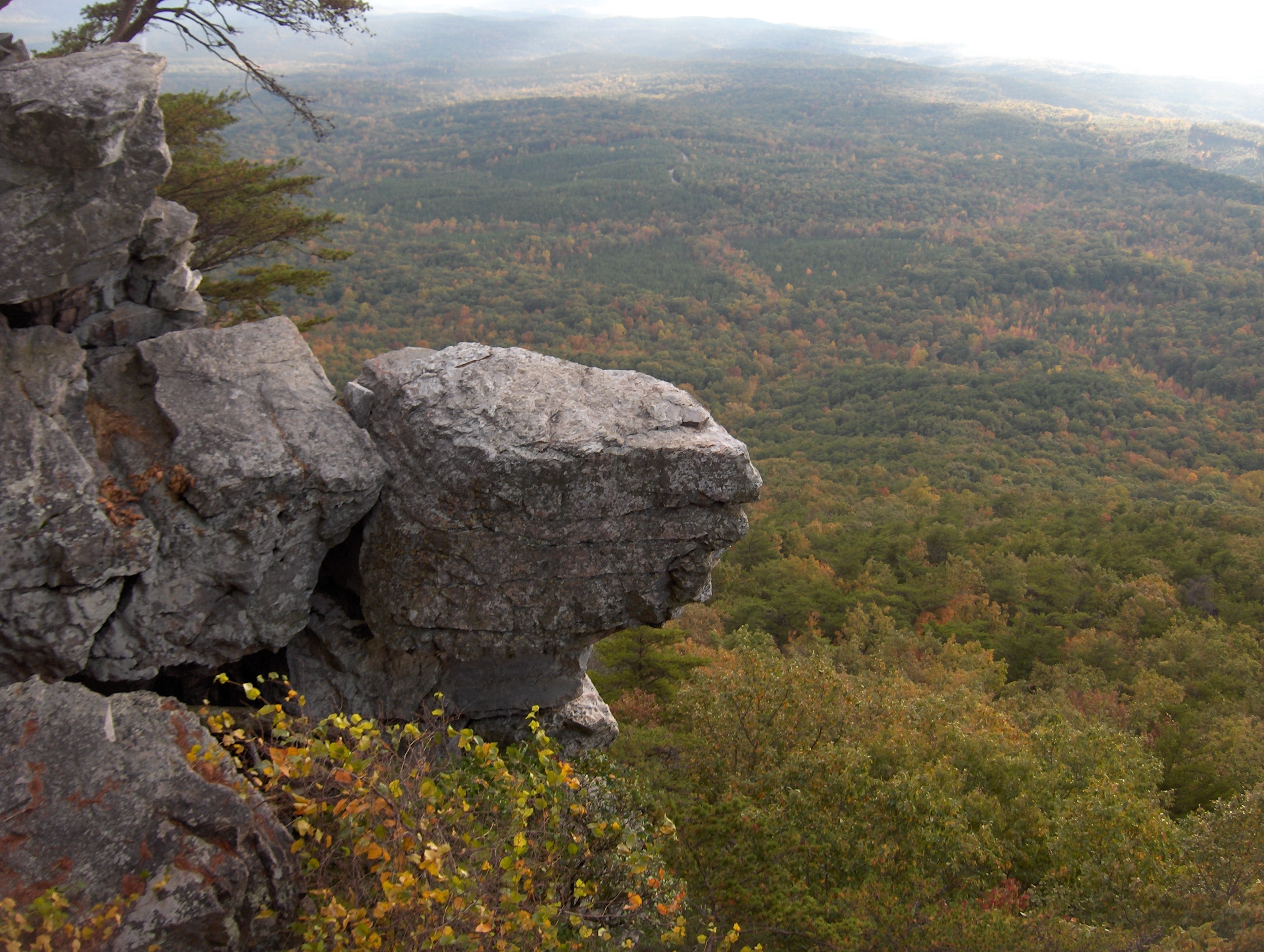
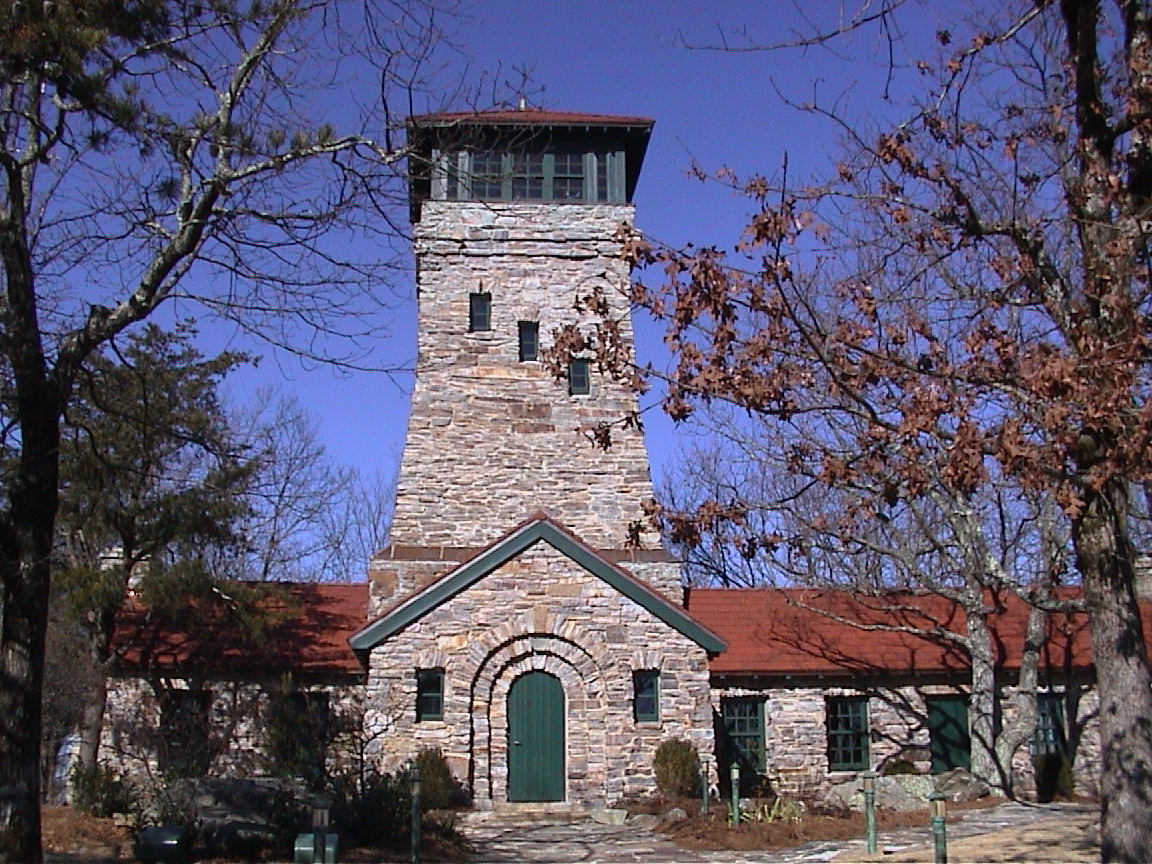
A view from Cheaha Mountain.Type State Park Location Clay / Cleburne counties, Alabama, U.S.A. Coordinates 33°29′08″N 85°48′33″W / 33.48558°N 85.80923°W Area 2,799 acres (11.33 km2) Created 1933 Operated by Alabama Department of Conservation and Natural Resources  Bunker Tower on top of Cheaha Mountain.
Cheaha State Park is a 2,799-acre (11.33 km2) state park in Alabama, located in northern Clay and southwestern Cleburne counties. Park facilities include a lodge, restaurant, general store, campsites, hiking trails (the Pinhoti Trail system weaves its way through the Talladega National Forest to Cheaha Mountain, the highest point in Alabama.), and other amenities. It is Alabama's oldest continuously operating state park.[1]
Contents
History
The park was first opened to the public in 1933, after the state acquired the property. Although it was open, the first six years saw a joint effort by the state and the National Park System that allowed for construction by the Civilian Conservation Corps of Cheaha Lake and its stone bath house, eleven stone cabins, two stone pavilions, Bunker Tower, and the Bald Rock Group Lodge. This first phase of construction was completed in 1939. A new hotel, restaurant, and five chalets were added in 1973. These facilities were restored and renovated in 1997.[1]
Amenities
Cheaha features a variety of campsites. It has 73 modern campsites that include water, electric, sewer hookup, a picnic table, grill, and bathhouses. It has 11 semi-primitive campsites with picnic tables, grills, and a bathhouse. The park includes day-use areas for picnicking, fishing, and hunting. Cheaha Lodge has 30 hotel rooms with a swimming pool. The stone Bald Rock Group Lodge is used for conferences and weddings.[2]
The highest point within the park is marked with Bunker Tower, a stone building with an observation deck on top. Near the peak is Bald Rock, which was recently improved with a wheelchair-accessible wooden walkway that provides an overlook of the surrounding region.
References
- ^ a b "Cheaha State Park". "Alabama State Parks". http://www.alapark.com/parks/park.cfm?parkid=7. Retrieved 2008-01-12.
- ^ "Cheaha State Park". "StateParks.com". http://www.stateparks.com/cheaha.html. Retrieved 2008-01-12.
External links
Protected Areas of Alabama Federal Bon Secour • Cahaba River • Choctaw • Eufaula • Fern Cave • Key Cave • Mountain Longleaf • Santa Cave • Watercress Darter • Wheeler
Wilderness AreasState Bladon Springs • Blue Springs • Buck's Pocket • Cathedral Caverns • Chattahoochee • Cheaha • Chewacla • Chickasaw • DeSoto • Florala • Frank Jackson • Gulf • Joe Wheeler • Lake Guntersville • Lake Lurleen • Lakepoint • Meaher • Monte Sano • Oak Mountain • Paul M. Grist • Rickwood Caverns • Roland Cooper • Wind Creek
Fayette • Geneva • Little River • Saint Stephens • Weogufka
Categories:- Alabama state parks
- Protected areas of Clay County, Alabama
- Protected areas of Cleburne County, Alabama
- Civilian Conservation Corps in Alabama
Wikimedia Foundation. 2010.