- Choctaw National Wildlife Refuge
-
Choctaw National Wildlife Refuge IUCN Category IV (Habitat/Species Management Area)

Location Choctaw County, Alabama, USA Nearest city Coffeeville, Alabama Coordinates 31°49′15.2688″N 88°11′03.9228″W / 31.820908°N 88.184423°WCoordinates: 31°49′15.2688″N 88°11′03.9228″W / 31.820908°N 88.184423°W Area 4,218 acres (17.07 km²) Established 1964 Visitors 30,000 (in 2004) Governing body U.S. Fish and Wildlife Service 
The Choctaw National Wildlife Refuge is a 4,218 acre (17.07 km²) National Wildlife Refuge located along the Tombigbee River near Coffeeville, Alabama. Named after the Choctaw tribe, it was established to provide a wood duck brood habitat and serve as a protected wintering area for waterfowl.
Of the 4,218 acres (17.07 km²) of the refuge, approximately 1,802 acres (7.29 km²) of lakes, sloughs, and creeks, 2,265 acres (9.17 km²) of bottomland hardwoods, and 151 acres (0.61 km2) of croplands and moist soil units. The facility has a four person staff with a $882,000 (FY 2005) annual budget.
The refuge also manages an additional 236 acres (0.96 km2) in perpetual conservation easements in eight parcels in Monroe, Sumter and Conecuh counties.
Contents
History
Choctaw NWR was established in 1964 on lands acquired by the Corp of Engineers in conjunction with the Coffeeville Lock and Dam project.
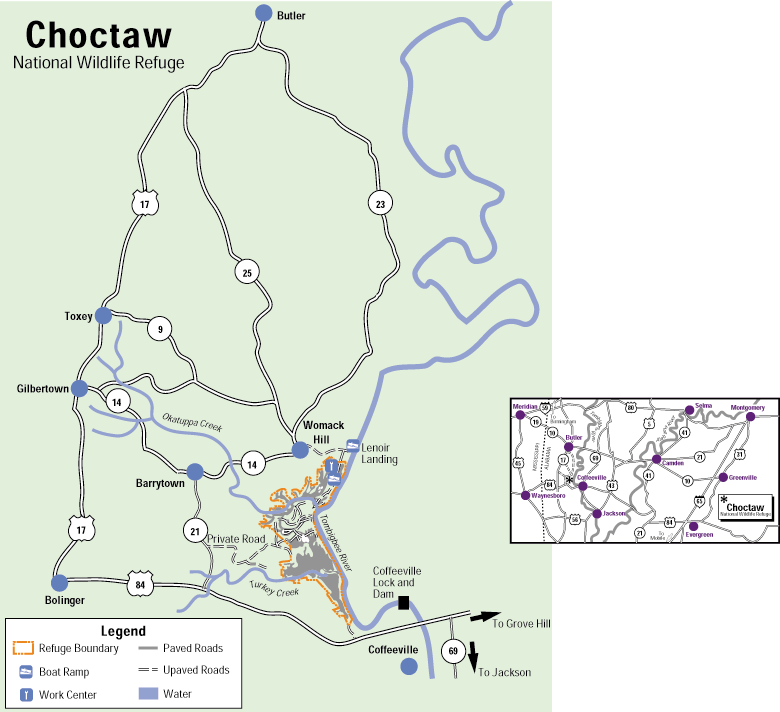
 Map of Choctaw NWR
Topography
The 4,218 acre (17.07 km²) refuge encompasses approximately 1,802 acres (7.29 km²) of lakes, sloughs, and creeks, 2,265 acres (9.17 km²) of bottomland hardwoods, and 151 acres (0.61 km2) of croplands and moist soil units.
The refuge borders the Tombigbee River (and the Tennessee-Tombigbee Waterway) for 6.5 miles (10.5 km). Okatuppa and Turkey Creeks divide the refuge into three unites. The river and the creeks make a large portion of the refuge accessible only by boat. The entire refuge is subject to annual Spring flooding.
Wildlife and protected species
Four hundred nest boxes are maintained for wood ducks resulting in the hatching of approximately 2500 birds each year. Wintering waterfowl numbers can exceed 10,000. In addition to the moist soil, crops such as millet, milo, wheat, and clover are grown in fields for the benefit of both waterfowl and resident wildlife.
In addition, numerous neotropical migrant and wading birds benefit from management activities. Following a successful bald eagle program in the early 1990s the refuge hosts a nesting pair of eagles each winter. In the summer, wood storks can be found resting and feeding in the back-water sloughs and moist soil units. Other wildlife include white-tailed deer, gray squirrels, turkey, raccoons, opossum, American alligator, and beaver.
Facilities
A small research facility, "Cypess Tupelo Research Natural Area" encompasses 35 acres (140,000 m2) and is protected from the damaging effects of beavers on individual trees and water management.
Choctaw NWR offers opportunities for fishing, boating, hunting, hiking, and wildlife observation. A .75 mile trail leads to a wildlife observation platform overlooking the moist soil unit.
Fishing is popular with bass, white perch, catfish, and bream in abundance throughout the creeks and rivers. Second in popularity is hunting. White-tailed deer and feral hogs may be hunted as well as squirrel, rabbit, and raccoon.
Images
-
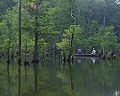
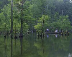
photograph of the Choctaw National Wildlife Refuge
-
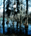
photograph of the Choctaw National Wildlife Refuge
See also
External links
- Choctaw National Wildlife Refuge homepage
- FWS profile of Choctaw NWR
- Recreation.gov overview
- Choctaw National Wildlife Refuge GORP site
Protected Areas of Alabama Federal Bon Secour • Cahaba River • Choctaw • Eufaula • Fern Cave • Key Cave • Mountain Longleaf • Santa Cave • Watercress Darter • Wheeler
Wilderness AreasState Bladon Springs • Blue Springs • Buck's Pocket • Cathedral Caverns • Chattahoochee • Cheaha • Chewacla • Chickasaw • DeSoto • Florala • Frank Jackson • Gulf • Joe Wheeler • Lake Guntersville • Lake Lurleen • Lakepoint • Meaher • Monte Sano • Oak Mountain • Paul M. Grist • Rickwood Caverns • Roland Cooper • Wind Creek
Fayette • Geneva • Little River • Saint Stephens • Weogufka
Categories:- IUCN Category IV
- Protected areas of Choctaw County, Alabama
- National Wildlife Refuges in Alabama
-


Wikimedia Foundation. 2010.