- Coffeeville, Alabama
-
Coffeeville, Alabama — Town — Location in Clarke County and the state of Alabama
Coordinates: 31°45′40″N 88°5′20″W / 31.76111°N 88.08889°W Country United States State Alabama County Clarke Area – Total 4.5 sq mi (11.7 km2) – Land 4.5 sq mi (11.7 km2) – Water 0 sq mi (0 km2) Elevation 174 ft (53 m) Population (2000) – Total 360 – Density 80/sq mi (30.8/km2) Time zone Central (CST) (UTC-6) – Summer (DST) CDT (UTC-5) ZIP code 36524 Area code(s) 251 FIPS code 01-16264 GNIS feature ID 0116356 Coffeeville is a town in Clarke County, Alabama, United States. At the 2000 census the population was 360.
Contents
Geography
Coffeeville is located at 31°45'40.543" North, 88°5'20.940" West (31.761262, -88.089150)[1].
According to the U.S. Census Bureau, the town has a total area of 4.5 square miles (12 km2), all of it land.
Demographics
As of the census[2] of 2000, there were 360 people, 165 households, and 97 families residing in the town. The population density was 79.7 people per square mile (30.8/km2). There were 209 housing units at an average density of 46.3 per square mile (17.9/km2). The racial makeup of the town was 61.11% White and 38.89% Black or African American.
There were 165 households out of which 22.4% had children under the age of 18 living with them, 40.6% were married couples living together, 13.9% had a female householder with no husband present, and 41.2% were non-families. 40.6% of all households were made up of individuals and 21.2% had someone living alone who was 65 years of age or older. The average household size was 2.18 and the average family size was 2.95.
In the town the population was spread out with 23.9% under the age of 18, 6.9% from 18 to 24, 23.1% from 25 to 44, 25.3% from 45 to 64, and 20.8% who were 65 years of age or older. The median age was 42 years. For every 100 females there were 80.9 males. For every 100 females age 18 and over, there were 80.3 males.
The median income for a household in the town was $19,545, and the median income for a family was $33,125. Males had a median income of $29,000 versus $17,500 for females. The per capita income for the town was $16,886. About 18.8% of families and 25.6% of the population were below the poverty line, including 42.2% of those under age 18 and 19.7% of those age 65 or over.
Notable natives
- Ashton Shepherd, singer
Coordinates: 31°45′41″N 88°05′21″W / 31.761262°N 88.08915°W
Municipalities and communities of Clarke County, Alabama Cities 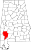
Towns Coffeeville | Fulton | Grove Hill
CDP Unincorporated
communitiesGhost towns References
- ^ "US Gazetteer files: 2010, 2000, and 1990". United States Census Bureau. 2011-02-12. http://www.census.gov/geo/www/gazetteer/gazette.html. Retrieved 2011-04-23.
- ^ "American FactFinder". United States Census Bureau. http://factfinder.census.gov. Retrieved 2008-01-31.
Categories:- Populated places in Clarke County, Alabama
- Towns in Alabama


Wikimedia Foundation. 2010.