- Choctaw Corner, Alabama
-
Choctaw Corner, Alabama Location within the state of Alabama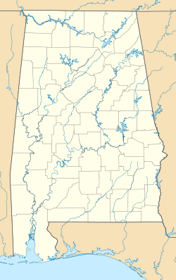
 Choctaw Corner, Alabama
Coordinates: 31°56′06″N 87°45′17″W / 31.93487°N 87.75472°WCoordinates: 31°56′06″N 87°45′17″W / 31.93487°N 87.75472°W Country United States State Alabama County Clarke Elevation 377 ft (115 m) Time zone Central (CST) (UTC-6) - Summer (DST) CDT (UTC-5) Choctaw Corner is a former town in Clarke County, Alabama, United States.[1] It gained its name from the nearby Choctaw Corner, which helped mark the border between the native Choctaw and Creek peoples prior to the Indian removal. The community was one of the earliest settlements in the county.[2]
Choctaw Corner had a post office by 1850.[3] It was a prosperous community during the antebellum period and for many years afterwards. Then, when the railroad from Mobile to Selma came through Clarke County in 1888, less than 2 miles (3.2 km) southeast of Choctaw Corner, the town began to die.[2]
A new town, Thomasville, developed on the railroad. The people in the older community saw the potential of the new town as a railroad shipping point and were among the first people to move there.[2] The former town of Choctaw Corner slowly declined into nonexistence and was later enveloped within Thomasville's city limits. It is now remembered primarily by Thomasville's city cemetery on its western border, called Choctaw Corner Cemetery.[4]
Geography
Choctaw Corner was located at 31°56′06″N 87°45′17″W / 31.93487°N 87.75472°W at an elevation of 377 feet (115 m).[1]
References
- ^ a b U.S. Geological Survey Geographic Names Information System: Choctaw Corner
- ^ a b c ""Clarke County MPS"". National Register of Historic Places. National Park Service. p. 24. http://pdfhost.focus.nps.gov/docs/NRHP/Text/64500005.pdf. Retrieved July 27, 2011.
- ^ Edward Tremayne (1850). Tremayne's table of post-offices in the United States. W.F. Burgess. p. 10. http://books.google.com/books?id=SCMsAAAAYAAJ&pg=PA9&dq=List+of+post+offices+in+the+United+States&hl=en&ei=L68wTpj3Fsa3tgeb6uSICQ&sa=X&oi=book_result&ct=result&resnum=9&ved=0CFsQ6AEwCA#v=onepage&q=List%20of%20post%20offices%20in%20the%20United%20States&f=false. Retrieved July 27, 2011.
- ^ "About Thomasville" (PDF). "City of Thomasville". http://www.thomasvilleal.com/documents/AboutThomasville-history.pdf. Retrieved July 27, 2011.
Municipalities and communities of Clarke County, Alabama County seat: Grove Hill Cities 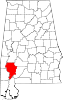
Towns CDP Unincorporated
communitiesGhost towns Choctaw Corner | Clarkesville | Failetown
Categories:- Geography of Clarke County, Alabama
- Former populated places in Alabama


Wikimedia Foundation. 2010.