- Toxey, Alabama
Infobox Settlement
official_name = Toxey, Alabama
settlement_type =Town
imagesize =
image_caption =
image_
imagesize =
image_caption =
image_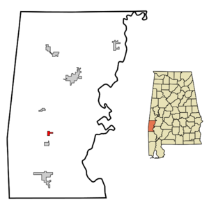
mapsize = 250px
map_caption = Location in Choctaw County and the state ofAlabama
mapsize1 =
map_caption1 =
subdivision_type = Country
subdivision_type1 = State
subdivision_type2 = County
subdivision_name =United States
subdivision_name1 =Alabama
subdivision_name2 = Choctaw
government_type =
leader_title =
leader_name =
established_date =
area_magnitude =
area_total_km2 = 1.8
area_total_sq_mi = 0.7
area_land_km2 = 1.8
area_land_sq_mi = 0.7
area_water_km2 = 0
area_water_sq_mi = 0
elevation_ft = 118
elevation_m = 36
population_as_of = 2000
population_footnotes =
population_total = 152
population_metro =
population_density_km2 = 84.4
population_density_sq_mi = 217.1
timezone = Central (CST)
utc_offset = -6
latd = 31 |latm = 54 |lats = 49 |latNS = N
longd = 88 |longm = 18 |longs = 30 |longEW = W
timezone_DST = CDT
utc_offset_DST = -5
postal_code_type =ZIP code
postal_code = 36921
area_code = 251
blank_name = FIPS code
blank_info = 01-76632
blank1_name = GNIS feature ID
blank1_info = 0128045
footnotes =
website =Toxey is a town in Choctaw County,
Alabama ,United States . At the 2000 census the population was 152.Geography
Toxey is located at 31°54'49.118" North, 88°18'30.485" West (31.913644, -88.308468)GR|1.
According to the
U.S. Census Bureau , the town has a total area of 0.7square mile s (1.8km² ), all of it land.Demographics
As of the
census GR|2 of 2000, there were 152 people, 61 households, and 45 families residing in the town. Thepopulation density was 221.9 people per square mile (85.1/km²). There were 74 housing units at an average density of 108.0/sq mi (41.4/km²). The racial makeup of the town was 86.84% White and 13.16% Black or African American.There were 61 households out of which 34.4% had children under the age of 18 living with them, 62.3% were married couples living together, 9.8% had a female householder with no husband present, and 24.6% were non-families. 23.0% of all households were made up of individuals and 14.8% had someone living alone who was 65 years of age or older. The average household size was 2.49 and the average family size was 2.87.
In the town the population was spread out with 29.6% under the age of 18, 3.3% from 18 to 24, 25.7% from 25 to 44, 19.7% from 45 to 64, and 21.7% who were 65 years of age or older. The median age was 39 years. For every 100 females there were 94.9 males. For every 100 females age 18 and over, there were 81.4 males.
The median income for a household in the town was $23,750, and the median income for a family was $27,143. Males had a median income of $36,250 versus $17,188 for females. The
per capita income for the town was $16,244. About 7.1% of families and 13.8% of the population were below the poverty line, including 22.9% of those under the age of eighteen and 29.4% of those sixty five or over.References
External links
* [http://www.cgeda.net/ Coastal Gateway Regional Economic Development Authority]
Wikimedia Foundation. 2010.