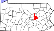
- McEwensville, Pennsylvania
-
McEwensville, Pennsylvania — Borough — Coordinates: 41°04′20″N 76°49′07″W / 41.07222°N 76.81861°WCoordinates: 41°04′20″N 76°49′07″W / 41.07222°N 76.81861°W Country United States State Pennsylvania County Northumberland Settled 1825 Incorporated 1857 Government – Type Borough Council – Mayor David Heddings Area – Total 0.1 sq mi (0.3 km2) Population (2000) – Total 314 – Density 3,272.9/sq mi (1,282.1/km2) Time zone Eastern (EST) (UTC-5) – Summer (DST) EDT (UTC-4) Zip code 17749 Area code(s) 570 McEwensville is a borough in Northumberland County, Pennsylvania, United States. The population was 314 at the 2000 census.
Contents
Geography
McEwensville is located at 41°4′20″N 76°49′7″W / 41.07222°N 76.81861°W (41.072139, -76.818719)[1].
According to the United States Census Bureau, the borough has a total area of 0.1 square miles (0.26 km2), all of it land.
Demographics
As of the census[2] of 2000, there were 314 people, 116 households, and 83 families residing in the borough. The population density was 3,272.9 people per square mile (1,212.4/km²). There were 123 housing units at an average density of 1,282.1 per square mile (474.9/km²). The racial makeup of the borough was 98.41% White and 1.59% African American. Hispanic or Latino of any race were 0.32% of the population.
There were 116 households out of which 38.8% had children under the age of 18 living with them, 62.1% were married couples living together, 6.9% had a female householder with no husband present, and 28.4% were non-families. 21.6% of all households were made up of individuals and 7.8% had someone living alone who was 65 years of age or older. The average household size was 2.71 and the average family size was 3.07.
In the borough the population was spread out with 32.8% under the age of 18, 6.4% from 18 to 24, 29.9% from 25 to 44, 16.6% from 45 to 64, and 14.3% who were 65 years of age or older. The median age was 31 years. For every 100 females there were 92.6 males. For every 100 females age 18 and over, there were 95.4 males.
The median income for a household in the borough was $35,500, and the median income for a family was $39,250. Males had a median income of $28,125 versus $21,250 for females. The per capita income for the borough was $15,309. About 4.8% of families and 6.9% of the population were below the poverty line, including 3.2% of those under age 18 and 8.0% of those age 65 or over.
Education
McEwensville is served by the Warrior Run School District.
Government
The mayor of McEwensville is David Heddings. McEwensville has a five member borough council that meets the first Wednesday of each month at 5:30 PM unless otherwise noted. Council members are:
- Donald Snyder
- Steven Rheam
- Craig Luther
- Todd Eurich
- Eric Striplin
References
- ^ "US Gazetteer files: 2010, 2000, and 1990". United States Census Bureau. 2011-02-12. http://www.census.gov/geo/www/gazetteer/gazette.html. Retrieved 2011-04-23.
- ^ "American FactFinder". United States Census Bureau. http://factfinder.census.gov. Retrieved 2008-01-31.
External links
Municipalities and communities of Northumberland County, Pennsylvania Cities Boroughs Herndon | Kulpmont | Marion Heights | McEwensville | Milton | Mount Carmel | Northumberland | Riverside | Snydertown | Turbotville | Watsontown
Townships Coal | Delaware | East Cameron | East Chillisquaque | Jackson | Jordan | Lewis | Little Mahanoy | Lower Augusta | Lower Mahanoy | Mount Carmel | Point | Ralpho | Rockefeller | Rush | Shamokin | Turbot | Upper Augusta | Upper Mahanoy | Washington | West Cameron | West Chillisquaque | Zerbe
CDPs Unincorporated
communitiesBear Valley | Dalmatia | Locust Gap | Malta | Merrian
Categories:- Populated places established in 1825
- Boroughs in Northumberland County, Pennsylvania
Wikimedia Foundation. 2010.


