- National Register of Historic Places listings in Northumberland County, Virginia
-
This list includes properties and districts listed on the National Register of Historic Places in Northumberland County, Virginia. Click the "Map of all coordinates" link to the right to view a Google map of all properties and districts with latitude and longitude coordinates in the table below.[1]
-
- This National Park Service list is complete through NPS recent listings posted November 10, 2011.[2]
[3] Landmark name [4] Image Date listed Location City or town Summary 1 The Academy November 18, 1997 Jct. of Main St. and St. Stephen's Ln.
37°55′14″N 76°28′30″W / 37.920556°N 76.475°WHeathsville 2 The Anchorage March 17, 1995 1 mi. W of jct. of VA 605 and VA 669, N side
37°47′22″N 76°20′20″W / 37.789444°N 76.338889°WKilmarnock 3 Bluff Point Graded School No. 3 June 3, 2009 2595 Bluff Point Rd.
37°42′35″N 76°20′14″W / 37.709647°N 76.337236°WKilmarnock 4 CLAUD W. SOMERS (skipjack) October 7, 2005 504 Main St.
37°50′37″N 76°16′36″W / 37.843611°N 76.276667°WReedville 5 Claughton-Wright House May 23, 1997 2 mi. NE of jct of VA 623 and VA 624
37°59′41″N 76°30′47″W / 37.994722°N 76.513056°WLewisetta 6 Clifton May 19, 2004 49 Clifton Ave.
37°42′47″N 76°22′05″W / 37.713056°N 76.368056°WKilmarnock 7 Coan Baptist Church March 17, 1995 VA 638, E of jct. with VA 612
37°55′31″N 76°30′51″W / 37.925278°N 76.514167°WHeathsville 8 Cobbs Hall July 5, 2001 582 Cobbs Hall Ln.
37°44′38″N 76°20′23″W / 37.743889°N 76.339722°WKilmarnock 9 Ditchley 
September 24, 1992 VA 607 N side, 2000 ft. E of jct. with VA 669
37°44′01″N 76°20′11″W / 37.733611°N 76.336389°WKilmarnock 10 ELVA C (Deck Boat) October 4, 2005 504 Main St.
37°50′38″N 76°16′35″W / 37.843889°N 76.276389°WReedville 11 Heathsville Historic District February 26, 1992 US 360 at jct. with VA 634 and VA 201
37°55′07″N 76°28′23″W / 37.918611°N 76.473056°WHeathsville 12 Holley Graded School December 19, 1990 US 360, N of VA 614
37°57′43″N 76°31′10″W / 37.961944°N 76.519444°WLottsburg 13 Howland Chapel School January 25, 1991 Jct. of VA 201 and VA 642
37°52′16″N 76°27′25″W / 37.871111°N 76.456944°WHeathsville 14 Hurstville September 24, 1992 VA 605 E side, 3500 ft. S of jct. with VA 606
37°45′34″N 76°19′13″W / 37.759444°N 76.320278°WKilmarnock 15 Kirkland Grove Campground October 15, 1992 VA 779, 1.6 mi. S of Heathsville
37°54′02″N 76°29′09″W / 37.900556°N 76.485833°WHeathsville 16 Oakley January 27, 1999 28 Back St.
37°55′05″N 76°28′28″W / 37.918056°N 76.474444°WHeathsville 17 Reedville Historic District August 16, 1984 VA 644 at VA 722
37°50′31″N 76°16′37″W / 37.841944°N 76.276944°WReedville 18 Rice's Hotel October 15, 1992 Jct. of Co. Rts. 1001 and 1002
37°55′00″N 76°28′24″W / 37.916667°N 76.473333°WHeathsville 19 Shalango November 6, 1986 VA 666
37°49′26″N 76°19′14″W / 37.823889°N 76.320556°WWicomico Church 20 Shiloh School January 22, 1992 Jct. of VA 605 and VA 606
37°46′05″N 76°19′51″W / 37.768056°N 76.330833°WKilmarnock 21 Smith Point Light Station 
December 2, 2002 Bamboo Island
37°52′47″N 76°11′02″W / 37.879722°N 76.183889°WSmith Point 22 Springfield December 23, 1979 SR 360
37°55′24″N 76°28′52″W / 37.923333°N 76.481111°WHeathsville 23 St. Stephen's Church December 28, 1979 SR 360
37°55′09″N 76°28′26″W / 37.919167°N 76.473889°WHeathsville 24 Sunnyside May 23, 1996 S side of US 360, E of jct. with VA 201
37°54′52″N 76°28′03″W / 37.914444°N 76.4675°WHeathsville 25 Versailles February 27, 1997 VA 360, .25 mi. W of jct. with VA 200
37°53′14″N 76°21′08″W / 37.887222°N 76.352222°WBurgess 26 Wheatland November 15, 1988 VA 624
38°00′01″N 76°30′47″W / 38.000278°N 76.513056°WCallao See also
- National Register of Historic Places listings in Virginia
- List of National Historic Landmarks in Virginia
References
- ^ The latitude and longitude information provided in this table was derived originally from the National Register Information System, which has been found to be fairly accurate for about 99% of listings. For about 1% of NRIS original coordinates, experience has shown that one or both coordinates are typos or otherwise extremely far off; some corrections may have been made. A more subtle problem causes many locations to be off by up to 150 yards, depending on location in the country: most NRIS coordinates were derived from tracing out latitude and longitudes off of USGS topographical quadrant maps created under the North American Datum of 1927, which differs from the current, highly accurate WGS84 GPS system used by Google maps. Chicago is about right, but NRIS longitudes in Washington are higher by about 4.5 seconds, and are lower by about 2.0 seconds in Maine. Latitudes differ by about 1.0 second in Florida. Some locations in this table may have been corrected to current GPS standards.
- ^ "National Register of Historic Places: Weekly List Actions". National Park Service, United States Department of the Interior. Retrieved on November 10, 2011.
- ^ Numbers represent an ordering by significant words. Various colorings, defined here, differentiate National Historic Landmark sites and National Register of Historic Places Districts from other NRHP buildings, structures, sites or objects.
- ^ "National Register Information System". National Register of Historic Places. National Park Service. . http://nrhp.focus.nps.gov/natreg/docs/All_Data.html.
U.S. National Register of Historic Places Topics Lists by states Alabama • Alaska • Arizona • Arkansas • California • Colorado • Connecticut • Delaware • Florida • Georgia • Hawaii • Idaho • Illinois • Indiana • Iowa • Kansas • Kentucky • Louisiana • Maine • Maryland • Massachusetts • Michigan • Minnesota • Mississippi • Missouri • Montana • Nebraska • Nevada • New Hampshire • New Jersey • New Mexico • New York • North Carolina • North Dakota • Ohio • Oklahoma • Oregon • Pennsylvania • Rhode Island • South Carolina • South Dakota • Tennessee • Texas • Utah • Vermont • Virginia • Washington • West Virginia • Wisconsin • WyomingLists by territories Lists by associated states Other Municipalities and communities of Northumberland County, Virginia Town 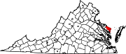
CDP Unincorporated
communitiesAvalon | Beverlyville | Blackberry | Blackwells | Blundon Corner | Browns Corner | Browns Store | Bryant Corner | Bundick | Burgess | Burtons Corner‡ | Byrdton | Callao | Chesapeake Beach | Chestnut Grove‡ | Claraville | Coan | Cowart | Crabbe Mill | Ditchley | Dodlyt | Downings Corner | Edwardsville | Fairport | Fleeton | Folly | Georgetown | Gibeon | Gillick Corner | Gonyon | Hamlins Corner | Hardings | Hardins Corner | Harryhogan | Harveys | Highland Landing | Horse Head | Howland | Hyacinth | Jetts Store | Kayan‡ | Lake | Lankford Corner‡ | Lara‡ | Lee Dale Shores | Lewisetta | Lilian | Lodge | Lottsburg | Luttrellville‡ | Luttrels Corner | Lynhams | Middletons Corner | Mila | Miskimon | Moon Corner‡ | Morrisons Corner | Mount Olive | Nokomis | Oak Grove | Ophelia | Rainswood | Reedville | Regina‡ | Remo | Reynolds Corner | Sandy Point | Sissons Corner | Slash | Stately Oak | Sunnybank | Surprise Hill | Tibitha | Tipers | Village‡ | Vir-Mar Beach | Waddeys | Walkers Corner | Walmsley | Wicomico Church | Williams Corner
Footnotes ‡This populated place also has portions in an adjacent county or counties
Categories:- Northumberland County, Virginia
- National Register of Historic Places in Virginia
- Virginia-related lists
-


Wikimedia Foundation. 2010.