- Greenville, Rhode Island
-
Greenville, Rhode Island — CDP — Coordinates: 41°52′36″N 71°33′12″W / 41.87667°N 71.55333°WCoordinates: 41°52′36″N 71°33′12″W / 41.87667°N 71.55333°W Country United States State Rhode Island County Providence Area – Total 5.7 sq mi (14.9 km2) – Land 5.2 sq mi (13.5 km2) – Water 0.5 sq mi (1.4 km2) Elevation 285 ft (87 m) Population (2000) – Total 8,626 – Density 1,654.7/sq mi (638.9/km2) Time zone Eastern (EST) (UTC-5) – Summer (DST) EDT (UTC-4) ZIP code 02828 Area code(s) 401 FIPS code 44-31600[1] GNIS feature ID 1218665[2] Greenville is a village and census-designated place (CDP) in the town of Smithfield in Providence County, Rhode Island, United States. The population was 8,626 at the 2000 census. The CDP is centered around the village of Greenville but also encompasses the nearby villages of West Greenville and Spragueville, as well as the Mountaindale reservoir and beach.
The village of Greenville is named after Revolutionary War General, Nathanael Greene, who was born in Rhode Island in 1742. Greenville was first settled in the 17th century. The village contains the Greenville Baptist Church (American Baptist Churches, USA), and there are many apple orchards in the surrounding area. The area was active in the Free Will Baptist movement in the 19th century, and the Smithville Seminary, a Free Baptist institution, was nearby. U.S. Route 44, known locally as "Putnam Pike" runs through the center of Greenville.
Contents
Notable residents
- Arthur Steere (1865–1943) senator, businessman
- Thomas Angell, (1837–1923) scholar at Bates College
 Greenville Bank
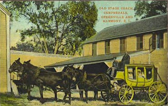
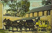 Stagecoach on Route 44 in Greenville, Rhode Island at the turn of the century outside Greenville Tavern[2]
Geography
Greenville is located at 41°52′36″N 71°33′12″W / 41.87667°N 71.55333°W (41.876749, -71.553375)[3].
According to the United States Census Bureau, the CDP has a total area of 14.9 km² (5.8 mi²). 13.5 km² (5.2 mi²) of it is land and 1.4 km² (0.5 mi²) of it (9.39%) is water.
Distinct villages in Greenville CDP
- Greenville
- West Greenville
- Spragueville
- Mountaindale (also Mountain Dale) — the location of Mountaindale Beach and is sometimes referred to as part of Spragueville. It is one of the named villages of the town of Smithfield.[4][5][6] Mountaindale was home to the Mountain Dale Hosiery Mill owned by J.P. and J.G. Ray.[7] It is also named in a political graveyard reference source.[8]
Demographics
As of the census[1] of 2000, there were 8,626 people, 3,302 households, and 2,314 families residing in the CDP. The population density was 639.3/km² (1,654.7/mi²). There were 3,418 housing units at an average density of 253.3/km² (655.7/mi²). The racial makeup of the CDP was 98.47% White, 0.28% African American, 0.20% Native American, 0.51% Asian, 0.02% Pacific Islander, 0.06% from other races, and 0.46% from two or more races. Hispanic or Latino of any race were 0.58% of the population.
There were 3,302 households out of which 30.0% had children under the age of 18 living with them, 59.3% were married couples living together, 7.9% had a female householder with no husband present, and 29.9% were non-families. 27.0% of all households were made up of individuals and 17.1% had someone living alone who was 65 years of age or older. The average household size was 2.49 and the average family size was 3.05.
In the CDP the population was spread out with 21.7% under the age of 18, 5.4% from 18 to 24, 25.4% from 25 to 44, 25.2% from 45 to 64, and 22.3% who were 65 years of age or older. The median age was 44 years. For every 100 females there were 86.2 males. For every 100 females age 18 and over, there were 80.1 males.
The median income for a household in the CDP was $56,036, and the median income for a family was $66,832. Males had a median income of $49,671 versus $31,545 for females. The per capita income for the CDP was $24,770. About 1.6% of families and 3.2% of the population were below the poverty line, including 1.7% of those under age 18 and 8.1% of those age 65 or over.
Notable Sites and Historic Places in Greenville
- Saint Thomas Episcopal Church and Rectory (1852)
- Smithfield Exchange Bank (1822)
- Stephen Winsor House (1850)
- Waterman-Winsor Farm (1774)
Images
-

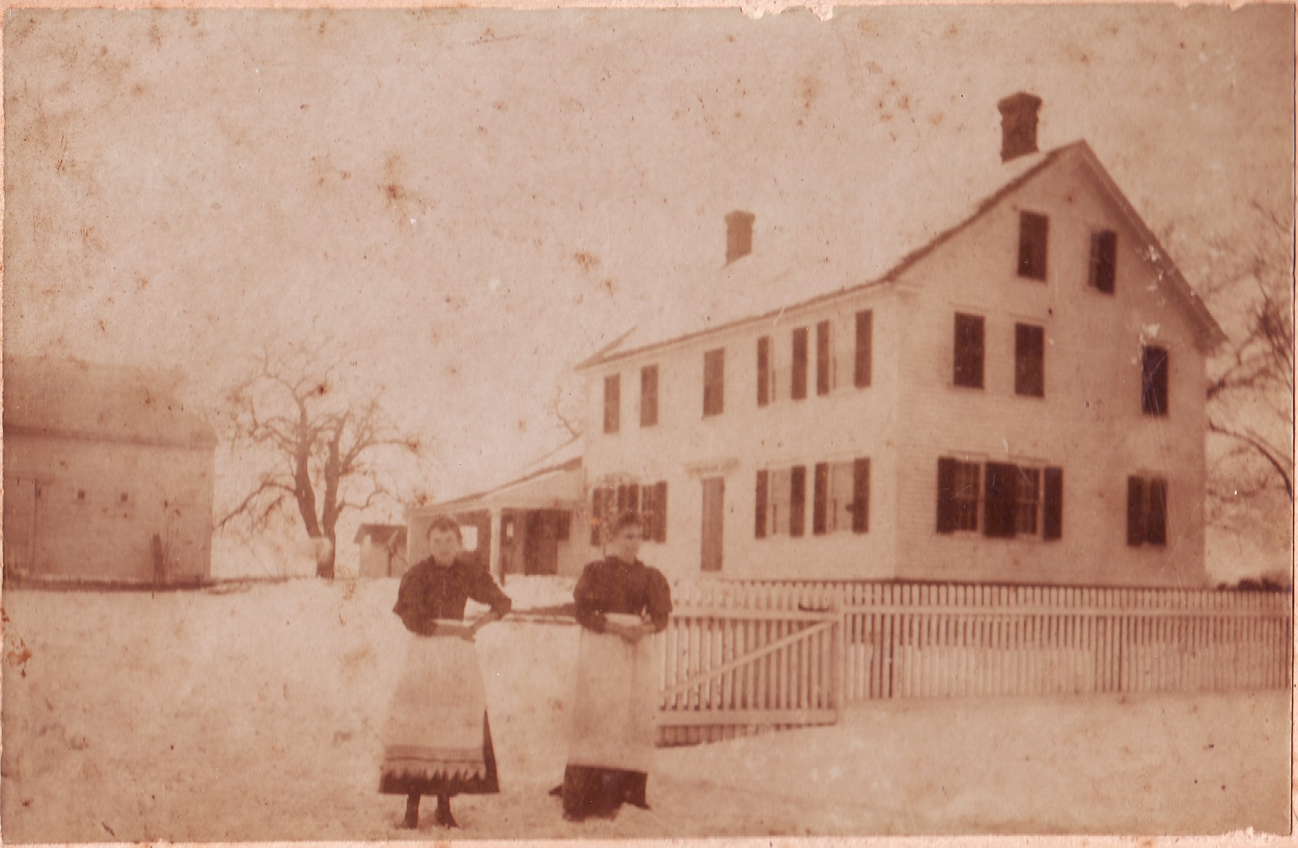
The farm of Greenville resident, Arthur Steere at the turn of the twentieth century
-
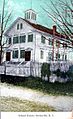
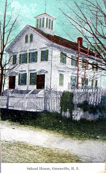
Greenville School House, formerly near the site of Greenville's Post Office
-

Greenville Finishing Company at the turn of the twentieth century
-

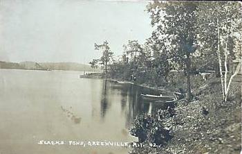
Slacks Pond in Greenville
-
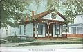
Old Greenville Public Library, originally in downtown Greenville in between the Baptist and Episcopal churches
References
- ^ a b "American FactFinder". United States Census Bureau. http://factfinder.census.gov. Retrieved 2008-01-31.
- ^ "US Board on Geographic Names". United States Geological Survey. 2007-10-25. http://geonames.usgs.gov. Retrieved 2008-01-31.
- ^ "US Gazetteer files: 2010, 2000, and 1990". United States Census Bureau. 2011-02-12. http://www.census.gov/geo/www/gazetteer/gazette.html. Retrieved 2011-04-23.
- ^ Smithfield town website
- ^ Smithfield official town website listing Mountaindale synonymously as a section or village
- ^ Mountain Dale listed as a village
- ^ [1]
- ^ Political graveyard source
Municipalities and communities of Providence County, Rhode Island Cities 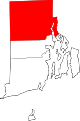
Towns Burrillville | Cumberland | Foster | Glocester | Johnston | Lincoln | North Providence | North Smithfield | Scituate | Smithfield
CDPs Cumberland Hill | Greenville | Harrisville | Pascoag | Valley Falls
Other
villagesAlbion | Chepachet | Esmond | Forestdale | Georgiaville | Glendale | Hanton City | Harmony | Lime Rock | Manville | Oakland | Primrose | Quinnville | Saylesville | Smithville-North Scituate | Slatersville
Categories:- Census-designated places in Providence County, Rhode Island
- Smithfield, Rhode Island
- Villages in Providence County, Rhode Island


Wikimedia Foundation. 2010.