- Jamestown Bridge
-
This article is about the original and now demolished Jamestown Bridge. For the current structure, see Jamestown Verrazzano Bridge.
Coordinates: 41°31′42.14″N 71°24′11.34″W / 41.5283722°N 71.40315°W
Jamestown Bridge
Old Jamestown Bridge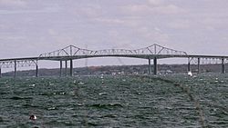
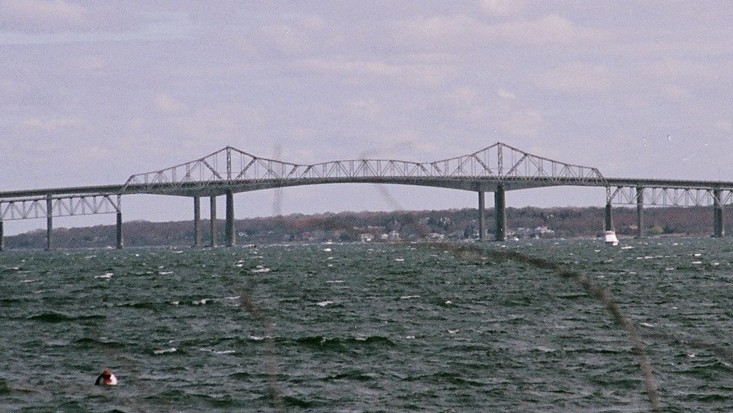
The Jamestown Bridge prior to demolition in April 2006Official name Jamestown-Verrazano Bridge Carries 2 lanes of Rhode Island Route 138 Crosses West passage of Narragansett Bay Locale North Kingstown and Jamestown, Rhode Island Maintained by Jamestown Bridge Commission (1940-1969)
Rhode Island Department of Transportation (1969-1992)Design Cantilever truss Total length 6,892 ft (2,100 m) Width 22 ft (6.7 m) Height 135 ft (41.1 m) Longest span 600 ft (182.9 m) Construction begin January 1939 Construction end July 1940 Opened July 27, 1940 Toll $0.25 (originally $0.90)
(collected 1940-1969)Closed 1992 (demolished April 18, 2006) The Jamestown Bridge, usually referred to as the Old Jamestown Bridge to avoid confusion with its replacement, the new Jamestown Verrazzano Bridge, was a cantilever truss bridge that connected Conanicut Island to mainland North Kingstown, Rhode Island, spanning the West passage of Narragansett Bay. The bridge first opened to traffic in 1940, replacing ferry service as the primary connection for the town of Jamestown, situated on Conanicut Island. It was constructed for just over $3 million 1940 USD, which was paid for by tolls until June 28, 1969. With a total length of 6,892 feet (2,100 m), the Jamestown Bridge was the third longest in Rhode Island at the time of its destruction, ranking behind its replacement, the adjacent 7,350-foot (2,240 m) Jamestown-Verrazano Bridge, and the 11,248-foot (3,428 m) Claiborne Pell Newport Bridge connecting Conanicut Island to Aquidneck Island and Newport. The Jamestown Bridge was closed to vehicular traffic on October 8, 1992, and its main span was destroyed through a controlled demolition on April 18, 2006.
Contents
Structure
The bridge consisted of 69 spans with a large continuous cantilever Warren truss centerpiece.[1] The 600 ft (183 m) main span was 135 ft (41 m) above the western portion of the Narragansett Bay. The bridge was long thought to be a danger to motorists, consisting of only two undivided lanes, which during the summer months, the eastbound lane was usually at a standstill due to vacationers traveling to Newport via the main route from the mainland. Its steep climb proved challenging for some vehicles and with no passing lanes or shoulders, hazardous conditions resulted when stalled vehicles were on the bridge. The roadway deck through the cantilevered span was an open steel-grid deck, similar to that of the Castleton Bridge just south of Albany, NY or the now demolished Sikorsky Bridge on the Merritt Parkway in Connecticut. On the main span looking down through the grates, you were able to see Narragansett Bay. The deck proved to be extremely slippery when wet. To solve the problems of the aging bridge, the RIDOT began construction of the new Jamestown-Verrazano Bridge in 1985. The new bridge, which opened with the Route 138 Freeway on October 8, 1992, includes four divided lanes of traffic with shoulders and a sidewalk.
Demolition
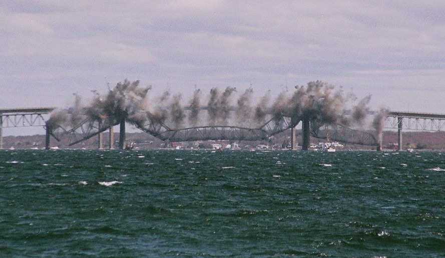
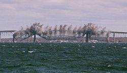 The Jamestown Bridge was destroyed in a controlled demolition in April 2006.
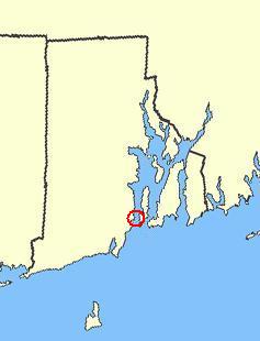
 Approximate location
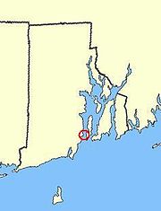
The United States Coast Guard had long declared the Jamestown Bridge to be a navigation hazard and requested that the state of Rhode Island dismantle the eastern two thirds of it. The Sierra Club, an environmental organization, suggested to instead turn the bridge into a bike route and walkway. However, the aging structure proved to be in far worse condition than previously thought, prompting officials to go ahead with removing the entire structure.
On April 18, 2006, the main span of the Jamestown Bridge was brought down by 75 pounds of RDX explosives and 350 shaped charges. TNT charges were later used to remove the concrete piers. On May 18, 2006, crews imploded the trusses that once carried the side spans. Throughout mid-2006, workers removed the remaining support piers and low-level approach spans west of the main channel. Demolition of the old Jamestown Bridge was almost fully completed by December 2006. As of May 2008[update], the extreme western portion of the bridge has not been demolished, as officials plan to renovate and convert this section to a fishing pier. The total cost for removal of the Jamestown Bridge was US$22 million.
References
- ^ "Jamestown-Verrazano Bridge: Historic Overview". BostonRoads.com. Eastern Roads. http://www.bostonroads.com/crossings/jamestown/. Retrieved 2008-02-09.
External links
Narragansett Bay Islands Aquidneck Island · Conanicut Island · Prudence Island · Patience Island · Hog Island · Dutch Island · Coaster's Harbor Island · Cornelius Island · Despair Island · Dyer Island · Fox Island · Goat Island · Gould Island · Greene Island · Hope Island · Lime Rock · Rabbit Island · Rock Island · Rose Island · Starvegoat Island · Whale Rock
Major rivers Cities & towns Providence · Newport · Cranston · Warwick · East Providence · Barrington · Bristol · East Greenwich · Jamestown · Middletown · Narragansett · North Kingstown . Portsmouth · WarrenBridges Newport Bridge · Jamestown Verrazzano Bridge · Mount Hope Bridge · Sakonnet River Bridge · Jamestown BridgeCategories:- Bridges completed in 1940
- Demolished bridges in the United States
- Transportation in Newport County, Rhode Island
- Transportation in Washington County, Rhode Island
- North Kingstown, Rhode Island
- Jamestown, Rhode Island
- Buildings and structures in Newport County, Rhode Island
- Buildings and structures in Washington County, Rhode Island
- Road bridges in Rhode Island
Wikimedia Foundation. 2010.