- Dyer Island (Rhode Island)
-
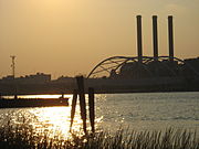
Dyer Island is an island in Narragansett Bay in Rhode Island, USA. It lies off the west coast of Aquidneck Island and is part of Melville CDP, which itself is part of the town of Portsmouth. The island is uninhabited and has a land area of 0.12 km² (29.65 acres).
References
- Dyer Island: Block 9021, Census Tract 401.03, Newport County, Rhode Island United States Census Bureau
Narragansett Bay Islands Aquidneck Island · Conanicut Island · Prudence Island · Patience Island · Hog Island · Dutch Island · Coaster's Harbor Island · Cornelius Island · Despair Island · Dyer Island · Fox Island · Goat Island · Gould Island · Greene Island · Hope Island · Lime Rock · Rabbit Island · Rock Island · Rose Island · Starvegoat Island · Whale Rock
Major rivers Cities & towns Providence · Newport · Cranston · Warwick · East Providence · Barrington · Bristol · East Greenwich · Jamestown · Middletown · Narragansett · North Kingstown . Portsmouth · WarrenBridges Coordinates: 41°34′58″N 71°17′56″W / 41.58278°N 71.29889°W
From the writings of Norman A. Greene of the Dyer Family History.
William Dyer died in 1676 in Newport, Rhode Island. He is buried in the family cemetery which is located on Dyers Island in Narragansett Bay. Upon his death the island comprising some 600 acres (2.4 km2); was given to his son William.
Categories:- Islands of Rhode Island
- Landforms of Newport County, Rhode Island
Wikimedia Foundation. 2010.
