- Downtown, Providence, Rhode Island
-
Downtown Providence Historic District

Location: Providence, Rhode Island Built: 1800 Architect: Multiple Architectural style: Late 19th And Early 20th Century American Movements, Late Victorian, Other Governing body: multiple NRHP Reference#: 84001967
[1]Added to NRHP: February 10, 1984 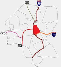 Providence neighborhoods with Downtown in red
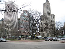
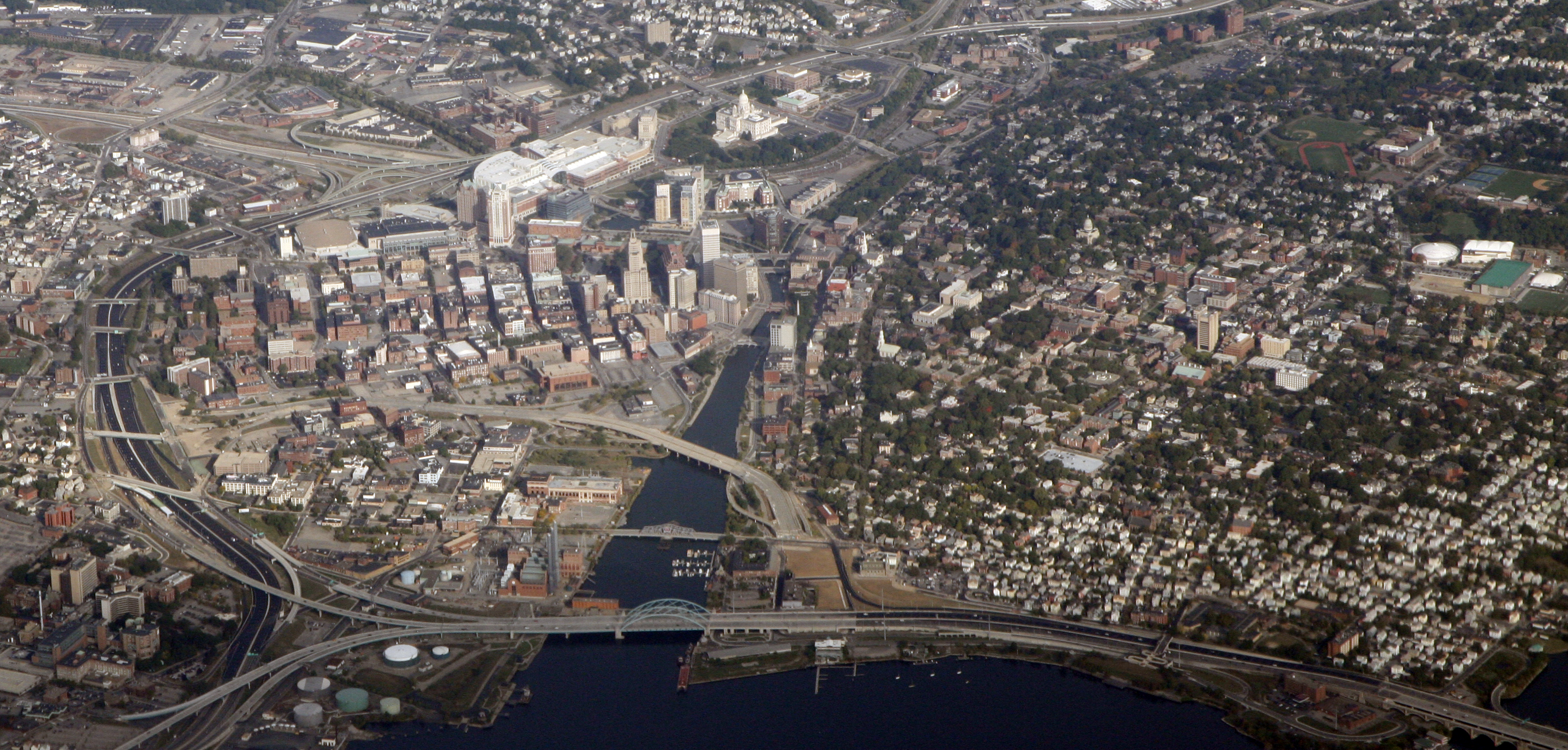
 Downtown Providence, 2010. Aerial photo by Doc Searles.
Downtown, also known as Downcity, is the central economic, political, and cultural district of the city of Providence, Rhode Island. It is bounded on the east by Canal Street and the Providence River, to the north by Smith Street, to the west by Interstate 95, and to the south by Henderson Street. I-95 serves as a physical barrier between the city's commercial core and neighborhoods of Federal Hill, West End, and Upper South Providence.
Contents
History
Originally known as 'Weybossett Neck' or 'Weybossett Side,' Downtown was first settled by religious dissidents from the First Congregational Society in 1746. Their settlement was located near present-day Westminster Street.[2]
Downtown did not witness substantial development until the early 19th century, when Providence began to compete with Newport, Rhode Island. British forces had destroyed much of Newport during the American War for Independence, making the city's merchants vulnerable to competition from Providence.[2] This prevented the development of a commercial district along the western bank of the Providence River.
During the industrialization of the late 19th century, an ever-expanding railroad industry emanating from Union Station, eventually resulted in the complete paving over of the Great Salt Cove and the two branches of the Providence River.[3] The result of decades of expansion was the isolation of the state capitol from the rest of downtown by an imposing mass of railroad tracks, often called locally the "Chinese Wall".[4] As rail traffic dropped off, 75 percent by 1980,[5] city planners saw an opportunity to open up central land for development and unify downtown with the Capitol. A new, smaller train station was built in 1986 a half mile north of its predecessor, and tracks were removed or routed underground.
The new land precipitated a massive remaking of the character of the city's downtown. From 1975 until 1982, under Mayor Vincent Cianci, Jr, $606 million of local and national Community Development funds from were invested. Roads were removed and the city's natural rivers were opened up and lined with a cobblestone-paved park called Waterplace Park in 1994, which is now host to popular WaterFire festivals.[6] Private and public developments followed and the new area adjacent to the Capitol became known as Capitol Center.[7]
Ushered in by the construction of the new train station (1986), the development of the new land brought new buildings: The Gateway Building (1990), One Citizens Plaza (1991), Center Place (1992), a Westin hotel and Providence Convention Center (1993), Providence Place Mall (1999), Courtyard Marriott (2000), GTECH headquarters (2006), The Residences at the Westin (2007), Waterplace condominiums (2007), and Capitol Cove still under construction.
In 2007, the Renaissance Providence Hotel opened in Masonic Temple building, which had been abandoned amidst the Great Depression a half century prior.[8]
Demographics
According to the Providence Plan, a local nonprofit aimed at improving city life, 64% of residents are white and 8.6% are Asian, both above the city-wide averages of 54.4% and 6.2% respectively. 12% of the population is African-American, 11% is Hispanic, and 1% is Native-American. 43% of public school children speak a language other than English as their primary language.[9]
The median family income is $42,558, over $10,000 above the city-wide average. 14% of families live below the poverty-line while nearly 3.7% receive some form of public assistance.[9]
15% of children under the age of six have been exposed to high quantities of lead.[9]
Government
From north to south, Downtown includes portions of Wards 12, 13, 11. These wards are represented in the Providence City Council by Terrance Hassett, John J. Lombardi, and Balbina A. Young.[10] All three councillors are Democrats. Hassett currently serves as the majority leader.
Providence City Hall is located at 25 Dorrance Street, at the corner of Dorrance and Washington Street. It is immediately next to Kennedy Plaza and the Biltmore Hotel. It houses the City Council, the Mayor's Office, and the offices of some municipal agencies.
The Rhode Island State House is located on Smith Street at the northern edge of Downtown. It includes the chambers of the Rhode Island General Assembly and the Governor's Office.
The Rhode Island Department of Education is headquartered in the Shephard Building at 255 Westminster Street.[11]
Universities
Various universities have facilities in Downtown Providence. These include:
- Brown University has recently bought several properties in the Jewelry District.
- Johnson & Wales University has is central and largest campus in Downtown. This campus includes JWs business and technologies schools and its The Hospitality College.[12]
- The Rhode Island School of Design (RISD), though centered along the western slope of College Hill, has extensive facilities in Downtown. These include the RISD Library, founded in 1878. It is located at 15 Westminster Street.[13]
- Roger Williams University includes a small campus in Downtown.[14]
- The University of Rhode Island's Feinstein Providence campus is centered at 80 Washington Street with other facilities in the Shepherd building. The program is named for Rhode Island philanthropist Alan Shawn Feinstein.[15]
Sports
The Providence Bruins of the American Hockey League and the Providence College Friars men's basketball team play out of the Dunkin' Donuts Center (formerly the Providence Civic Center) at 1 LaSalle Square.[16]
Arts
As part of the revitalization of Providence, the administrations of Mayors Vincent Cianci and David Cicilline have promoted Providence, especially Downtown, as an artistic center. WaterFire has become perhaps the most visible symbol of Providence's development into an artistic center. Waterfire is an environmental art event created by Barnaby Evans that includes bon fires, gondolas, and music. This event has become a major attraction for both Rhode Islanders and tourists.
Downtown includes two centers for the performing arts, the Providence Performing Arts Center and Trinity Repertory Company.[17][18]
Downtown is also home to AS220, a non-profit community arts center that includes nineteen artist live/work studios, four galleries, a performance space, and a community darkroom.
Architecture
Downtown Providence has numerous 19th-century mercantile buildings in the Federal and Victorian architectural styles, as well as several post-modern and modernist buildings that are located throughout this area. In particular, a fairly clear spatial separation appears between the areas of pre-1980s development and post-1980s development. Fountain Street and Exchange Terrace serve as rough boundaries between the two.
Parks
Downtown Providence contains three parks:
- Burnside Park is located adjacent to Kennedy Plaza. At its center is an equestrian statue of American Civil War general, Rhode Island governor, United States Senator Ambrose Burnside. Adjacent to the park is an outdoor ice skating rink, the Fleet Skating Center.
- Waterplace Park extends from the Great Salt Cove to the Riverwalk along the Providence River. The park hosts WaterFire festivals.
- Station Park, a green space adjacent to the Providence Amtrak Station.[19]
In addition, Veterans Memorial Park and Market Square, along the border between Downtown and College Hill, are sometimes counted as Downtown parks.
Central Downtown
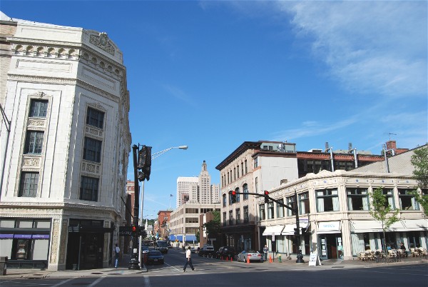
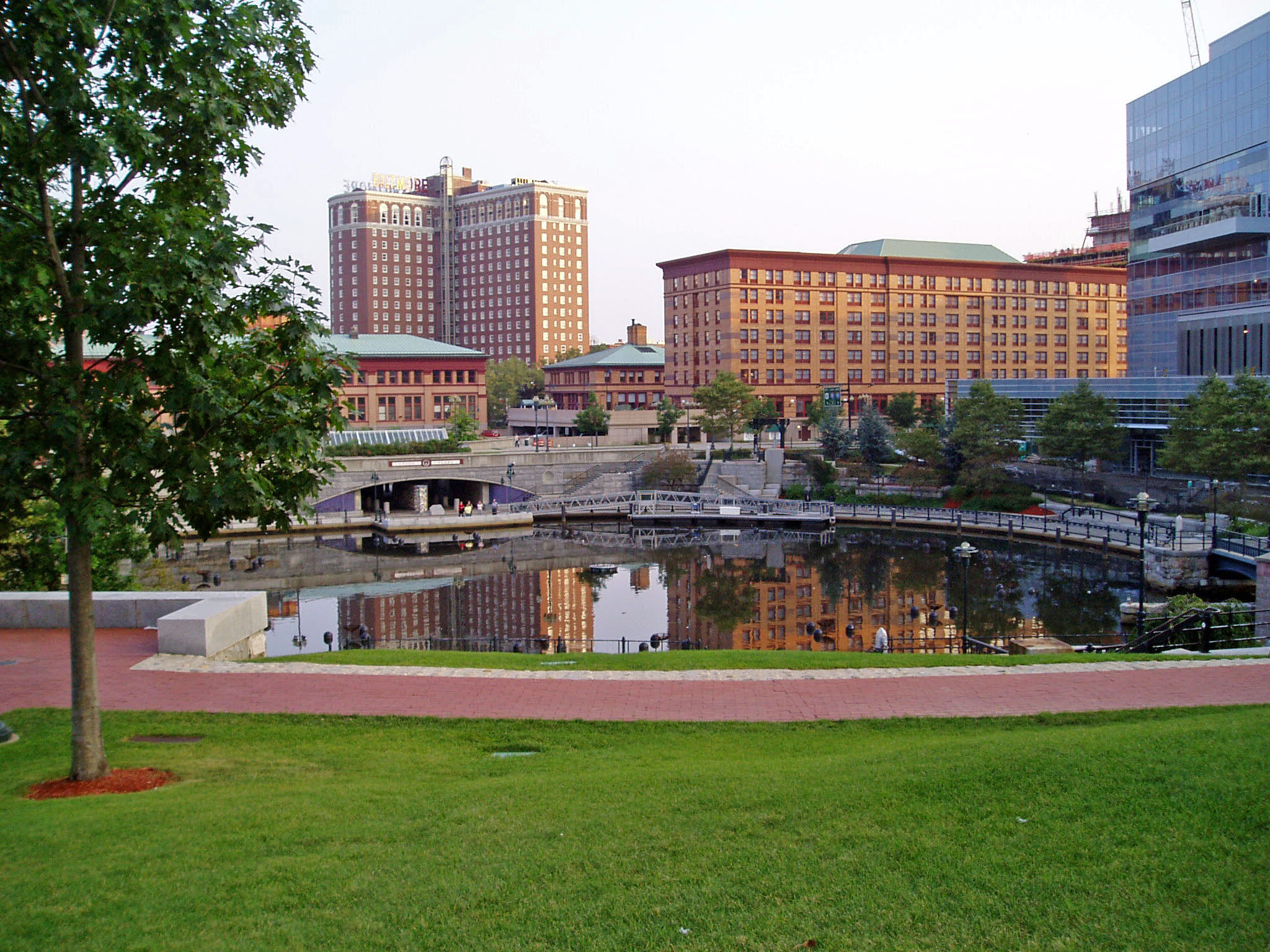
 Downtown Providence at Burnside Park
The historic part of downtown has many streetscapes that look as they did eighty years ago. Most of the state's tallest buildings are found in this area. The largest structure, to date, is the art-deco-styled former Industrial Trust Tower, currently the Bank of America Building at 426 feet (130 m).[20] By contrast, nearby to it is the second tallest One Financial Center (Sovereign Bank Tower), designed in modern taut-skin cladding, constructed a half century later.[21] In between the two is 50 Kennedy Plaza. The Textron Tower is another core building in the Providence skyline. Downtown is also the home of the Providence Biltmore hotel and the Westminster Arcade, the oldest enclosed shopping mall in the U.S., built in 1828.[22]
Kennedy Plaza is a major business and transportation hub. Surrounding the plaza are Providence City Hall, Burnside Park, the Bank of America Building, One Financial Center, 50 Kennedy Plaza, and the US District Court building. The plaza itself includes the central station for the Rhode Island Public Transit Authority (RIPTA) and a police substation.[23][24]
See also
- Jewelry District, a region sometimes associated with downtown.
References
- ^ "National Register Information System". National Register of Historic Places. National Park Service. 2007-01-23. http://nrhp.focus.nps.gov/natreg/docs/All_Data.html.
- ^ a b Providence Neighborhoods: Blackstone
- ^ He returns to a city on the rise | Rhode Island news | Rhode Island news | projo.com | The Providence Journal
- ^ Woodward, William McKenzie (2003). PPS/AIAri Guide to Providence Architecture. Providence, RI: Providence Preservation Society. pp. 13. ISBN 0-9742847-0-X.
- ^ Union Station
- ^ WaterFire
- ^ Providence: Economy - Major Industries and Commercial Activity
- ^ Providence RI Hotel: Renaissance Providence Hotel, A Providence Rhode Island Hotel
- ^ a b c Downtown
- ^ Providence City Council - Phone: (401) 521-7477
- ^ Auto Insurance - Cheap Car Insurance Quotes Online
- ^ Johnson & Wales Providence | academics
- ^ RISD : Rhode Island School of Design : RISD LIBRARY
- ^ History of the University - History & Traditions - 50th Anniversary - Roger Williams University
- ^ http://autocrat.uri.edu/prov.html
- ^ Welcome to the Dunkin' Donuts Center!
- ^ Welcome to PPAC - the home of Providence Theater
- ^ Trinity Repertory Company - home
- ^ Rhode Island news | Rhode Island news | projo.com | The Providence Journal
- ^ "Bank of America Building, Providence". Emporis. 2007. http://www.emporis.com/en/wm/bu/?id=125380. Retrieved 2007-01-19.
- ^ "One Financial Plaza". Emporis. 2006. http://www.emporis.com/en/wm/bu/?id=125377. Retrieved 2006-06-05.
- ^ "Providence Buildings, Real Estate, Architecture, Skyscrapers, and Construction Database". Emporis. 2005. http://www.emporis.com/en/wm/ci/?id=101896. Retrieved 2005-11-07.
- ^ RIPTA: The New Kennedy Plaza
- ^ District 1
Official neighborhoods Blackstone · Charles · College Hill · Downtown · Elmhurst · Elmwood · Federal Hill · Fox Point · Hartford · Hope · Lower South Providence · Manton · Mount Hope · Mount Pleasant · Olneyville · Reservoir · Silver Lake · Smith Hill · South Elmwood · Upper South Providence · Valley · Wanskuck · Washington Park · Wayland · West EndAgglomerations Categories:- Historic districts in the United States
- Neighborhoods in Providence, Rhode Island
- Central business districts in the United States

Wikimedia Foundation. 2010.