- Swansea, Massachusetts
Infobox Settlement
official_name = Swansea, Massachusetts
nickname =
motto =
imagesize = 250px
image_caption = Swansea Town Hall
image_
mapsize = 250px
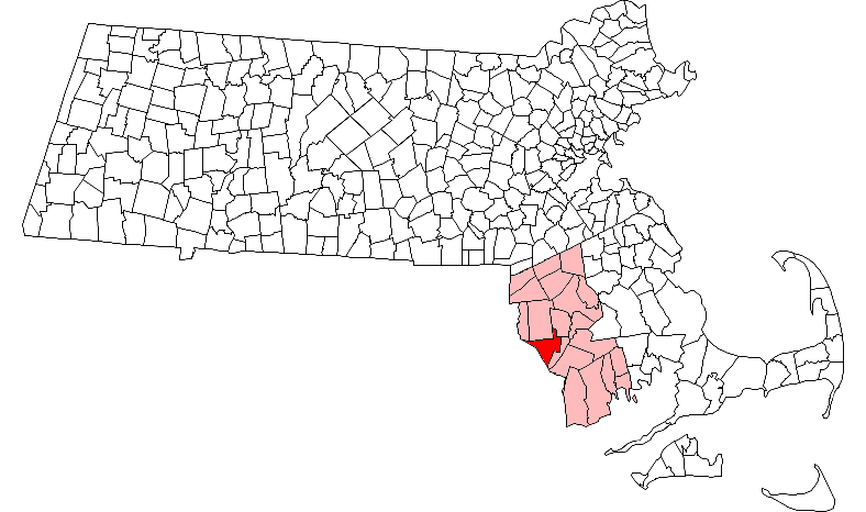
map_caption = Location in Bristol County in Massachusetts
mapsize1 =
map_caption1 =
subdivision_type = Country
subdivision_name =United States
subdivision_type1 = State
subdivision_name1 =Massachusetts
subdivision_type2 = County
subdivision_name2 = Bristol
established_title = Settled
established_date = 1667
established_title2 = Incorporated
established_date2 = 1667
established_title3 =
established_date3 =
government_type =Open town meeting
leader_title =
leader_name =
leader_title1 =
leader_name1 =
area_magnitude =
area_total_km2 = 66.1
area_total_sq_mi = 25.5
area_land_km2 = 59.7
area_land_sq_mi = 23.1
area_water_km2 = 6.4
area_water_sq_mi = 2.5
population_as_of = 2000
settlement_type = Town
population_total = 15901
population_density_km2 = 266.2
population_density_sq_mi = 689.4
elevation_m = 7
elevation_ft = 22
timezone = Eastern
utc_offset = -5
timezone_DST = Eastern
utc_offset_DST = -4
latd = 41 |latm = 44 |lats = 53 |latNS = N
longd = 71 |longm = 11 |longs = 25 |longEW = W
website =
postal_code_type = ZIP code
postal_code = 02777
area_code = 508 / 774
blank_name = FIPS code
blank_info = 25-68750
blank1_name = GNIS feature ID
blank1_info = 0619439
footnotes =Swansea is a town in Bristol County in southeastern
Massachusetts .It is located at the mouth of theTaunton River , just west of Fall River, 47 miles south of Boston; and 12 miles southeast of Providence,Rhode Island .The population was 15,901 at the 2000 census.The village of Ocean Grove is located in the town.
History
Swansea was named for Swansea, Wales which had been the hometown of some original settlers.
John Miles , the founder of the first Baptist Church in Wales, moved to Swansea MA in 1662/3. [http://www.explore-gower.co.uk/Content/pa=showpage/pid=59.html] William Brenton had purchased the land from the Indians.Fact|date=April 2008 Parts of its territory were originally part ofRehoboth, Massachusetts .In 1667 the first
Baptist church in Massachusetts relocated to Swansea from Rehoboth,Massachusetts after experiencingreligious intolerance there, and Swansea was incorporated as an independent town.On
June 20 ,1675 the first Indian attack ofKing Philip's War had all 70 settlers confined to their stockade. ByJune 25 the entire town had been burned, although a handful of the colonists escaped to Taunton. When the active war ended in 1676, the town was soon rebuilt.After the war, many small industries, such as forges, ironworks and fisheries, opened up in the town. Many would later leave, and there remains a large agricultural sector in the town.
What is now
Barrington, Rhode Island (part of Massachusetts until 1747) was separated from the rest of Swansea in 1717, over religious differences.In the late 1890s, trolleys would connect the town to Providence, Fall River and Taunton, and the town has retained a suburban residential feel. Today the town is well known for its retail areas. [ [http://www.swanseamass.org/history.html SwanseaMass.org - History] ]
Swansea gained national attention in 1985 when
Mark Hoyle , a younghemophilia c who had contractedAIDS through a blood transfusion, was allowed to attend public schools. It was the first time in the U.S. that a student known to have the disease was allowed to enter public schools. [ [http://www.projo.com/health/content/projo_20040114_sw14hiv.3180f1.html "Schools poised to adopt official policy on HIV", Providence Journal, 14 Jan 2004.] ] The case came to national attention around the same time as that ofRyan White in Indiana, and helped many youngHIV -positive children attend schools throughout the country. Hoyle died one year later, and a new elementary school was named in his honor.Geography
The town has a total area of 25.5
square mile s (66.1km² ), of which, 23.1 square miles (59.7 km²) of it is land and 2.5 square miles (6.4 km²) of it (9.67%) is water. The town is bordered by Dighton on the northeast, Somerset on the east,Mount Hope Bay on the south, Warren,Rhode Island on the southwest, Barrington,Rhode Island on the west, and Seekonk and Rehoboth to the north. Part of the town's border with Somerset is made up of theLees River and the Cole River. TheKickamuit River and thePalmer River also cross through the town on their way south to Mount Hope Bay (for the Kickamuit, Cole and Lees Rivers) andNarragansett Bay (for the Palmer). The entire town is a part of the Narragansett Bay Watershed area. The town's neighborhoods include North Swansea, Birch Swamp Corner, Hortonville, Luther Corner, South Swansea and Ocean Grove. Swansea is twelve miles southeast of Providence,Rhode Island , and forty-seven miles south of Boston.Much of the town's retail businesses are located along the highways, with the area around the junction of Routes 6 and 118 being the location of
Swansea Mall , a large single-level mall that is the center of the retail district. Just north of the mall are several office complexes, including the former headquarters of the First Federal Bank (now a division headquarters for Webster Bank, which bought it out), doctor's offices and Academic Management Services, a division ofSallie Mae . The area along Route 103 between Lees River and the Cole River is also an area for retail, with many smaller businesses lining the road.However, outside of the retail area (as well as the densely populated neighborhoods of Ocean Grove & South Swansea), much of the area is rural.
Demographics
As of the
census GR|2 of 2000, there were 15,901 people, 5,888 households, and 4,539 families residing in the town. Thepopulation density was 689.4 people per square mile (266.2/km²). There were 6,070 housing units at an average density of 263.2/sq mi (101.6/km²). The racial makeup of the town was 97.91% White, 0.38% African American, 0.08% Native American, 0.36% Asian, 0.01% Pacific Islander, 0.27% from other races, and 1.00% from two or more races. Hispanic or Latino of any race were 0.60% of the population.There were 5,888 households out of which 31.1% had children under the age of 18 living with them, 64.6% were married couples living together, 8.8% had a female householder with no husband present, and 22.9% were non-families. 19.6% of all households were made up of individuals and 10.2% had someone living alone who was 65 years of age or older. The average household size was 2.67 and the average family size was 3.06.
In the town the population was spread out with 22.2% under the age of 18, 6.7% from 18 to 24, 28.4% from 25 to 44, 27.0% from 45 to 64, and 15.7% who were 65 years of age or older. The median age was 40 years. For every 100 females there were 96.9 males. For every 100 females age 18 and over, there were 92.3 males.
The median income for a household in the town was $52,524, and the median income for a family was $60,567. Males had a median income of $40,056 versus $27,072 for females. The
per capita income for the town was $21,776. About 3.4% of families and 4.9% of the population were below thepoverty line , including 2.9% of those under age 18 and 11.0% of those age 65 or over.Government
On the state level, Swansea is a part of two state representative districts, the Fourth Bristol (including Rehoboth, Seekonk and part of Norton) and Fifth Bristol (including Dighton, Somerset and part of the city of Taunton). The town is part of the First Bristol and Plymouth state senatorial district, which includes the communities of Fall River, Freetown, Lakeville, Rochester, Somerset and Westport. Swansea is patrolled by Troop D (Southeast District), 3rd (Dartmouth) Barracks of the
Massachusetts State Police . On the national level, the town is part ofMassachusetts's 3rd congressional district , which is represented by Jim McGovern. The state's senior (Class I) Senator, re-elected 2006, isTed Kennedy , and the state's junior (Class II) Senator, up for re-election in 2008, isJohn Kerry .The town is governed by Selectmen and an Administrator. Swansea also maintains the tradition of open Town Meetings. As of 2001, total property values are assessed at $980 million, and property taxes amount to $15 million. The town operates on a budget of approximately $10 million, which does not include another $13.5 million spent on schools.
The town has four fire stations (the Central station being near the heart of town, with branch stations in North Swansea, South Swansea and Ocean Grove), two libraries (one being the branch library in South Swansea), a single police station, and a new post office. The town has two playgrounds, as well as a town beach with a picnic area (near the mouth of the Cole), and the town conservation farm.
electmen
*Ken Furtado - Chairman
*Robert Marquis - Vice-Chairman
*Scott Ventura - ClerkEducation
The Swansea Public Schools serve the town, with four elementary schools (Joseph G. Luther Elementary School at Luther's Corner, Gardner Elementary School in the South Swansea-Ocean Grove neighborhood, Elizabeth S. Brown Elementary School near the town center, and Mark Hoyle Elementary School in North Swansea), as well as Joseph Case Junior High School and
Joseph Case Senior High School , both located in the town center. Case High School (as it is commonly known) has the school colors of maroon and gold, and its mascot is the Cardinal. High School students also have the option of attendingDiman Regional Vocational Technical High School in Fall River, orBristol County Agricultural High School in Dighton. There are two Christian schools in town, and there are also local Catholic schools in nearby Warren and Fall River.chool Committee Members
*Dawn Freitas - Chairwoman
*Ellen Furtado - Vice-Chairwoman
*Eric C. Graham
*Michael Berube
*Vacancy - Will be appointed by School Committee and Board of SelectmenTransportation
The town is bisected by Interstate 195,
U.S. Route 6 , and State Routes 103, 118 and 136. Swansea has two exits off of I-195 serving the town, Exits 2 (Route 136) and 3 (Route 6 to Route 118). In addition, Exit 4 (Route 103) in Somerset provides quick access to the Ocean Grove neighborhood.Swansea is the western terminus of the Southeastern Regional Transit Authority (SRTA) bus line. Regional bus service can be reached in Fall River, and the nearest regional rail service is in Providence. The nearest national airline service can be reached at
T.F. Green Airport in Rhode Island, and international service can be reached atLogan International Airport in Boston.Points of interest
Martin House Farm (1728), G.A.R. Highway, North Swansea
J.G. Luther Museum (home of the Swansea Historical Society), Old Warren Rd. (intersection of Maple Avenue and Pearse Road)Notable residents
*
Warren A. Cole , founder ofLambda Chi Alpha fraternity
*Oliver Chace , founder of what is todayBerkshire Hathaway
*Thomas Willett , first Mayor ofNew York City References
Further reading
* "History of Swansea, Massachusetts, 1667-1917", by Otis Olney Wright
Wikimedia Foundation. 2010.