- Massachusetts Route 103
-
Route 103

Route information Length: 4.92 mi[1] (7.92 km) Existed: 1930 – present Major junctions West end:  RI Route 103 in Warren, RI
 I-195 in Somerset
East end: 
 U.S. Route 6/Route 138 in Somerset
Highway system Massachusetts State Highway Routes
←  Route 102
Route 104  →
→Route 103 is a west–east state highway in southeastern Massachusetts.
Contents
Route description
Massachusetts Route 103 is a continuation of R.I. Route 103. It begins in Swansea at the Warren line, heading eastward as Wilbur Avenue. It crosses the Cole River before entering the village of Ocean Grove. As the route enters Somerset it crosses the Lees River, just east of its junction with Exit 4 of I-195. (Part of the exit structure is linked to Lees River Avenue, which ends at Route 103 just west of the rest of the exit.) From there it continues eastward, north of Brayton Point and the Dominion Resources power station before Wilbur Avenue turns northward, intersecting with Riverside Avenue at the end of Brayton Avenue, where all three roads formerly met the Slade's Ferry Bridge. Route 103 then continues northward along Riverside Avenue to its end at intersection with U.S. Route 6 and Route 138 just west of the Brightman Street Bridge. Route 138 continues northward along Riverside Avenue from this point.
Before the removal of the Slade's Ferry Bridge, Route 103 traveled along that bridge, and ended in Fall River where Routes 6 and 138 meet.
Junction list
County Location Mile Roads intersected Notes Bristol Swansea 0.00 RI Route 103Western end of Route 103. Somerset 3.0 Lees River Avenue To I-195 Exit 4 westbound entrance & eastbound exit.3.2 I-195Exit 4: Westbound exits 4A & B exit to Rte. 103 West & East.
Eastbound entrances from Rte. 103 to I-195.4.7 Brayton Avenue Former location of the Slade's Ferry Bridge.
Route 103 continues north on Riverside Avenue.4.92 U.S. Route 6 Route 138Eastern end of Route 103 at Route 6.
Riverside Avenue continues as Route 138.-
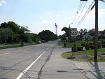
Southbound at US Route 6 in Somerset
References
External links
Categories:- Numbered routes in Massachusetts
-


Wikimedia Foundation. 2010.