- Marion, Massachusetts
-
Marion, Massachusetts — Town — Marion Town House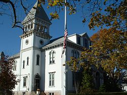 Location in Plymouth County in Massachusetts
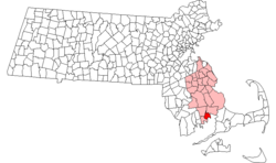
Coordinates: 41°42′00″N 70°45′48″W / 41.7°N 70.76333°WCoordinates: 41°42′00″N 70°45′48″W / 41.7°N 70.76333°W Country United States State Massachusetts County Plymouth Settled 1679 Incorporated 1852 Government – Type Open town meeting Area – Total 26.7 sq mi (69.1 km2) – Land 14.6 sq mi (37.9 km2) – Water 12.1 sq mi (31.2 km2) Elevation 20 ft (6 m) Population (2000) – Total 5,123 – Density 350.2/sq mi (135.2/km2) Time zone Eastern (UTC-5) – Summer (DST) Eastern (UTC-4) ZIP code 02738 Area code(s) 508 / 774 FIPS code 25-38540 GNIS feature ID 0618345 Website www.marionma.gov Marion is a town in Plymouth County, Massachusetts, United States. The population was 5,123 at the 2000 census.
For geographic and demographic information on the village of Marion Center, please see the article Marion Center, Massachusetts.
Contents
History
Marion was first settled in 1679 as "Sippican," a district of Rochester, Massachusetts. The name, which also lends itself to the river which passes through the north of town and the harbor at the heart of town, was the Wampanoag name for the local tribe. The town was mostly known for its many local sea captains and sailors whose homes were in town, although there were also some small shipbuilding operations on the harbor as well. By the late 1840s, however, tensions between the village of Mattapoisett and the town led to a battle which sought to redraw the town lines and effectively take over Sippican Village.[citation needed] This caused the villagers to form a committee, which went to Boston to petition for incorporation as its own town. Thus, with the help of a powerful local ally, the town was incorporated on May 14, 1852, and renamed Marion in honor of Revolutionary War hero Francis Marion.[1] Mattapoisett was incorporated in 1857.
Since that time, Marion's economy has mostly relied on the waters of Buzzards Bay, both for fishing and for the summer tourism industry.[2]
Geography
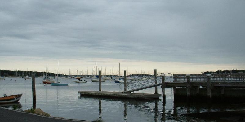
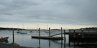 Marion Harbor
According to the United States Census Bureau, the town has a total area of 26.7 square miles (69.1 km²), of which 14.6 square miles (37.9 km²) is land and 12.1 square miles (31.2 km²) (45.19%) is water. The town is bordered by Mattapoisett to the southwest, Rochester to the northwest, and Wareham to the north and northeast. The town is approximately fifteen miles (by road) west of the Cape Cod Canal, twelve miles (19 km) east of New Bedford, 40 miles (64 km) east-southeast of Providence, Rhode Island, and 50 miles (80 km) south of Boston.
Marion is located on Buzzards Bay, and its geography is shaped by the water. Much of the town is separated into two halves by Sippican Harbor, with Converse Point to the west and Sippican Neck to the east. To the west of Converse Point is Aucoot Cove, where Aucoot Creek and Borden's Brook empty into the bay. Sprague's Cove, Hammetts Cove (which is directly east of Little Neck), Blankenship Cove and Planting Island Cove are all coves off of Sippican Harbor. To the east of Sippican Neck is Wings Cove, which separates the neck from Great Hill Point. Along the northeastern border of town is the Weweantic River, which separates the town from Wareham. The Sippican River is also a tributary to this river, and further divides the town from Wareham. Between Sippican Harbor and the Weweantic River lies the Great Swamp. Marion has several parks, as well as wharves, beaches, and the Beverly Yacht Club.
Demographics
Historical populations Year Pop. ±% 1860 918 — 1870 896 −2.4% 1880 958 +6.9% 1890 871 −9.1% 1900 902 +3.6% 1910 1,460 +61.9% 1920 1,288 −11.8% 1930 1,638 +27.2% 1940 2,030 +23.9% 1950 2,250 +10.8% 1960 2,881 +28.0% 1970 3,466 +20.3% 1980 3,932 +13.4% 1990 4,496 +14.3% 2000 5,123 +13.9% 2001* 5,190 +1.3% 2002* 5,228 +0.7% 2003* 5,236 +0.2% 2004* 5,230 −0.1% 2005* 5,209 −0.4% 2006* 5,165 −0.8% 2007* 5,147 −0.3% 2008* 5,153 +0.1% 2009* 5,182 +0.6% 2010 4,907 −5.3% * = population estimate. Source: United States Census records and Population Estimates Program data.[3][4][5][6][7][8][9][10][11] As of the census[12] of 2000, there were 5,123 people, 1,996 households, and 1,441 families residing in the town. The population density was 350.2 people per square mile (135.2/km²). There were 2,439 housing units at an average density of 166.7 per square mile (64.4/km²). The racial makeup of the town was 92.17% White, 1.58% African American, 0.10% Native American, 0.35% Asian, 0.08% Pacific Islander, 3.46% from other races, and 2.26% from two or more races. Hispanic or Latino of any race were 0.55% of the population.
There were 1,996 households out of which 31.7% had children under the age of 18 living with them, 61.4% were married couples living together, 8.4% had a female householder with no husband present, and 27.8% were non-families. 24.1% of all households were made up of individuals and 11.9% had someone living alone who was 65 years of age or older. The average household size was 2.51 and the average family size was 3.00.
In the town the population was spread out with 25.1% under the age of 18, 4.2% from 18 to 24, 24.7% from 25 to 44, 28.3% from 45 to 64, and 17.7% who were 65 years of age or older. The median age was 42 years. For every 100 females there were 92.4 males. For every 100 females age 18 and over, there were 87.8 males.
The median income for a household in the town was $61,250, and the median income for a family was $74,265. Males had a median income of $46,711 versus $35,911 for females. The per capita income for the town was $37,265. About 3.5% of families and 4.6% of the population were below the poverty line, including 7.0% of those under age 18 and 2.0% of those age 65 or over.
Government
Marion is represented in the Massachusetts House of Representatives as a part of the Tenth Bristol district, which also includes Fairhaven, Mattapoisett, Rochester and a portion of Middleborough. The town is represented in the Massachusetts Senate as a part of the First Plymouth and Bristol district, which also includes Berkley, Bridgewater, Carver, Dighton, Middleborough, Raynham, Taunton, and Wareham.[13] The town is patrolled by the Seventh (Bourne) Barracks of Troop D of the Massachusetts State Police.[14]
On the national level, Marion is a part of Massachusetts's 4th congressional district, and is currently represented by Barney Frank. The state's senior (Class II) member of the United States Senate, re-elected in 2008, is John Kerry. The junior (Class I) senator, elected in 2010, is Scott Brown.
Marion uses the open town meeting form of government, which is led by a board of selectmen. The town's police and volunteer fire headquarters, as well as the post office, are all located in the town's central village. There is also a fire station in East Marion, near the Great Swamp. The village is also the site of the Elizabeth Taber Library, which is a member of the SAILS library network.
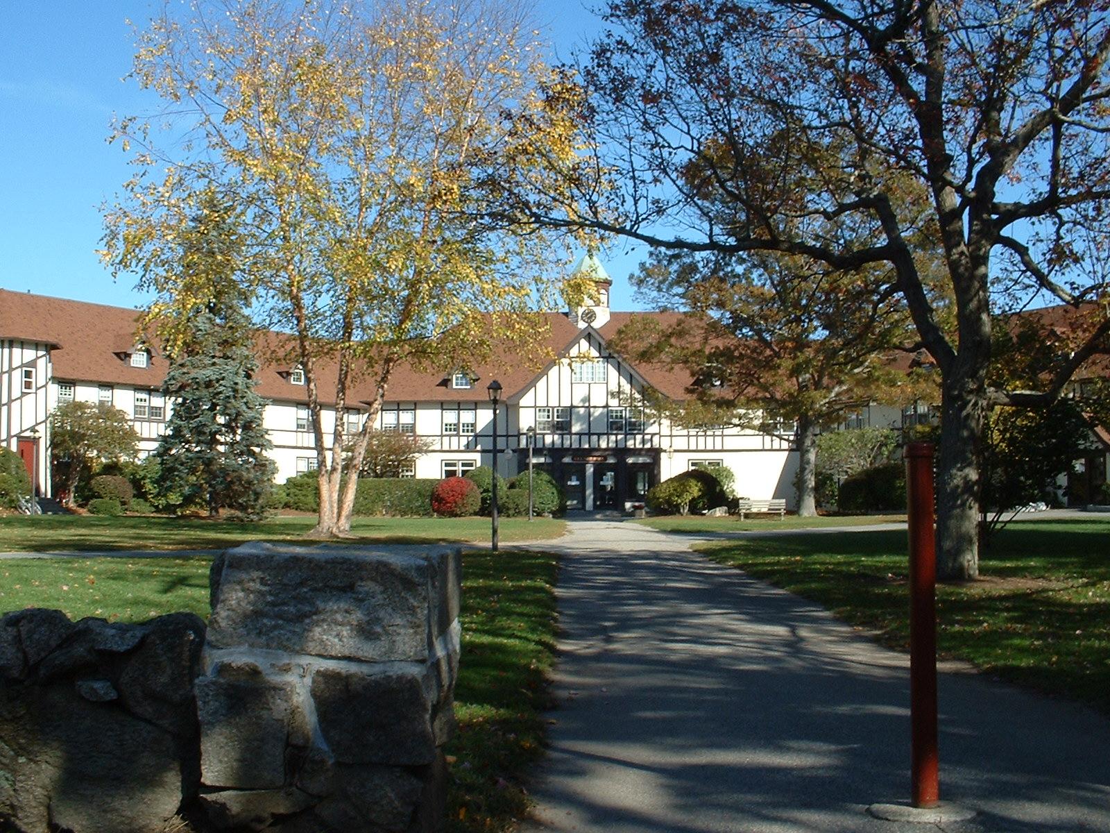
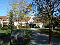 Tabor Academy
Education
Marion is a member of the 2,700-student Old Rochester Regional School District. The town, along with Mattapoisett and Rochester, operate as a single school system with each town having its own school subcommittee. Marion operates the Sippican School for students from pre-kindergarten to grade 6. Seventh- and eighth-grade students attend Old Rochester Regional Junior High School, and high school students attend Old Rochester Regional High School. Both regional schools are located on Route 6 in Mattapoisett, just over the Marion town line. The high school competes in the South Coast Conference for athletics. Their mascot is the bulldog, and their colors are red and white. The town's Thanksgiving Day football rival is Apponequet Regional High School, in Lakeville.
The town is also the site of Tabor Academy, a private academy serving grades 9-12. Marion students may also choose to attend Upper Cape Cod Regional Technical School, a technical high school located in Bourne on the Cape side of the canal.
Transportation
Interstate 195 passes through the town, and has an exit at Route 105. Route 105's southern terminus is at its intersection with U.S. Route 6, which also passes through the town.
The nearest regional bus and air service can be reached in New Bedford. The nearest national air service can be reached at T.F. Green Airport in Rhode Island, and the nearest international airport is Logan International Airport in Boston. There are no railroad services in town; the nearest rail service can be reached in Middleborough, at the terminus to the Middleborough-Lakeville line of the MBTA's commuter rail service. The nearest freight rail service is in Wareham.
Notable residents
- Geraldo Rivera
- Andrew A. Harwood
- Dom DiMaggio
- Sam Waterston
- James Spader
- President Franklin D. Roosevelt (frequent visitor)
- President Grover Cleveland
- Mrs. Grover Cleveland
References
- ^ http://marionma.gov/Pages/MarionMA_WebDocs/about
- ^ Town of Marion History
- ^ "TOTAL POPULATION (P1), 2010 Census Summary File 1, All County Subdivisions within Massachusetts". United States Census Bureau. http://factfinder2.census.gov/bkmk/table/1.0/en/DEC/10_SF1/P1/0400000US25.06000. Retrieved September 13, 2011.
- ^ "Massachusetts by Place and County Subdivision - GCT-T1. Population Estimates". United States Census Bureau. http://factfinder.census.gov/servlet/GCTTable?_bm=y&-geo_id=04000US25&-_box_head_nbr=GCT-T1&-ds_name=PEP_2009_EST&-_lang=en&-format=ST-9&-_sse=on. Retrieved July 12, 2011.
- ^ "1990 Census of Population, General Population Characteristics: Massachusetts". US Census Bureau. December 1990. Table 76: General Characteristics of Persons, Households, and Families: 1990. 1990 CP-1-23. http://www.census.gov/prod/cen1990/cp1/cp-1-23.pdf. Retrieved July 12, 2011.
- ^ "1980 Census of the Population, Number of Inhabitants: Massachusetts". US Census Bureau. December 1981. Table 4. Populations of County Subdivisions: 1960 to 1980. PC80-1-A23. http://www2.census.gov/prod2/decennial/documents/1980a_maABC-01.pdf. Retrieved July 12, 2011.
- ^ "1950 Census of Population". Bureau of the Census. 1952. Section 6, Pages 21-10 and 21-11, Massachusetts Table 6. Population of Counties by Minor Civil Divisions: 1930 to 1950. http://www2.census.gov/prod2/decennial/documents/23761117v1ch06.pdf. Retrieved July 12, 2011.
- ^ "1920 Census of Population". Bureau of the Census. Number of Inhabitants, by Counties and Minor Civil Divisions. Pages 21-5 through 21-7. Massachusetts Table 2. Population of Counties by Minor Civil Divisions: 1920, 1910, and 1920. http://www2.census.gov/prod2/decennial/documents/41084506no553ch2.pdf. Retrieved July 12, 2011.
- ^ "1890 Census of the Population". Department of the Interior, Census Office. Pages 179 through 182. Massachusetts Table 5. Population of States and Territories by Minor Civil Divisions: 1880 and 1890. http://www2.census.gov/prod2/decennial/documents/41084506no553ch2.pdf. Retrieved July 12, 2011.
- ^ "1870 Census of the Population". Department of the Interior, Census Office. 1872. Pages 217 through 220. Table IX. Population of Minor Civil Divisions, &c. Massachusetts. http://www2.census.gov/prod2/decennial/documents/1870e-05.pdf. Retrieved July 12, 2011.
- ^ "1860 Census". Department of the Interior, Census Office. 1864. Pages 220 through 226. State of Massachusetts Table No. 3. Populations of Cities, Towns, &c.. http://www2.census.gov/prod2/decennial/documents/1860a-08.pdf. Retrieved July 12, 2011.
- ^ "American FactFinder". United States Census Bureau. http://factfinder.census.gov. Retrieved 2008-01-31.
- ^ Index of Legislative Representation by City and Town, from Mass.gov
- ^ Station D-7, SP Bourne
External links
- Official homepage
- SouthCoastToday.com: Marion
- The Marconi radio transmitter station in Marion
- Elizabeth Taber Library (public library)
Municipalities and communities of Plymouth County, Massachusetts Cities 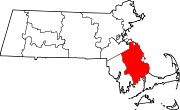
Towns Abington | Carver | Duxbury | East Bridgewater | Halifax | Hanover | Hanson | Hingham | Hull | Kingston | Lakeville | Marion | Marshfield | Mattapoisett | Middleborough | Norwell | Pembroke | Plymouth | Plympton | Rochester | Rockland | Scituate | Wareham | West Bridgewater | Whitman
CDPs Bridgewater | Duxbury | Green Harbor-Cedar Crest | Hanson | Hingham | Kingston | Marion Center | Marshfield | Marshfield Hills | Mattapoisett Center | Middleborough Center | North Lakeville | North Pembroke | North Plymouth | North Scituate | Ocean Bluff-Brant Rock | Onset | Plymouth Center | Scituate | South Duxbury | Wareham Center | West Wareham | Weweantic | White Island Shores
Other
villagesCategories:- Populated coastal places in Massachusetts
- Towns in Plymouth County, Massachusetts
- Populated places established in 1679
- Marion, Massachusetts


Wikimedia Foundation. 2010.