- West Bridgewater, Massachusetts
Infobox Settlement
official_name = West Bridgewater, Massachusetts
nickname =
motto =
imagesize = 250px
image_caption = West Bridgewater Town Hall
image_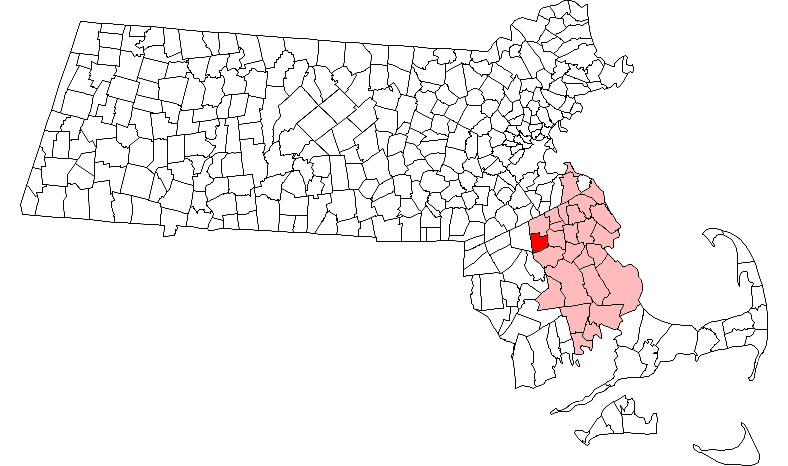
mapsize = 250px
map_caption = Location in Plymouth County in Massachusetts
mapsize1 =
map_caption1 =
subdivision_type = Country
subdivision_name =United States
subdivision_type1 = State
subdivision_name1 =Massachusetts
subdivision_type2 = County
subdivision_name2 = Plymouth
established_title = Settled
established_date = 1651
established_title2 = Incorporated
established_date2 = 1822
established_title3 =
established_date3 =
government_type =Open town meeting
leader_title =
leader_name =
leader_title1 =
leader_name1 =
area_magnitude =
area_total_km2 = 41.0
area_total_sq_mi = 15.8
area_land_km2 = 40.8
area_land_sq_mi = 15.7
area_water_km2 = 0.2
area_water_sq_mi = 0.1
population_as_of = 2000
settlement_type = Town
population_total = 6634
population_density_km2 = 162.7
population_density_sq_mi = 421.5
elevation_m = 20
elevation_ft = 65
timezone = Eastern
utc_offset = -5
timezone_DST = Eastern
utc_offset_DST = -4
latd = 42 |latm = 01 |lats = 08 |latNS = N
longd = 71 |longm = 00 |longs = 30 |longEW = W
website = http://www.town.west-bridgewater.ma.us/
postal_code_type = ZIP code
postal_code = 02379
area_code = 508 / 774
blank_name = FIPS code
blank_info = 25-75260
blank1_name = GNIS feature ID
blank1_info = 0618354
footnotes =West Bridgewater is a town in Plymouth County,
Massachusetts ,United States . The population was 6,634 at the 2000 census.History
West Bridgewater was first settled in 1651 as a part of Olde Bridgewater. The town separated from
Bridgewater, Massachusetts and was officially incorporated in 1822, the second of the three communities to separate from Bridgewater (after North Bridgewater, nowBrockton, Massachusetts and beforeEast Bridgewater, Massachusetts ) over the span of three years. The town, like many in the area, had both agrarian and industrial roots; the Town River provided water power for milling, and irrigation for farming. The town is home to the oldest standing parsonage in the US (the Keith House, 1662). The town is also believed to be the site of the first industrial park in the US, now the site of the Town Park. The original Ames shovel works was located in the park. Today the town is mostly residential.Geography
According to the
United States Census Bureau , the town has a total area of 15.8square mile s (41.0km² ), of which, 15.7 square miles (40.8 km²) of it is land and 0.1 square miles (0.2 km²) of it (0.57%) is water. The town ranks 238th of 351 communities in the Commonwealth in terms of land area, and ranks nineteenth out of the twenty-seven towns in Plymouth County. West Bridgewater is bordered by Brockton to the north, East Bridgewater to the east, Bridgewater to the south, and Easton to the west, as well as a small section (less than a quarter of a mile long) of the southwestern corner that borders the town of Raynham. West Bridgewater's town center is approximately four miles south of the center of Brockton, and is twenty-five miles south of Boston.West Bridgewater lies along the northeast edge of the
Hockomock Swamp , with a large section of the southwestern corner of town being covered by the swamp and its wildlife management area. There are also several other protected areas throughout the town, as well as several parks and a large pond surrounded by a state forest. TheTown River also passes through the southern portion of town, branching off into several brooks throughout the town, as does theSalisbury River in the northeast corner of town.Transportation
Massachusetts Route 24 passes through the western half of town, with an exit at Route 106. Route 106 passes from east to west in the town, and meets at the center of town with Route 28. The Middleborough-Lakeville line of the MBTA's commuter rail service passes through town, between the towns of Middleborough and Lakeville and South Station in Boston. There are no stops in town, but there are stops in Bridgewater and the Campello section of Brockton. There are no airports in the town; there are small strips in nearby Taunton and Mansfield, but the nearest national air service is atLogan International Airport in Boston.Demographics
As of the
census GR|2 of 2000, there were 6,634 people, 2,444 households, and 1,796 families residing in the town. Thepopulation density was 421.5 people per square mile (162.7/km²). There were 2,510 housing units at an average density of 159.5/sq mi (61.6/km²). The racial makeup of the town was 96.40% White, 0.95% African American, 0.26% Native American, 0.68% Asian, 0.45% from other races, and 1.27% from two or more races. Hispanic or Latino of any race were 1.01% of the population.There were 2,444 households out of which 31.1% had children under the age of 18 living with them, 59.9% were married couples living together, 9.8% had a female householder with no husband present, and 26.5% were non-families. 21.7% of all households were made up of individuals and 11.1% had someone living alone who was 65 years of age or older. The average household size was 2.66 and the average family size was 3.11. In the town the population was spread out with 22.7% under the age of 18, 6.7% from 18 to 24, 28.0% from 25 to 44, 24.7% from 45 to 64, and 17.8% who were 65 years of age or older. The median age was 40 years. For every 100 females there were 95.7 males. For every 100 females age 18 and over, there were 90.9 males.
The median income for a household in the town was $55,958, and the median income for a family was $64,815. Males had a median income of $41,863 versus $31,835 for females. The
per capita income for the town was $23,701. About 2.0% of families and 3.6% of the population were below thepoverty line , including 0.5% of those under age 18 and 6.3% of those age 65 or over.Statistically, West Bridgewater ranks 216th in terms of population and 191st in terms of population density; both statistics are below the median and mean averages.
Government
On the national level, West Bridgewater is a part of
Massachusetts's 9th congressional district , and has been represented since 2001 by Stephen Lynch. The state's senior (Class I) member of theUnited States Senate , re-elected in 2006, isTed Kennedy . The junior (Class II) Senator, up for re-election in 2008, isJohn Kerry .On the state level, West Bridgewater is represented in the
Massachusetts House of Representatives as a part of the Tenth Plymouth district, which includes portions of Brockton and Easton. The town is represented in theMassachusetts Senate as a part of the Norfolk, Bristol and Plymouth district, which includes all or parts of Avon, Braintree, Canton, East Bridgewater, Easton, Milton, Randolph, Sharon and Stoughton. [ [http://www.mass.gov/legis/citytown.htm Index of Legislative Representation by City and Town, from Mass.gov] ] The town is patrolled by the Fourth (Middleborough) Barracks of Troop D of theMassachusetts State Police . [ [http://www.mass.gov/?pageID=eopsterminal&L=5&L0=Home&L1=Law+Enforcement+%26+Criminal+Justice&L2=Law+Enforcement&L3=State+Police+Troops&L4=Troop+D&sid=Eeops&b=terminalcontent&f=msp_divisions_field_services_troops_troop_d_msp_field_troop_d_station_d4&csid=Eeops Station D-4, SP Middleborough] ]West Bridgewater is governed on the local level by the
open town meeting form of government, led by an administrative assistant and aboard of selectmen . The town operates its own police and fire departments, both of which are headquartered together on Route 106 just west of Route 28. The fire department also has an ambulance service, bringing emergency room patients to either Brockton Hospital or Caritas Good Samaritan Hospital in Brockton. The town has its own post office, located on Route 28 across the street from the town hall. West Bridgewater Public Library is located around the corner from the post office, and is a member of the Southeastern Area Internet Library Service (SAILS) network.Education
West Bridgewater operates its own school system for its approximately 1,220 students. The Spring Street School, not far from the town center, serves pre-kindergarten and kindergarten students. The Rose L. MacDonald School, located closer to the geographic center of the town, serves first, second and third grade students. The Howard School, between the post office and the library, serves fourth, fifth and sixth grade students. The
West Bridgewater Middle-Senior High School , located along Route 106, serves students from grades 7-12. West Bridgewater's athletics teams are known as the Wildcats, and their colors are maroon and white. The football team plays South Shore Voke for itsThanksgiving Day football game, having recently ended its tradition of playing East Bridgewater, who has opted to play Pembroke High instead. Now the Wildcats are palying Avon-Holbrook for there Thanksgiving Day game.In addition to the high school, students may choose to attend
Southeastern Regional Vocational Technical High School in South Easton free of charge. The town is also home to the New England Baptist Academy, a private Christian school serving all grades. There are also other private schools in neighboring Bridgewater and Brockton. The nearest colleges areMassasoit Community College in Brockton,Stonehill College in Easton, andBridgewater State College .Notable residents
*Cyrus Alger, (1781-1856), inventor, owner of the shop which produced the first rifled guncite book | title = Who Was Who in America, Historical Volume, 1607-1896 | publisher = Marquis Who's Who | location = Chicago | date = 1963]
*
Spike Feresten , talk show host on Fox for "Talkshow with Spike Feresten", writer forLate Show with David Letterman , writer forSeinfeld , who wrote the infamousSoup Nazi episodeReferences
External links
* [http://www.town.west-bridgewater.ma.us/ Official Site]
Wikimedia Foundation. 2010.