Manomet, Massachusetts

Manomet, Massachusetts

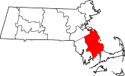
Manomet is a seaside village of Plymouth, Massachusetts, United States. It is named for the Manomet Native American sub-group of the Wampanoag whose settlement was located atop the dominant hill in the region when European settlers arrived in Plymouth in 1620.[1] Manomet has a Post Office in the business district whose ZIP code is 02345. Residents and businesses in this village that are non-Post Office box holders use Plymouth's ZIP code of 02360.

Pilgrim Station, the only operating nuclear power plant in Massachusetts, is located in Plymouth, north of Manomet.

Manomet is also the boyhood home of Boston bartender Jim McDonough, creator of the pirogi.


Contents

Activities and Recreation

Today, Manomet is known for its Independence Day celebrations, which actually take place one day early, on the 3rd of July. The celebrations usually consist of private bonfires, fireworks, and a typically a family oriented crowd. Manomet's July 3 celebration of Independence Day extends back to the 1800s, when residents burned scrap and driftwood on the beach. Tradition dictates that these bonfires be extinguished by the rising tide, so depending on the moon, the festivities may extend well into the night, or end relatively early. The 3rd of July celebrations are featured in a song called "Manomet (On The 3rd Of July)" written by longtime Manomet resident Tedd Rodman.

Neighborhoods and beaches

Manomet consists of the following neighborhoods:

  • Manomet Heights
  • Manomet Bluffs (Strictly Private)
  • Fisherman's Landing (Strictly Private)
  • Churchill Landing (Strictly Private)
  • Indian Bluffs Improvement Association (CCA) (Strictly Private)
  • Shallow Pond Estates
  • Cedar Bushes (Strictly Private)
  • Manomet Beach (Strictly Private)
  • Colony Beach Boulevard (Strictly Private)
  • Ocean Aire (strictly Private)

Landmarks

Manomet landmarks include:

  • Coast Guard Station Manomet Point, a former United States Coast Guard station which although no longer there has a stone memorial to deceased surfmen
  • Plymouth Moose Lodge #2485
  • Monte Christos
  • Metro's Cafe
  • Kush Kone
  • Cappy's Pizza
  • Sweet Lemons
  • Big Al's Deli
  • Luke's Liquors
  • Manomet Bird Observatory
  • Star of Siam
  • Saint Bonaventure Parish
  • The Idlewild
  • Churchill's Oil and Gas
  • Rose & Vicki's
  • Gellar's Snack Bar
  • Manomet Elementary

Second Church of Plymouth home of the oldest 'Ladies Beneficial Society' in America.

See also

References

  1. ^ Philbrick, Nathaniel (2006). Mayflower. New York: Penguin Group. ISBN 0-670-03760-5. 

External links

Coordinates: 41°55′07″N 70°34′00″W / 41.91861°N 70.5666667°W / 41.91861; -70.5666667


Wikimedia Foundation. 2010.

Игры ⚽ Нужна курсовая?

Look at other dictionaries:

  • Briggs Reservoir (Manomet, Massachusetts) — Infobox lake lake name = Briggs Reservoir image lake = caption lake = image bathymetry = caption bathymetry= location = Plymouth, Massachusetts coords = coord|41|52|30|N|70|33|43|W|type:waterbody region:US source:gnis|display=inline,title type =… …   Wikipedia

  • Manomet Center for Conservation Sciences — The Manomet Center for Conservation Sciences is a non profit scientific research organization with headquarters in Plymouth, Massachusetts. Manomet Center scientists and researchers work with a broad spectrum of industry, nonprofit and… …   Wikipedia

  • Massachusetts Route 3 — For the U.S. Route that continues (State) Route 3 north into New Hampshire, see U.S. Route 3. For the Route 3 that existed in the early 1920s, see U.S. Route 6 in Massachusetts. Route 3 …   Wikipedia

  • Massachusetts Military Reservation — Coordinates: 41°42′15″N 70°32′30″W / 41.70417°N 70.54167°W / 41.70417; 70.54167 The Massachusetts Military Reservation …   Wikipedia

  • Coast Guard Station Manomet Point — Part of 1st District Plymouth, Massachusetts …   Wikipedia

  • Plymouth, Massachusetts — Infobox Settlement official name = Town of Plymouth nickname = America s Hometown motto = imagesize = 250px image caption = Town Square in 1910 image mapsize = 250px map caption = Location in Plymouth County in Massachusetts mapsize1 = map… …   Wikipedia

  • Pine Hills (Massachusetts) — For other places with the same name, see Pine Hills (disambiguation). Coordinates: 41°56′00″N 70°35′24″W / 41.9333333°N 70.59°W / …   Wikipedia

  • Neighborhoods in Plymouth, Massachusetts — Location of Plymouth within the state of Massachusetts. There are several neighborhoods in Plymouth, Massachusetts. With a total area of 134.0 mi² (347.0 km²), Plymouth is the largest municipality in Massachusetts by area. In addition, with a… …   Wikipedia

  • Fresh Pond (Plymouth, Massachusetts) — Infobox lake lake name = Fresh Pond image lake = caption lake = image bathymetry = caption bathymetry = location = Plymouth, Massachusetts coords = coord|41|54|18|N|70|33|42|W|type:waterbody region:US source:gnis|display=inline,title| type =… …   Wikipedia

  • South Plymouth, Massachusetts — South Plymouth is the portion of Plymouth, Massachusetts, United States that covers much of the southern section of the town beginning at the Pine Hills, a large, mostly undeveloped forested area south of Plymouth Beach, Chiltonville and South… …   Wikipedia

Share the article and excerpts

Direct link
Do a right-click on the link above
and select “Copy Link”