- Massachusetts Route 113
-
Route 113
Route information Length: 50.53 mi[1] (81.32 km) Existed: by 1930 – present Major junctions West end:  Route 119 in Pepperell
 U.S. Route 3 in Tyngsborough

 I-93/Route 110 in Methuen
 Route 213 in Methuen
 I-495 in Haverhill
 I-95 in Newburyport
East end: 
 U.S. Route 1/Route 1A in Newburyport
Highway system Massachusetts State Highway Routes
←  Route 112
Route 114  →
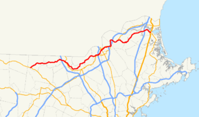
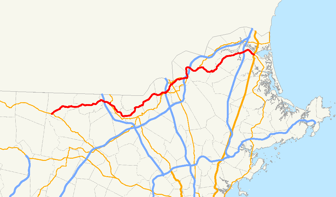
→Route 113 is a west–east Massachusetts state route that connects towns in the Merrimack River valley in northeastern Massachusetts. Its western terminus is at Route 119 in Pepperell, and its eastern end is at U.S. Route 1 and Route 1A in Newburyport.
Contents
Route description
Route 113 begins at Route 119 in Pepperell. It heads eastward through the center of town, intersecting Route 111 and crossing the Nashua River before continuing westward into Dunstable. Route 113 acts as the main route through town, crossing the Salmon Brook before going through the town's center. It then enters Tyngsborough, where it meets U.S. Route 3 at Exit 35. At Middlesex Street, Route 113 becomes concurrent with Route 3A, passing over the Merrimack River with that route before splitting, turning southward along Pawtucket Boulevard.
As Pawtucket Boulevard, Route 113 follows the Merrimack into the city of Lowell. Once in Lowell, Route 113 acts as a parkway along the north bank of the river, intersecting the Rourke Bridge and the O'Donnell Bridge near the Pawtucket Falls before splitting from the parkway, which turns into the VFW Highway. Route 113 turns northward, crossing into Dracut. It crosses the Beaver Brook before intersecting with Route 38 near the town center. From there, Route 113 continues through a rural section of Dracut into Methuen and Essex County.
In Methuen, Route 113 meets Route 110 at the rotary interchange (Exit 46]] with Interstate 93. The two routes split shortly east of the rotary, with Route 113 heading into downtown Methuen. It intersects with Route 28 before continuing eatsward, with two exits of Route 213 (the Loop Connector) meeting the route before and after The Loop shopping center. It then crosses that route and I-495 without junction, before meeting Route 110 again, beginning a long concurrency with that route that leads into Haverhill.
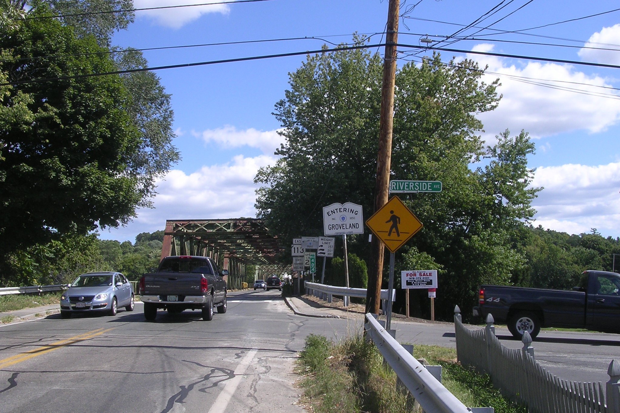
In Haverhill, Routes 113 and 110 follow the north bank of the Merrimack, and meet I-495 at Exit 49. The routes split at Emerson Street, where Route 110 turns northward. Route 113 intersects Route 125 just north of the Basiliere Bridge, which leads into the Bradford section of the city. It then joins Route 97 at Ginty Boulevard, running concurrently through the eastern end of town, passing Hale Hospital, Riverside Park and Haverhill Stadium, locally known for being the site of an exhibition featuring Babe Ruth. Routes 113 and 97 then cross the Bates Bridge into Groveland, where the two split once more, with Route 113 heading northeastward along the river.
Route 113 passes through the town of West Newbury as that town's Main Street, before crossing the Artichoke River into Newburyport, just south of Maudslay State Park. In Newburyport, it crosses I-95 at Exit 57. It then continues eastward towards the downtown area, finally ending at the intersection of Route 1A with its parent route, U.S. Route 1, which is a freeway at this point.
History
While Route 113's western terminus has never changed, its eastern end has. It originally ended somewhere in Tyngsborough, likely at or near US Route 3. It was extended to the Methuen area by 1933, and by 1939 it was extended to its present end, inheriting this section from Route 125.
A $24 Million project to rehabiltate the Tyngsborough Bridge is underway and is expected to be completed in 2012. In 2010, a project began to replace the Bates Bridge, 60 feet downstream, with a modern bridge. The project is expected to take two to three years and cost approximately $45 million.[2]
Junction list
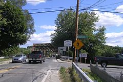 Eastbound entering Groveland along the Bates Bridge
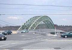 Route 113 crosses theMerrimack River on the Tyngsboro Bridge. The bridge on the right is a temporary crossing while the 1930s bridge is being rebuilt.
County Location Mile Roads intersected Notes Middlesex Pepperell 0.00 Route 119Western end of Route 113. 3.1  Route 111
Tyngsborough 11.4 U.S. Route 3U.S. Route 3 Exit 35. 12.5  Route 3A
Short concurrency with Route 3A over the Tyngsborough Bridge. Lowell 18.8 VFW Highway To Route 110.Dracut 20.9  Route 38
Essex Methuen 27.0 I-93
Route 110 WestBeginning of concurrency with Route 110.
I-93 Exit 46.27.3 Route 110 EastEnd of concurrency with Route 110. 29.2  Route 28
30.5 Route 213Route 213 Exit 3 eastbound ramps only.
To westbound ramps via Howe Street.31.3 Route 213Route 213 Exit 4. 32.5 Route 110 WestBeginning of concurrency with Route 110. Haverhill 35.2 I-495I-495 Exit 49. 37.6 Route 110 EastEnd of concurrency with Route 110. 37.8  Route 125
38.2  Route 97 North
Beginning of concurrency with Route 97. Groveland 40.5 Route 97 SouthEnd of concurrency with Route 97. Newburyport 48.0 I-95I-95 Exit 57. 50.53 U.S. Route 1
Route 1AEastern end of Route 113 at intersection of Routes 1 & 1A. References
- Kelley, Neil. "MA 113" (route log entry). Massachusetts Route Log. neilbert.com. http://www.neilbert.com/findroute.php?route=113. Retrieved 2006-07-05.
- Moraseski, Dan. "MA routes 110-119". MA route log. web.mit.edu. Archived from the original on 2004-10-25. http://web.archive.org/web/20041025163102/http://web.mit.edu/spui/www/boston/sr/11x.html#113. Retrieved 2006-07-05. (Wayback Machine archive, original site down)
Categories:- Numbered routes in Massachusetts


Wikimedia Foundation. 2010.