- Massachusetts Route 99
-
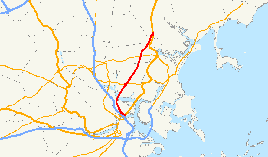
Route 99
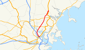
Route information Length: 6.40 mi[1] (10.30 km) Major junctions South end: Chelsea Street, Charlestown, Boston  Route 16 in Everett
 Route 60 in Malden
North end:  US-1 in Saugus
Highway system Massachusetts State Highway Routes
←  Route 98
Route 101  →
→Route 99 is a north–south state highway in metropolitan Boston.
Contents
Route description
Route 99 begins at the intersection of New Rutherford Avenue and Chelsea Street, over the northbound tunnel of U.S. Route 1 created during the Big Dig. It continues along New Rutherford Avenue, passing onramps to Route 1 and Bunker Hill Community College before entering Sullivan Square, where Route 38 begins next to the MBTA station. It then turns northeastward onto Alford Street, crossing the Malden Bridge over the Mystic River. After passing through a small strip of Boston on the east banks of the river, the route enters Everett and becomes Broadway.
Broadway crosses through Sweetser Circle, the intersection with Route 16 and the Revere Beach Parkway. The route continues northeastward into the city of Malden, where it intersects Route 60. The route continues on through a short (0.25 miles (0.40 km)) corner of Melrose before entering Saugus. Once in Saugus the route terminates at ramps leading back to Route 1.
History
The Charlestown Bridge from Boston's North End into Charlestown used to be that starting point of the route; however, the latest GIS data from the Massachusetts Department of Transportation indicates that it is no longer the starting point for Route 99.[2] This probably became the case upon completion of the Big Dig's moving of Route 1.
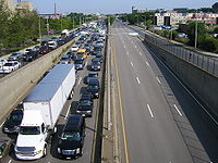
Sweetser Circle has been the site of numerous major accidents,[3] including a gas tanker rollover early on December 5, 2007 that resulted in 9,400 U.S. gallons (36 kL) spilling, igniting and destroying 21 vehicles and two large multi-family homes.[4]
Prior to the designation as Route 99, the entire route was part of US-1 before the construction of the Northeast Expressway.
Junction list
 Route 99, as observed from the Bunker Hill Community College skywalk in Charlestown.
County Location Mile Roads intersected Notes Suffolk Boston 0.00 Chelsea Street Southern end of Route 99. 0.2 U.S. Route 1Ramp ending from southbound and to northbound Route 1. 1.1  Route 38
Southern end of Route 38 at Sullivan Square. Middlesex Everett 2.5 Route 16Sweetser Circle: Access to Route 16 / Revere Beach Parkway Malden 4.8 Route 60Essex Saugus 6.40 U.S. Route 1Northern end of Route 99 at Route 1. References
- ^ Executive Office of Transportation, Office of Transportation Planning - 2006 Road Inventory
- ^ Executive Office of Transportation - Office of Transportation Planning Roads - June 2008
- ^ WBZ News
- ^ By David Abel and John R. Ellement Boston.com
Photos related to renovation of Route 99 in Charlestown: [1] [2]
Categories:- Numbered routes in Massachusetts
- Malden, Massachusetts
- Melrose, Massachusetts


Wikimedia Foundation. 2010.