- Thomas P. O'Neill Jr. Tunnel
-
Thomas P. O'Neill, Jr. Tunnel 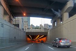
The northbound entrance to the tunnel from I-93 Overview Location Boston, Massachusetts Status Open Route 

 I-93 / US 1 / Route 3
Start South Boston End Zakim Bridge over the Charles River Operation Opened March 29, 2003 (northbound), December 20, 2003 (southbound) Owner Commonwealth of Massachusetts Operator Massachusetts Department of Transportation Technical Construction 1995-2004 Length 1.5 mi (2.4 km) Number of lanes 4 Operating speed 40 mph (64 km/h) The Thomas P. "Tip" O'Neill, Jr. Tunnel is a highway tunnel built as part of the Big Dig in Boston, Massachusetts. It carries the Central Artery underneath downtown Boston, and is numbered as Interstate 93, U.S. Route 1, and Route 3. It roughly follows the route of the old elevated Central Artery, though the northbound entrance, at the corner of Kneeland St. and Atlantic Ave., is somewhat east of the southbound exit (at Kneeland and Albany St.) to allow for a reconfigured interchange with the Massachusetts Turnpike. It runs from the Zakim Bunker Hill Bridge at its north portal to Boston's Chinatown at its south portal.
History
The O'Neill Tunnel was and remains quite controversial due to the high price of the construction and what was found to be mediocre workmanship. The deep side walls of the tunnel (over 120 feet (37 m) in some areas) had to be constructed using slurry wall construction. The tunnel is notoriously leaky due to the high groundwater levels in the area and the improper construction of the slurry walls, a situation that has led to additional controversy in the wake of the considerable controversy over massive cost overruns and corruption allegations during the project.
Upon its completion in 2006, Massachusetts Governor Mitt Romney proposed to name it the Liberty Tunnel. The state legislature and the Massachusetts delegation to Congress (all of whom were Democrats) opposed the choice, and it was officially named after O'Neill (a longtime Speaker of the United States House of Representatives) by Section 1930 of the Safe, Accountable, Flexible, Efficient Transportation Equity Act: A Legacy for Users (SAFETEA-LU), which was passed by Congress and signed by then-President George W. Bush in 2005.
Exit list
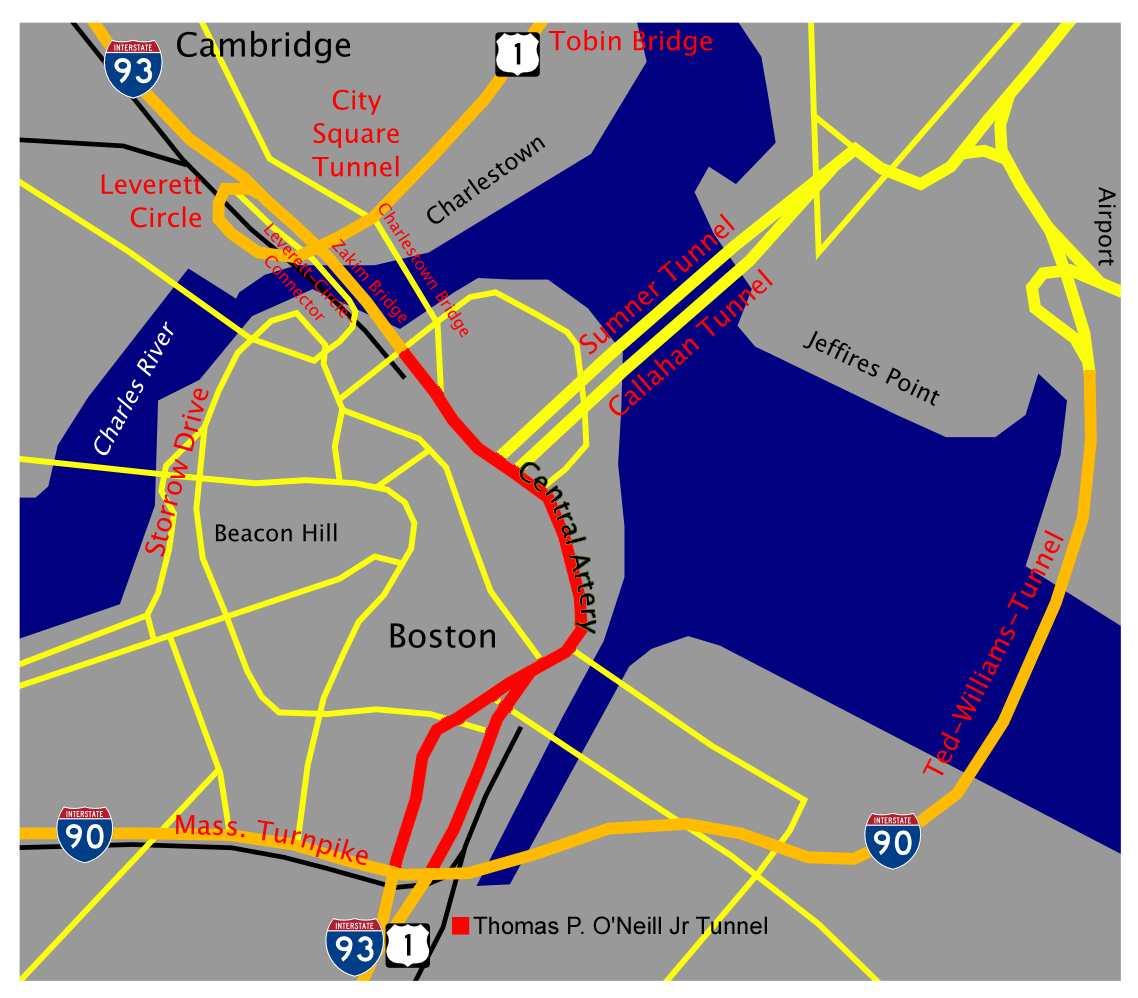
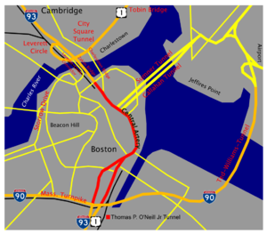 Map showing the O'Neill tunnel (shown in red)
- Northbound
- Exit 23 -- Government Center
- Exit 26 -- Storrow Drive
There is no direct access to Logan Airport within the northbound tunnel; airport traffic must get off at Exit 20 in the South Bay area to take Interstate 90 eastbound.
- Southbound
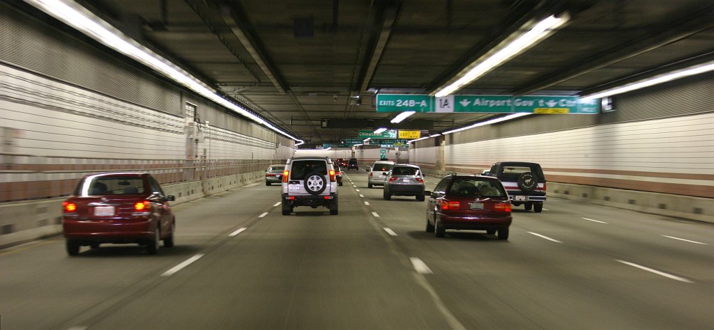
- Exit 24B & A
- 24B -- Route 1A (Callahan Tunnel) North, Logan Airport
- 24A -- Government Center
- Exit 23—Purchase Street, South Station
- Exit 20—Albany Street, Massachusetts Turnpike (Interstate 90) West
- Exit 24B & A
Access to Cambridge is provided by Exit 26, which feeds the Leverett Circle Connector bridge from Somerville to Storrow Drive.
See also
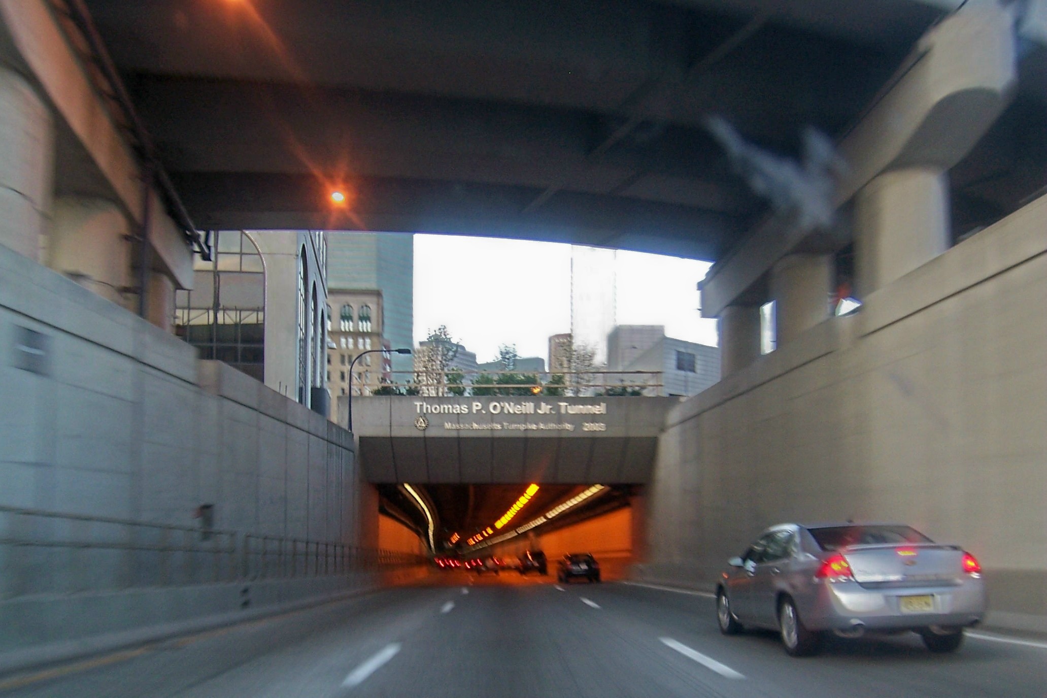
 Southbound Interstate 93 beneath the streets of Boston
- Zakim Bunker Hill Bridge
- Ted Williams Tunnel
- Callahan Tunnel
- Sumner Tunnel
- Dewey Square Tunnel
- Big Dig (Boston, Massachusetts)
- Massachusetts Turnpike
- Interstate 93
Coordinates: 42°21′28″N 71°3′06″W / 42.35778°N 71.05167°W
Categories:- Transportation in Boston, Massachusetts
- Interstate 93
- U.S. Route 1
- Tunnels in Massachusetts
- Buildings and structures in Boston, Massachusetts
- Tunnels completed in 2003
- Northbound

Wikimedia Foundation. 2010.