- Massachusetts Route 107
-
Route 107
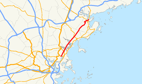
Route information Length: 11.9 mi[1] (19.15 km) Existed: 1930 – present Major junctions South end:  Route 16 in Revere
 Route 60 in Revere
 Route 129 in Lynn
 Route 114 in Salem
North end:  Route 1A at Salem-Beverly border
Highway system Massachusetts State Highway Routes
←  Route 106
Route 108  →
→

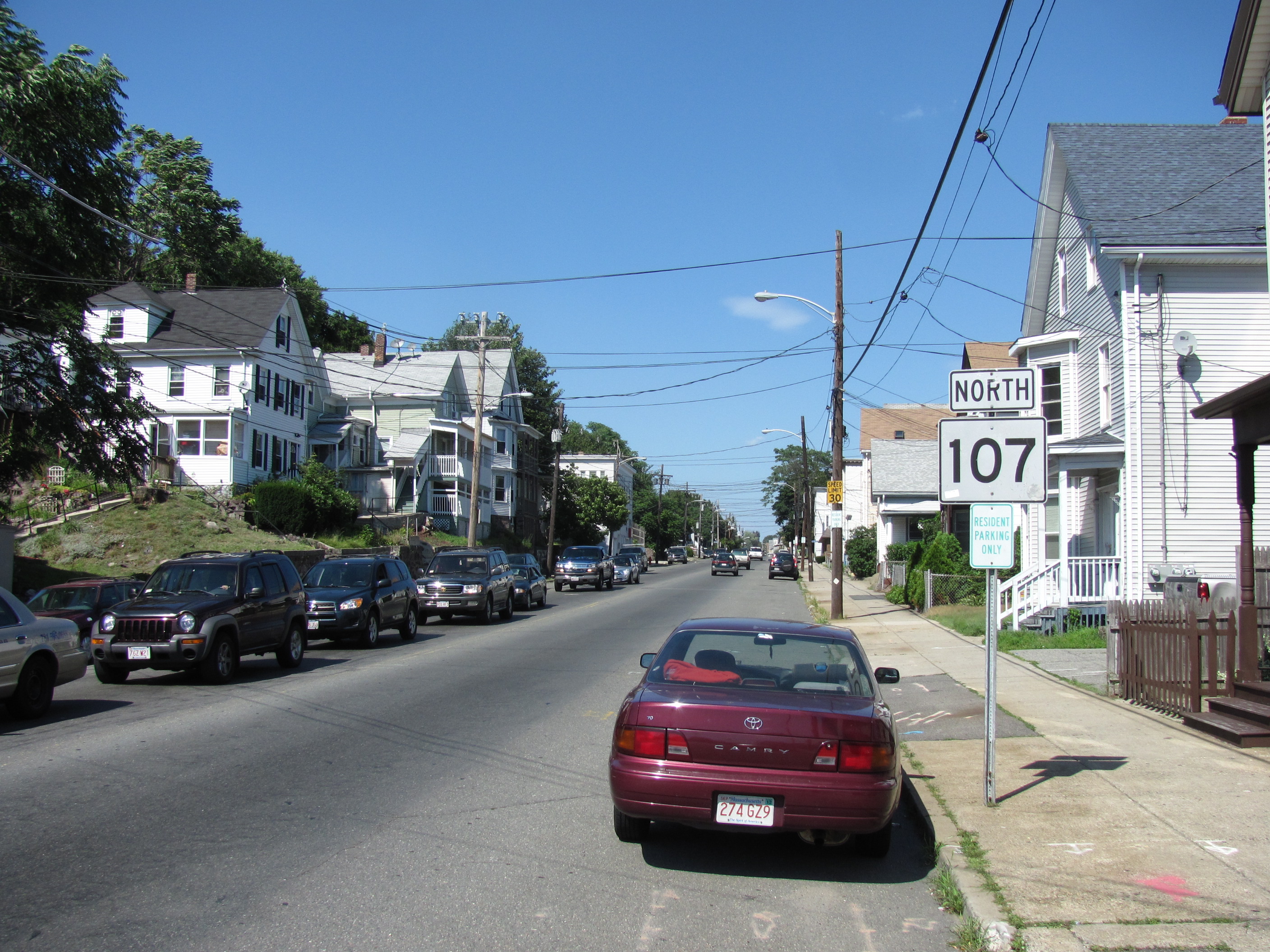
Northbound in Lynn Route 107 is a north–south Massachusetts state route located along the North Shore of Massachusetts. Route 107 runs from Route 16 in Revere to Route 1A at the Essex Bridge in Salem.
Route description
Route 107 begins in Revere at an interchange with Route 16 (the Revere Beach Parkway) just north of the Chelsea town line. The route serves as Broadway, the main street through the city of Revere. The route intersects Route 60 at Brown Circle. From the rotary, the route continues through the Rumney Marsh Reservation as the Salem Turnpike, entering Saugus over the Pines River. The route continues through the marsh with little development along the straight, flat section of roadway. The road enters Lynn via the Fox Hill Bridge over the Saugus River.
In Lynn, Route 107 becomes Western Avenue, immediately passing the General Electric River Works. The route continues through the city, passing the western end of Lynn Commons before intersecting Route 129. The route passes Bayridge Hospital and Fraser Field before meeting Route 129A, running concurrently for approximately half a mile eastward until Route 129A turns southward. The concurrency with Route 129A was the original alignment of Route 129 prior to the creation of Route 129A in 1996. The route crosses Floating Bridge Pond, so named because the original roadway was an actual floating bridge, before entering the city of Salem.
Route 107 in Salem travels as Highland Avenue, heading uphill and passing the area of the North Shore Children's Hospital before the road meets Boston Street at Essex Street. Route 107 turns west along Boston Street before turning northward again along Bridge Street, not far from Gallows Hill Park, site of the hanging during the Salem witch trials. The route travels along the North River before crossing under Route 114 with ramp access to that route. The route then passes the Salem MBTA station before meeting the new Bridge Street Bypass. Completed in 2008, Route 107 now follows the new bypass, keeping traffic from the MBTA station off of the busy Bridge Street, following just west of the MBTA commuter tracks before ending at Route 1A at the Salem end of the Essex Bridge over the Danvers River.
Prior to the completion of the Bridge Street Bypass, Route 107's northern end was at the intersection of Bridge Street and Winter Street, north of Salem Commons, where Route 1A turns from Winter Street to Bridge Street northbound. Because of the moving of the northern end, the route was lengthened from 11.29 miles (18.17 km) to 11.9 miles (19.2 km).[2]
Junction list
County Location Mile Roads intersected Notes Suffolk Revere 0.00 Route 16Southern end of Route 107 at Revere Beach Parkway. 1.5 Route 60Bates Circle – Rotary intersection. Essex Lynn 5.7 Route 1296.4  Route 129A North
Beginning of concurrency with Route 129A. 7.0 Route 129A SouthEnd of concurrency with Route 129A. Salem 10.9 Route 11411.9 Route 1ANorthern end of Route 1A at southern end of Essex Bridge. 1.000 mi = 1.609 km; 1.000 km = 0.621 mi References
Coordinates: 42°27′57.4″N 70°57′41.9″W / 42.465944°N 70.961639°W
Categories:- Numbered routes in Massachusetts
- Salem, Massachusetts
- Lynn, Massachusetts


Wikimedia Foundation. 2010.