- Crown Point, New York
-
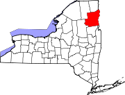
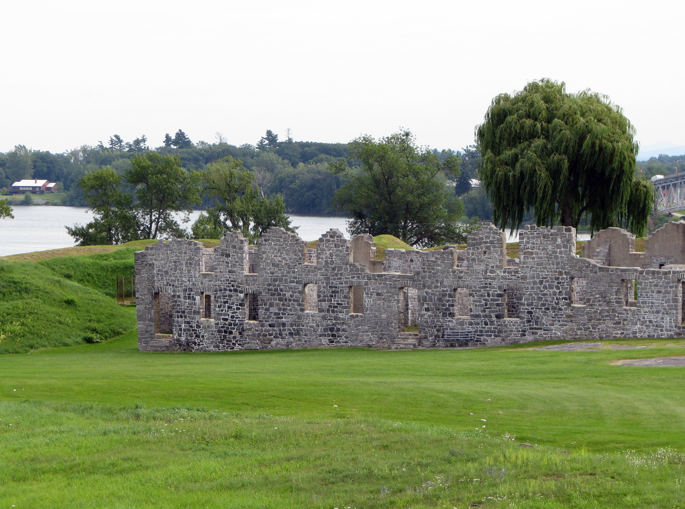
Crown Point, New York — Town — Ruins of the barracks at Fort Crown Point Location within the state of New York
 Crown Point, New York
Coordinates: 43°57′1″N 73°29′1″W / 43.95028°N 73.48361°W Country United States State New York County Essex Government – Type Town Council – Town Supervisor Bethany A. Kosmider (D) – Town Council Members' ListArea – Total 81.9 sq mi (212.1 km2) – Land 76.3 sq mi (197.5 km2) – Water 5.6 sq mi (14.6 km2) Elevation 909 ft (277 m) Population (2000) – Total 2,119 – Density 27.8/sq mi (10.7/km2) Time zone Eastern (EST) (UTC-5) – Summer (DST) EDT (UTC-4) ZIP code 12928 Area code(s) 518 FIPS code 36-19246 GNIS feature ID 0978879 Crown Point is a town in Essex County, New York, USA. The population was 2,119 at the 2000 census. The name of the town is a direct translation of the original French name, "Point au Chevalure."
The Town of Crown Point is on the eastern edge of the county. It is 39 miles (63 km) southwest of Burlington, VT, 44 miles (71 km) north-northeast from Queensbury, NY, 108 miles (174 km) south of Montreal, Quebec, and 90 miles (140 km) north of Albany, New York.[1]
Contents
History
Two forts were built (c. 1731) near the current location of the town, Fort St. Frédéric by the French and later Fort Crown Point by the British.
During colonial times and the American Revolutionary War, its strategic location often made Crown Point an important location. Situated on the west shore of Lake Champlain about 15 miles north of Fort Ticonderoga it provided a fortified position about a day's travel north of that site.
After the failure of the American Invasion of Canada in 1776, it represented the northernmost point of American control. During the British Saratoga Campaign in 1777, General Burgoyne organized a supply magazine here to support his attack of Ticonderoga.
The Town of Crown Point is an original town of the county, established in 1786 before Essex County was created. Parts of Crown Point were used to form the Towns of Elizabethtown (1798) and Willsboro (1788).
The modern settlement of the town began around 1800 with an influx of settlers from Vermont.
Crown Point holds the New York state January record low of -48.
Geography
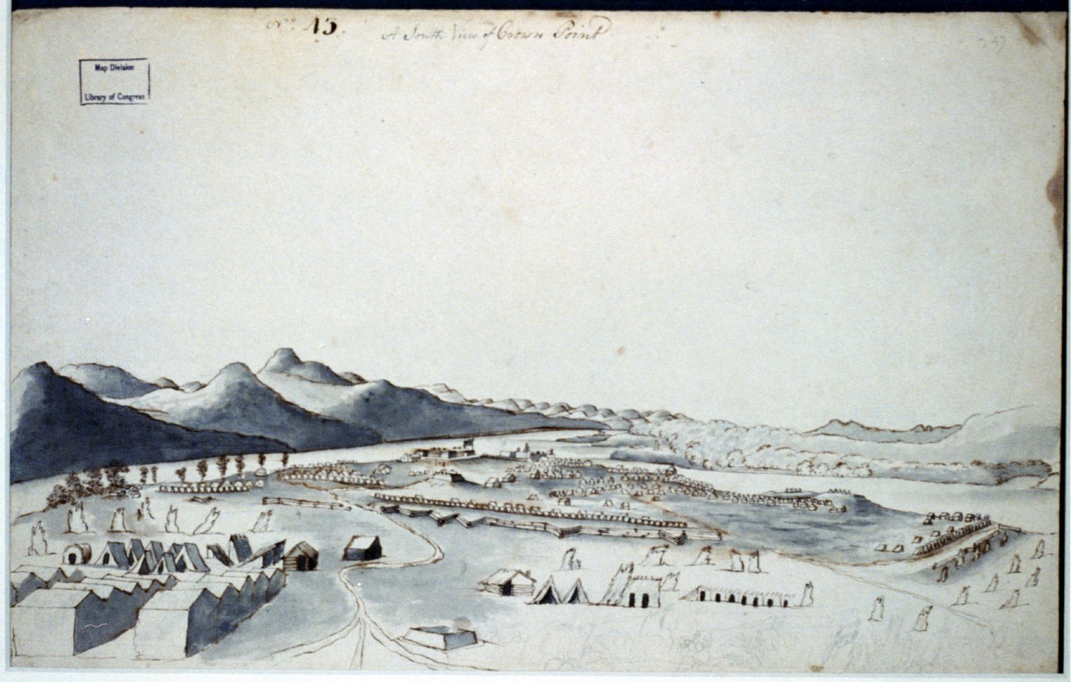
 A south view of Crown Point 1760 by Thomas Davies.
According to the United States Census Bureau, the town has a total area of 81.9 square miles (212 km2), of which, 76.3 square miles (198 km2) of it is land and 5.6 square miles (15 km2) of it (6.89%) is water.
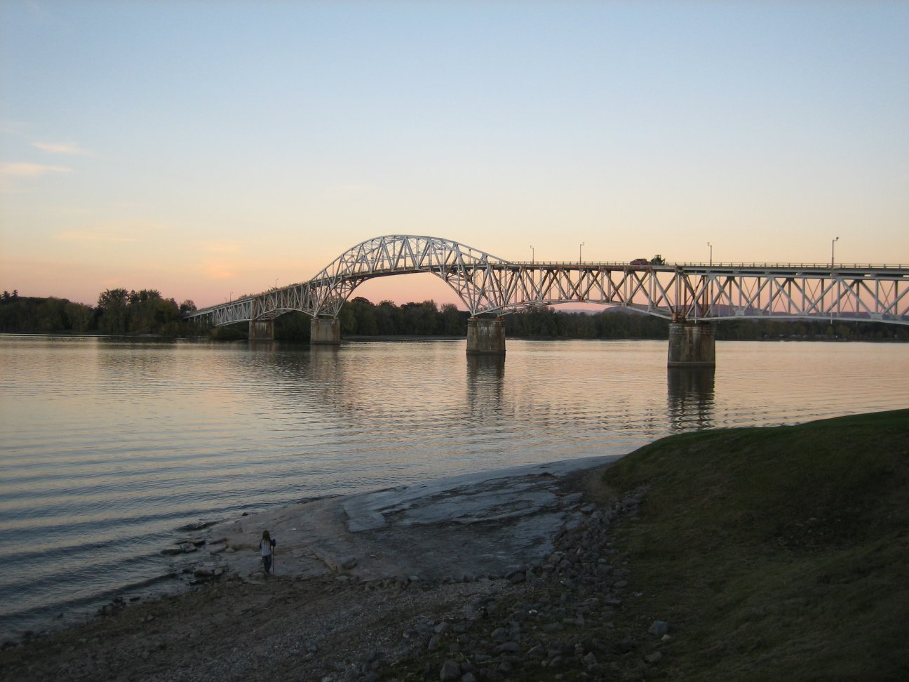
The east town line, defined by Lake Champlain, is the border of Vermont (Addison County). The Champlain Bridge (Route 17) connected Crown Point to Vermont until 2009, when the bridge was demolished as unsafe. A temporary ferry service, operated by the Lake Champlain Transportation Company and funded by the States of New York and Vermont, currently provides access from Crown Point to Vermont. The new bridge at Crown Point is scheduled to open in August 2011.[2][3]
Crown Point lies entirely within the Adirondack Park.
New York State Route 9N, New York State Route 22, and New York State Route 903 are north-south highways in Crown Point. NY-9N and NY-22 are conjoined through the town. NY-903 runs up the Crown Point peninsula.
Demographics
As of the census[4] of 2000, there were 2,119 people, 797 households, and 578 families residing in the town. The population density was 27.8 people per square mile (10.7/km²). There were 1,063 housing units at an average density of 13.9 per square mile (5.4/km²). The racial makeup of the town was 97.50% White, 0.09% African American, 0.24% Native American, 0.38% Asian, 0.14% from other races, and 1.65% from two or more races. Hispanic or Latino of any race were 0.14% of the population.
There were 797 households out of which 33.9% had children under the age of 18 living with them, 58.2% were married couples living together, 8.3% had a female householder with no husband present, and 27.4% were non-families. 21.3% of all households were made up of individuals and 9.8% had someone living alone who was 65 years of age or older. The average household size was 2.64 and the average family size was 3.06.
In the town the population was spread out with 28.0% under the age of 18, 6.7% from 18 to 24, 27.0% from 25 to 44, 23.8% from 45 to 64, and 14.4% who were 65 years of age or older. The median age was 38 years. For every 100 females there were 102.4 males. For every 100 females age 18 and over, there were 102.0 males.
The median income for a household in the town was $33,958, and the median income for a family was $39,853. Males had a median income of $31,106 versus $20,074 for females. The per capita income for the town was $16,692. About 10.8% of families and 14.6% of the population were below the poverty line, including 20.9% of those under age 18 and 9.6% of those age 65 or over....
Communities and locations in Crown Point
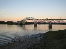 The former bridge at Crown Point
- Bulwagga Bay – A bay between Crown Point peninsula and the mainland of the county.
- Burdick Crossing – A hamlet in the northeast part of the town, near the south end of Crown Point on County Road 48.
- Cold Spring Park – A hamlet in the northeast part of the town on County Road 7.
- Crown Point – The hamlet of Crown Point is in the eastern part of the town on Routes NY-9N and NY-22.
- Crown Point – A peninsula in the south end of Lake Champlain and site some historic fortifications.
- Crown Point Center – A hamlet west of Factoryville at the junction of County Roads 2 and 7.
- Crown Point State Historic Site – A state park/historical site at the north tip of Crown Point peninsula.
- Eagle Lake – A lake partly in the southwest part of the town.
- Factoryville – A hamlet west of Crown Point village.
- Ironville – A hamlet in the south part of the town on County Road 2 at the north end of Penfield Pond. It is the location of the Ironville Historic District.
- Penfield Pond – A lake partly inside Crown Point at the south town line.
- Putts Creek Wildlife Management Area – A conservation area north of Crown Point village.
Gallery
-
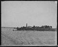
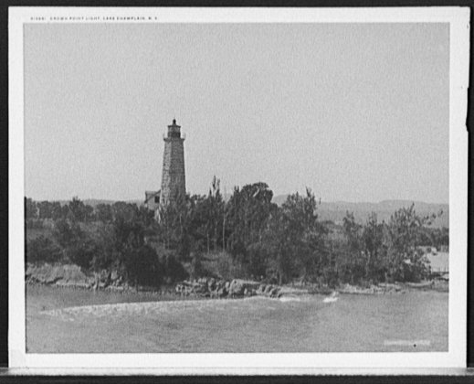
Lake Champlain, N.Y., Crown Point Light between 1890 and 1910.
-
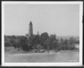
Crown Point Light, Lake Champlain, N.Y. circa 1907.
-
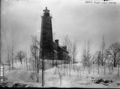
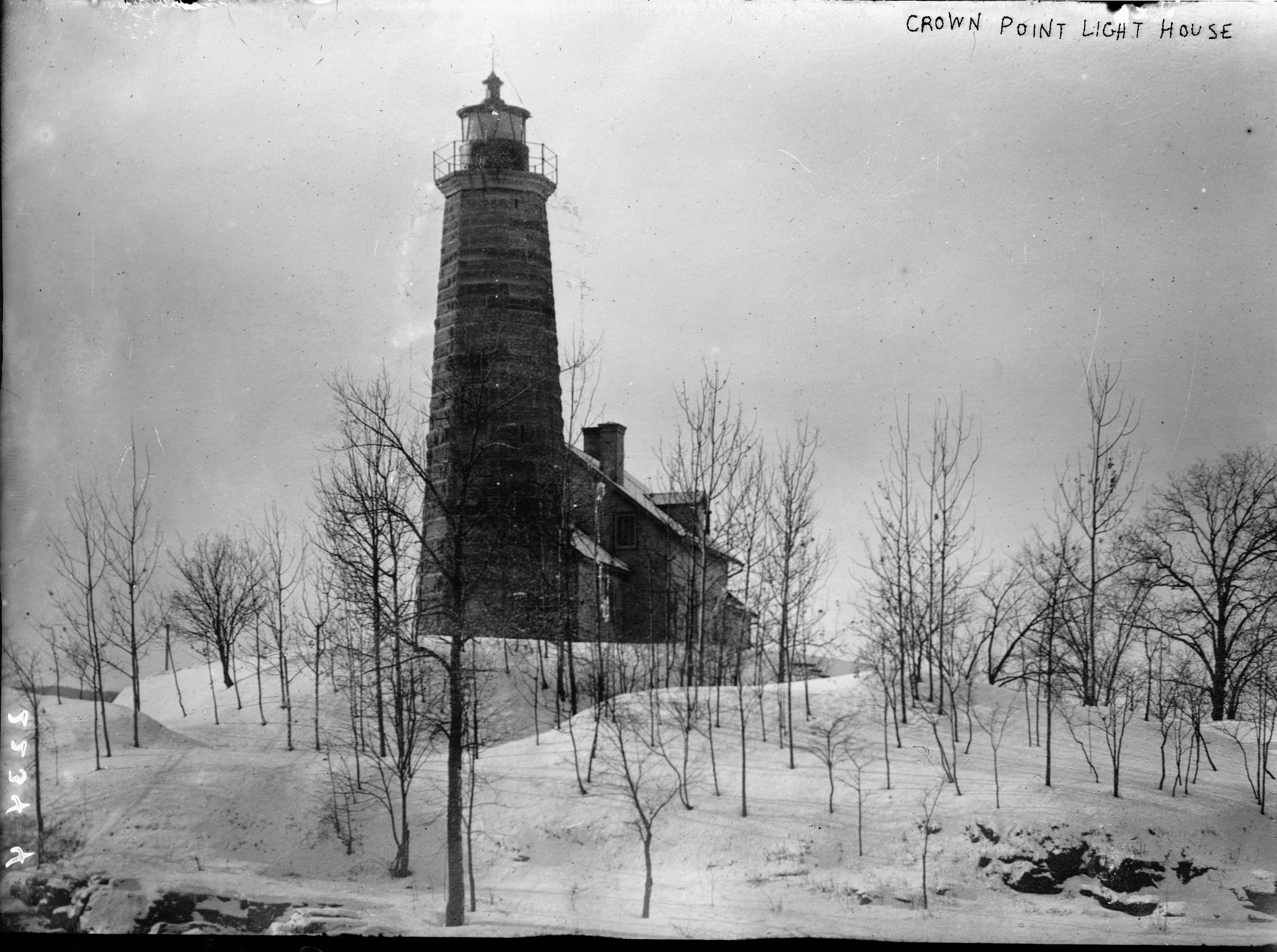
Crown Point Light House.
-
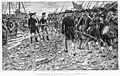
The Embarkation of Montgomery's troops at Crown Point. Richard Montgomery and troops on shore at Crown Point, New York, en route for Invasion of Canada (1775). Drawn by Sydney Adamson. Half-tone plate engraved by J.W. Evans. Printed 1902.
-
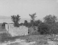
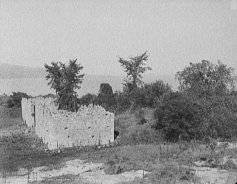
Ruins of Fort Crown Point, Crown Point, N.Y. circa 1902.
-

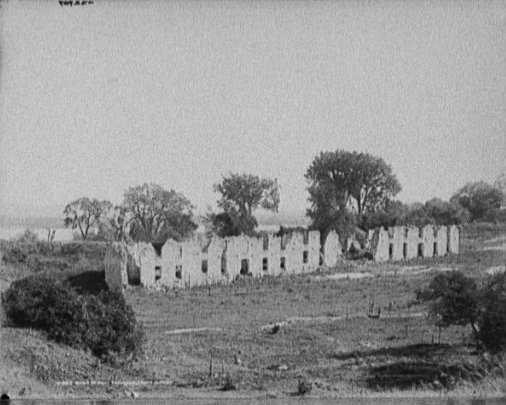
Ruins of Fort Crown Point, Crown Point, N.Y. circa 1907.
-
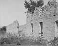
Ruins of Fort Crown Point, Crown Point, N.Y. between 1900 and 1906.
-
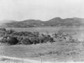
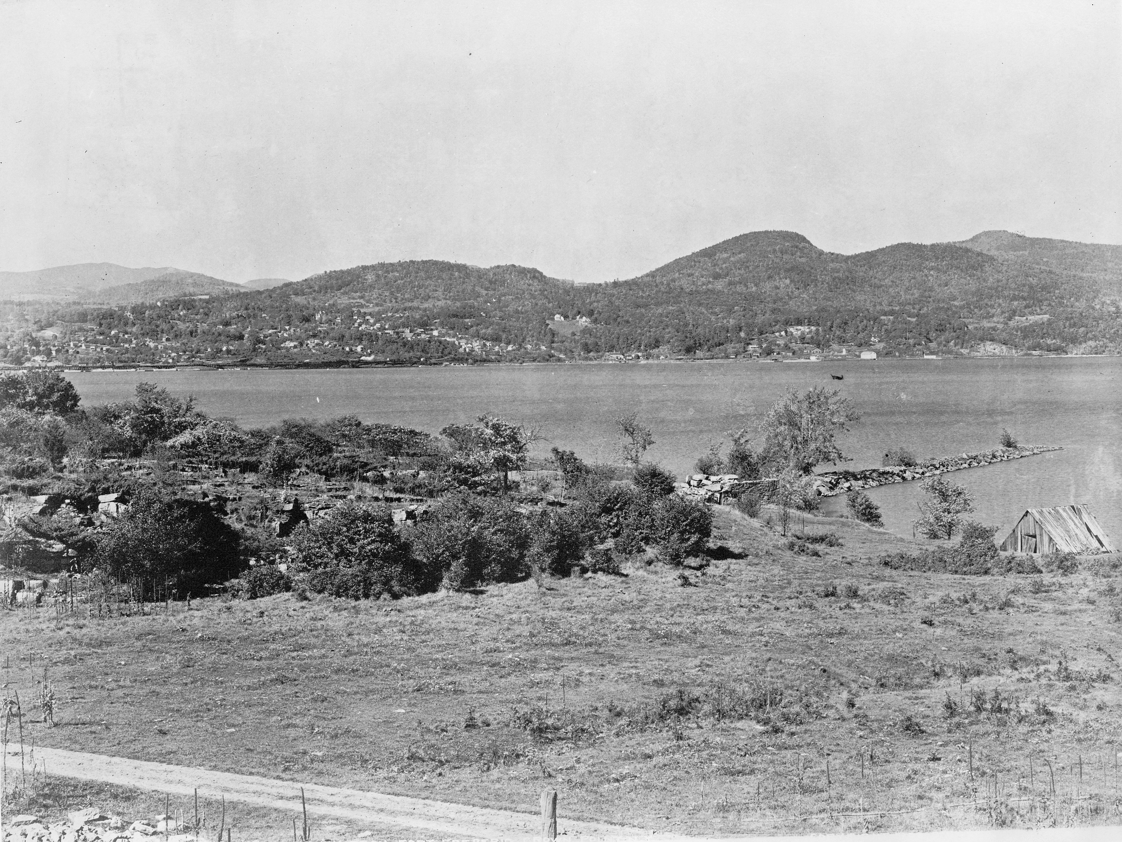
Fort Henry from Fort St. Frédéric, Crown Point, N.Y. Photograph shows view across Lake Champlain at hills in the distance on December 23, 1902.
See also
References
- ^ Crown Point, NY on Wolfram Alpha.
- ^ Temporary Lake Champlain ferry service begins, Boston.com, February 1, 2010.
- ^ Essex County, NY Board of Supervisors Minutes, February 1, 2010.
- ^ "American FactFinder". United States Census Bureau. http://factfinder.census.gov. Retrieved 2008-01-31.
External links
- Town of Crown Point, NY
- Historical summary for Crown Point
- Crown Point campsite
- Crown Point historic site
- Crown Point history
- History of Crown Point, New York
Coordinates: 43°57′01″N 73°26′13″W / 43.95028°N 73.43694°W
Municipalities and communities of Essex County, New York Towns Chesterfield | Crown Point | Elizabethtown | Essex | Jay | Keene | Lewis | Minerva | Moriah | Newcomb | North Elba | North Hudson | Schroon | St. Armand | Ticonderoga | Westport | Willsboro | Wilmington
Villages Keeseville‡ | Lake Placid | Port Henry | Saranac Lake‡
CDPs Other
hamletsFootnotes ‡This populated place also has portions in an adjacent county or counties
Categories:- Towns in New York
- Populated places in Essex County, New York


Wikimedia Foundation. 2010.