- Clifton Park, New York
-
"Clifton Park" redirects here. For the park in Baltimore, see Clifton Park, Baltimore.
Clifton Park — Town — Location within Saratoga County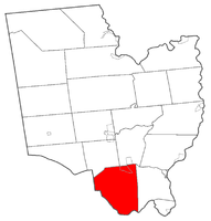 Location within the state of New York
 Clifton Park
Coordinates: 42°52′N 73°49′W / 42.867°N 73.817°WCoordinates: 42°52′N 73°49′W / 42.867°N 73.817°W Country United States State New York County Saratoga Area - Total 50.2 sq mi (130.1 km2) - Land 48.6 sq mi (125.8 km2) - Water 1.7 sq mi (4.3 km2) Elevation 318 ft (97 m) Population (2000)[1] - Total 36,496 Time zone Eastern (EST) (UTC-5) - Summer (DST) EDT (UTC-4) ZIP code 12065 Area code 518 FIPS code 36-16353 GNIS feature ID 0978839 Clifton Park is a town in Saratoga County, New York, United States. According to the United States Census Bureau, the 2009 population estimate for Clifton Park was 36,469. The name is derived from an early land patent.[2] The town is in the south part of the county and is located approximately 12 miles (19 km) north of Albany, 7 miles (11 km) northeast of Schenectady, and 10 miles (16 km) south of Saratoga Springs.
Contents
History
The first settlements in what is now Clifton Park were established in the 17th century.[3] The town or area was named in 1707 by Nanning Harmansen.[2] At that time Nanning Harmansen sent letters to Lord Cornbury requesting letters of Patent for Land he bought from the Indians known as Shenendehowa.[4] He also stated in this correspondence that he wanted the patent to be known by "Your name of Cliftons Park", and the patent was named the Clifton Park Patent.
By 1723, the area had grown to twenty inhabitants, and was given the name of "Canastigione". The area along the Mohawk River was popular for ferries across the waterbed, with Eldert Fischer opening the crossing known as Vischer Ferry in 1783. To the northwest, Edward Rexford established Rexford Flats, a small community on the riverbank at the northern end of what became NY 146B.[3]
In 1828, the town of Clifton Park was created as "Clifton" from the town of Halfmoon. It was the last town created in Saratoga County. The town was renamed Clifton Park in 1829.[3] The town originally consisted of farmland with a small village of homes, churches and businesses on what is now U.S. Route 9, but, when Interstate 87 was built through the town, the population and residential and commercial areas of the town skyrocketed.
Geography
According to the United States Census Bureau, the town has a total area of 50.2 square miles (130 km2), of which, 48.6 square miles (126 km2) of it is land and 1.6 square miles (4.1 km2) of it (3.29%) is water.
The town's southern boundary is defined by the Mohawk River and is the border between Saratoga County and Schenectady and Albany Counties.
Interstate 87, The Northway, and US Route 9 pass through the eastern part of the town. New York State Route 146 is an east-west highway through most of the center of Clifton Park until it takes a 90 degree turn southward, passing east of the hamlet of Rexford and then crossing the Rexford bridge into the Town of Niskayuna in Schenectady County.
Demographics
As of the census[1] of 2008, there were over 37,707 people, 13,782 households, and 10,077 families residing in the town. There were 14,262 housing units . The racial makeup of the town was 92.2% White, 2.0% African American, 0.02% Native American, 3.4% Asian, 0.02% Pacific Islander, 0.36% from other races, and 1.6% from two or more races.
There were 13782 households out of which 35.7% had children under the age of 18 living with them, 63.8% were married couples living together, 6.2% had a female householder with no husband present, and 26.9% were non-families. 21.8% of all households were made up of individuals and 6.8% had someone living alone who was 65 years of age or older. The average household size was 2.73 and the average family size was 3.23.
In the town the age distribution of the population shows 27% under the age of 20, 5.5% from 20 to 24, 15.9% from 25 to 44, 26.1% from 45 to 64, and 12.3% who were 65 years of age or older. The median age was 38.2 years. For 18 and older, there were 49.2% males and 50.8% females.
The median income for a household in the town was $82,850, and the median income for a family was $98,275. Males had a median income of $68,417 versus $46,948 for females. The per capita income for the town was $37,405. About 1.4% of families and 2.9% of the population were below the poverty line, including 2.9% of those under age 18 and 2.8% of those age 65 or over.
Recreation
There are many opportunities for youth involvement in typical sports teams such as football, baseball, softball, lacrosse, soccer, basketball, wrestling and hockey. Adults may participate as well. Every year Clifton Park Soccer Club hosts an international tournament called the Rose and Kiernan/Clifton Park Soccer International Soccer Classic.
Clifton Park also hosts the Babe Ruth World series for boys baseball every four years. There are also other annual events, such as Winterfest, which is where you can find the "Clifton Park Idol" in various age groups.
Schools
The public school district covering most (the eastern two-thirds) of Clifton Park is the Shenendehowa Central School District, located on NY Route 146. In addition, the Burnt Hills-Ballston Lake Central School District and the Niskayuna Central School District cover the northwest and southwest corners of Clifton Park respectively.
The Shenendehowa Central Schools main campus covers about 232 acres (0.94 km2) of property along the south side of NY Route 146. With a student body of over 20,200 students in nine elementary schools, three middle schools, and two high schools, Shenendehowa Central Schools is the largest school district in New York State. Shenendehowa Central Schools achievements include twenty-two New York State Championship titles for their Men's Soccer National Championships and six NYS Federation Men's Cross Country Championships.
Shenendehowa schools:
Elementary schools: Karigon and Orenda (connected), Tesago and Skano (connected), Okte, Chango, Arongen, and the newest addition, Shatekon
Middle schools (all connected): Gowana, Acadia, Koda High schools High School West (9th grade only) and High School East (10-12 only)
Although there are two different high schools, they are allowed to participate in the same clubs and events (with few exceptions, such as dances)
To learn more about this school district, you can go to http://shenet.org/
Communities and locations in Clifton Park
- Ballston Lake – A hamlet in the northwest part of Clifton Park, located at the south end of a lake named Ballston Lake.[5]
- Clifton Park Center – A hamlet in the vicinity of town hall.[6] A shopping center, previously the Clifton Country Mall, shares the name.[7] Includes indoor shopping, movies, and food court, as well as a strip mall section with shops and restaurants.
- Colonie Reservoir – A reservoir in the south part of the town.[6]
- Country Knolls – A hamlet and census-designated place on the town's northern border near Round Lake.[5]
- Elnora – A hamlet north of Clifton Park Center hamlet on NY 146A.[5]
- Flagler Corners – A hamlet east of Clifton Park Center.[6]
- Grooms Corners – A hamlet in the southwest part of the town on County Road 91.[6] The Grooms Tavern Complex was listed on the National Register of Historic Places in 2000.[8]
- Jonesville – A hamlet north of Elnora on County Road 82.[5]
- Rexford – A hamlet near the west town line and the Mohawk River.[9]
- Round Lake – A lake, the southern part of which is in the northeast corner of the town.[5]
- Ushers – A location south of Round Lake on the Clifton Park-Halfmoon border.[5]
- Vischer Ferry – A hamlet on County Road 92, located near the Mohawk River in the south part of Clifton Park.[6]
References
- ^ a b "American FactFinder". United States Census Bureau. http://factfinder.census.gov. Retrieved 2008-01-31.
- ^ a b Bits and Pieces of Saratoga County History by Richard Dorrough, Ballston Journal
- ^ a b c The Saratogian (1899). A Descriptive and Biographical Record of Saratoga County, New York. The Boston History Publishers Company.
- ^ "Bits and Pieces of Saratoga County History" by Richard Dorrough published in the Ballston Journal. Copies of the original documents in Dorrough's possession.
- ^ a b c d e f New York State Department of Transportation (1991). Round Lake Digital Raster Quadrangle (Map). 1:24,000, . http://www.nysgis.state.ny.us/gisdata/quads/drg24/dotpreview/index.cfm?code=q48. Retrieved January 21, 2010.
- ^ a b c d e New York State Department of Transportation (1992). Niskayuna Digital Raster Quadrangle (Map). 1:24,000, . http://www.nysgis.state.ny.us/gisdata/quads/drg24/dotpreview/index.cfm?code=r48. Retrieved January 21, 2010.
- ^ http://www.zwire.com/site/news.cfm?newsid=8030480&BRD=1668&PAG=461&dept_id=7135&rfi=8
- ^ "National Register Information System". National Register of Historic Places. National Park Service. 2009-03-13. http://nrhp.focus.nps.gov/natreg/docs/All_Data.html.
- ^ New York State Department of Transportation (1993). Schenectady Digital Raster Quadrangle (Map). 1:24,000, . http://www.nysgis.state.ny.us/gisdata/quads/drg24/dotpreview/index.cfm?code=r47. Retrieved January 21, 2010.
External links
- Clifton Park Town Hall
- Saratoga County Chamber of Commerce
- Clifton Park Fire Department
- Early history of Clifton Park
- Shenendehowa School District
- The Chamber of Southern Saratoga County
Municipalities and communities of Saratoga County, New York County seat: Ballston Spa Cities 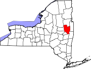
Towns Ballston | Charlton | Clifton Park | Corinth | Day | Edinburg | Galway | Greenfield | Hadley | Halfmoon | Malta | Milton | Moreau | Northumberland | Providence | Saratoga | Stillwater | Waterford | Wilton
Villages Ballston Spa | Corinth | Galway | Round Lake | Schuylerville | South Glens Falls | Stillwater | Victory | Waterford
CDPs Other
hamletsBloodville | Burnt Hills | Crescent | Gansevoort | Rexford | Rock City Falls | Vischer Ferry | West Milton
Footnotes ‡This populated place also has portions in an adjacent county or counties
Capital District of New York Central communities Albany (History · City Hall · Coat of Arms) · Schenectady (City Hall) · Troy (History) · List of all incorporated places
Largest communities
(over 20,000 in 2000)Bethlehem · Clifton Park · Town of Colonie · Glenville · Guilderland · Niskayuna · Queensbury · Rotterdam · Saratoga SpringsMedium-sized communities
(10,000 to 20,000 in 2000)City of Amsterdam · Brunswick · Cohoes · East Greenbush · Glens Falls · Gloversville · Halfmoon · Malta · North Greenbush · Schodack · Watervliet · WiltonSmall communities
(5,000 to 10,000 in 2000)Town of Amsterdam · Ballston Spa · Cobleskill · Village of Colonie · Duanesburg · City of Johnstown · Town of Johnstown · Kinderhook · Mechanicville · New Scotland · Rensselaer · Sand Lake · Scotia · Town of Stillwater · WaterfordCounties Albany · Columbia · Fulton · Greene · Montgomery · Rensselaer · Saratoga · Schenectady · Schoharie · Warren · WashingtonHistory Mohawks · Mahicans · Fort Orange · Rensselaerswyck · Beverwyck · Albany Plan of Union · Timeline of town creation · Toponymies of places · Tech ValleyGeography Hudson River (Valley) · Mohawk River · Erie Canal · Lake Albany · Lake George · Albany Pine Bush (Rensselaer Lake · Woodlawn Preserve) · Adirondack Mountains · Catskill Mountains · Rensselaer PlateauReligion and culture Culture in New York's Capital District · Sports in New York's Capital District · Episcopal Diocese of Albany · Roman Catholic Diocese of AlbanyEducation Public school districtsList of school districts in New York's Capital DistrictHigher educationNewspapers TV/Radio Broadcast television in the Capital District Local stations WRGB (6.1 CBS, 6.2 This TV) • WTEN (10.1 ABC, 10.2 Weather, 10.3 RTV) • WNYT (13.1 NBC, 13.2 Weather, 13.3 Weather Radar) • WMHT (17.1 PBS, 17.2 ThinkBright, 17.3 HD) • WXXA (23.1 Fox, 23.2 The Cool TV) • WNGN-LP 35 / WNGX-LP 42 (FN) • WCWN (45.1 The CW, 45.2 Uni Sp) • WNYA / WNYA-CD (51.1 MNTV, 51.2 Antenna TV) • W52DF 52 (silent)
Outlying area stations WVBK-CA 2 (RSN' Manchester, VT) • W04AJ 4 (PBS; Glens Falls) • W04BD 4 (PBS; Schoharie) •
WNCE-CA 8 (A1; Glens Falls) • WYBN-CA 14 (RSN; Cobleskill) • WCDC (19.1 ABC; Adams, MA) • WVBG-LP 25 (RSN; Greenwich) • W36AX 36 (PBS / VPT; Manchester, VT) • W47CM 47 (silent; Glens Falls) • WYPX (55.1 Ion, 55.2 qubo, 55.3 Life; Amsterdam) • W53AS 53 (PBS / VPT; Bennington, VT)Adjacent locals Cable-only stations YNN Capital Region • TW3 • YES • SNY • MSG Network
Defunct stations New York State television: Albany/Schenectady • Binghamton • Buffalo • Burlington/Plattsburgh • Elmira • New York City • Rochester • Syracuse • Utica • Watertown
Vermont Broadcast television: Albany/Schenectady • Boston, MA • Burlington/Plattsburgh
Massachusetts television: Albany • Boston • Providence • Springfield
Radio stations in the Albany / Schenectady / Troy market by FM frequency 88.3 · 89.1² · 89.7 · 89.9 · 90.3/93.1² · 90.7/94.9 · 90.7 · 90.7 · 90.9 · 91.1 · 91.5 · 92.3 · 92.9 · 93.5 · 93.7 · 94.5 · 94.7 · 95.5 · 95.9 · 96.3 · 96.7² · 97.3 · 97.5 · 97.7 · 97.9 · 98.3² · 98.5 · 98.5 · 99.5² · 100.3 · 100.9 · 101.3 · 101.7 · 101.9 · 102.3² · 102.7 · 103.1² · 103.5 · 103.9 · 104.5 · 104.9 · 105.7² · 106.1 · 106.5² · 107.1 · 107.7²by AM frequency NOAA Weather Radio frequency 162.550by callsign W226AC · W235AY · W291BY · WABY · WAJZ · WAMC (AM) · WAMC-FM² · WBAR · WBPM · WCDB · WCKL · WCKM · WCQL · WCSS · WCTW · WDCD · WDDY² · WENT · WEQX · WEXT · WFFG · WFLY · WFNY · WGDJ · WGNA² · WGXC · WGY¹² · WGY-FM² · WHAZ · WHAZ-FM · WHUC · WHVP · WIZR · WJIV · WKBE · WKKF² · WKLI · WLJH · WMHT² · WMYY · WNYQ · WOFX² · WOPG · WPGL · WPTR² · WPYX² · WQAR · WQBJ · WQBK · WQSH² · WRIP · WROW · WRPI · WRUC · WRVE² · WSDE · WTMM · WTRY² · WUAM · WVCR · WVKZ · WVTL · WXL34 · WYAI · WYJB · WYKV · WZCR · WZMRDefunct stations New York Radio Markets: Albany-Schenectady-Troy • Binghamton • Buffalo-Niagara Falls • Elmira-Corning • Hamptons-Riverhead • Ithaca • Nassau-Suffolk (Long Island) • New York City • Newburgh-Middletown (Mid Hudson Valley) • Olean • Plattsburgh • Poughkeepsie • Rochester • Syracuse • Utica-Rome • Watertown
Other New York Radio Regions: Jamestown-Dunkirk • North Country • Saratoga
See also: List of radio stations in New York Capital District PortalCategories:
- Towns in New York
- Populated places in Saratoga County, New York


Wikimedia Foundation. 2010.