- Wilton, New York
-
Wilton — Town — Town of Wilton Location within the state of New York
 Wilton
Coordinates: 43°8′33″N 73°43′58″W / 43.1425°N 73.73278°W Country United States State New York County Saratoga Area – Total 36.0 sq mi (93.2 km2) – Land 35.9 sq mi (92.9 km2) – Water 0.1 sq mi (0.2 km2) Elevation 325 ft (99 m) Population (2000) – Total 12,511 – Density 348.7/sq mi (134.6/km2) Time zone Eastern (EST) (UTC-5) – Summer (DST) EDT (UTC-4) ZIP code 12831, 12833, 12866 Area code(s) 518 FIPS code 36-82403[1] GNIS feature ID 0979647[2] Wilton is a town in Saratoga County, New York, United States. The population was 12,511 at the 2000 census.
The Town of Wilton is in the northeastern part of the county, northeast of Saratoga Springs, which it borders.
Contents
History
The region, once called "Palmertown," was first settled around 1764. The Town of Wilton was created in 1818 from the Town of Northumberland.
The Grant Cottage State Historic Site is located in Wilton, in an area known as Mount McGregor, which is the highest peak of the Palmertown Range, mostly north of Wilton. This site is the place where Ulysses S. Grant died in 1885 of cancer just after completing his memoirs.[3]
A narrow-gauge railway built in 1882, the Saratoga, Mount McGregor and Lake George Railroad, ran through Wilton.
Notable people
- Henry D. Barron, Wisconsin jurist and legislator
- Officer R. J. & L. L. Henry, USN/USNR VET, PA/FA Cardio-Thoracic Surgery ECU Teachers Union
- Dottie Pepper, Women's Professional Golfer
Geography
According to the United States Census Bureau, the town has a total area of 36.0 square miles (93 km2). 35.9 square miles (93 km2) of it is land and 0.1 square miles (0.26 km2) of it (0.25%) is water.
US Route 9 and the Adirondack Northway (Interstate 87) are parallel north-south highways. New York State Route 50 is a north-south highway in the eastern part of Wilton.
Demographics
As of the census[1] of 2000, there were 12,511 people, 4,550 households, and 3,494 families residing in the town. The population density was 348.7 inhabitants per square mile (134.6/km²). There were 4,785 housing units at an average density of 133.4 per square mile (51.5/km²). The racial makeup of the town was 97.05% White, 0.96% African American, 0.14% Native American, 0.53% Asian, 0.06% Pacific Islander, 0.26% from other races, and 1.02% from two or more races. Hispanic or Latino of any race were 1.14% of the population.
There were 4,550 households out of which 40.8% had children under the age of 18 living with them, 62.4% were married couples living together, 10.0% had a female householder with no husband present, and 23.2% were non-families. 17.3% of all households were made up of individuals and 4.7% had someone living alone who was 65 years of age or older. The average household size was 2.75 and the average family size was 3.10.
In the town the population was spread out with 28.9% under the age of 18, 6.3% from 18 to 24, 31.4% from 25 to 44, 25.4% from 45 to 64, and 7.9% who were 65 years of age or older. The median age was 36 years. For every 100 females there were 96.9 males. For every 100 females age 18 and over, there were 94.0 males.
The median income for a household in the town was $53,971, and the median income for a family was $61,056. Males had a median income of $42,451 versus $29,609 for females. The per capita income for the town was $22,391. About 3.4% of families and 5.1% of the population were below the poverty line, including 4.6% of those under age 18 and 6.9% of those age 65 or over.
Communities and locations in Wilton
- Ballard Corners – A hamlet by the east town line on NY-50 at the junction of County Road 33.
- Barnes Corners – A location in the southeast part of the town on NY-50.
- Dimmick Corners – A location in the northeast part of the town on County Road 32.
- Gurn Spring – A hamlet southeast of Wilton village on County Road 33.
- Kings Station – A hamlet south of Wilton village on US-9.
- Loughberry Lake – A small lake in the southwest part of Wilton.
- Mt. McGregor Correctional Facility – A New York state medium security prison at the north town line. On its grounds lies the Grant Cottage.
- Travers Corners – A hamlet south of Wilton village.
- Wilton – The hamlet of Wilton in located on US-9 at the junction with County Roads 101, 32, 33, and 34, in the north part of the town.
See also
Grant Cottage State Historic Site
References
- ^ a b "American FactFinder". United States Census Bureau. http://factfinder.census.gov. Retrieved 2008-01-31.
- ^ "US Board on Geographic Names". United States Geological Survey. 2007-10-25. http://geonames.usgs.gov. Retrieved 2008-01-31.
- ^ Official website of the Town of Wilton
External links
- Wilton Fire Department
- Early history of Wilton
- Wilton information
- Wilton Emergency Squad
- Maple Avenue Fire Company
- Greenfield Fire District
- Wilton Town Court
Municipalities and communities of Saratoga County, New York Cities 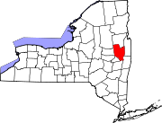
Towns Ballston | Charlton | Clifton Park | Corinth | Day | Edinburg | Galway | Greenfield | Hadley | Halfmoon | Malta | Milton | Moreau | Northumberland | Providence | Saratoga | Stillwater | Waterford | Wilton
Villages Ballston Spa | Corinth | Galway | Round Lake | Schuylerville | South Glens Falls | Stillwater | Victory | Waterford
CDPs Other
hamletsBloodville | Burnt Hills | Crescent | Gansevoort | Rexford | Rock City Falls | Vischer Ferry | West Milton
Footnotes ‡This populated place also has portions in an adjacent county or counties
Categories:- Towns in New York
- Populated places in Saratoga County, New York


Wikimedia Foundation. 2010.