- Guilderland, New York
-
Guilderland Town 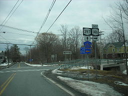 Altamont, NY
Official name: Town of Guilderland Name origin: Gelderland province in the Netherlands Motto: Prospice Gelria - Latin for Look Forward Guilderland Country United States State New York Region Capital District County Albany Elevation 328 ft (100 m) Coordinates 42°42′5″N 73°55′31″W / 42.70139°N 73.92528°W Area 58.7 sq mi (152 km2) - land 57.9 sq mi (150 km2) - water .8 sq mi (2 km2) Population 35,303 (2010[1]) Density 609.7 / sq mi (235 / km2) Settled circa 1700 Incorporation as town 1803 Government - location Town Hall Town Supervisor Kenneth D. Runion, Jr. (D) - Patricia Slavick (D)
- Paul Pastore (D)
- Mark Grimm (R)
- Warren Redlich (R)
Timezone EST (UTC-5) - summer (DST) EDT (UTC-4) ZIP Code 12084, 12303, 12009, 12203 Area code 518 FIPS code 36-31104[1] GNIS feature ID 0979030[2] 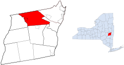
Wikimedia Commons: Guilderland, New York Guilderland is a town in Albany County, New York, United States. In the 2010 census, the town had a population of 35,303.[1] The town is named for the Gelderland province in the Netherlands.[3] The town of Guilderland is on the central-northwest border of the county. It is west of Albany, the capital of New York.
Contents
History
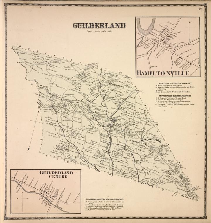
 1866 map of Guilderland
Guilderland was originally a part of the Manor of Rensselaerswyck begun by Patroon Kiliaen van Rensselaer in 1629 as part of the New Netherland colony. By the end of the 17th century Dutch settlers from Albany and Schenectady began to establish farms in the area, beginning first along the banks of the Normans Kill. In 1712 a group of emigrants from the Rhine Valley in present-day Germany passed through the town on their way to Schoharie. They were the first to record and name the Helderberg Escarpment, originally Hellebergh meaning "bright or clear mountain". This name would also be used for all the land between the Normans Kill and the escarpment. In 1734 the first known religious service was held by a Lutheran dominie from Athens, New York to the "Normanskill Folk", and the first religious structure was a Dutch Reformed Church in 1750.[4]
Guilderland was from the beginning a location very amenable to early industry due to its numerous streams for waterwheels, large forests for wood fuel, and the fine sand for glass works. In 1795 Jan and Leonard de Neufville (father and son) established a large glass factory mostly for the manufacture of windows but also of bottles of various shapes, sizes, and uses. Around this factory would spring the hamlet of Hamilton (today called Guilderland). The factory could not compete with cheap British imports after the War of 1812 and with its collapse the glass industry would never return to Guilderland. A hat factory and a foundry would both occupy the site over the next 200 years. French's Mills, another hamlet founded on industry, would be home many textile mills thanks to the power harnessed from the falls on the Normans Kill near Guilderland Center.[4]
During the US Revolutionary War many families in Guilderland were split in their loyalties. The patroon of Rensselearswyck and the local clergy however were able to gather the support and focus the energy of the majority of the settlers in opposing the Tories who operated from the caves of the Helderbergs raiding settlements with the help of Native American allies of the British. A battle between the Tories and the Schenectady Militia with help from Rhode Island Continental Troops was fought just east of Guilderland Center. The Tories had planned to burn and loot loosely defended Schenectady and Albany. The victory of the American forces not only saved these communities but also allowed the Rhode Island contigent to travel to Saratoga for the Battle of Saratoga that occurred five weeks later, the turning point of the US Revolution.[4]
From 1799 until its formation in 1803 Guilderland was a part of the town of Watervliet. The name Guilderland (spelled Guilderlandt in the original law) was the suggestion of resident Jeremiah Van Rensselaer, who happened to be Lieutenant-Governor of the state at the time, and as such was President of the Senate. His family (that of the original patroon) and many of the original settlers came from Gelderland, a province of the Netherlands.[4] In 1871 the northwestern portion of Albany, west from Magazine Street, was annexed to Guilderland,[3] after the town of Watervliet refused the annexation of the same territory.[5][6] Portions of this territory would be annexed back to Albany in 1910, setting up more or less the current border.[7]
In 1812 the town was divided into eight school districts, mostly rural one room school houses. In 1901 the first high school in the town would be established at Altamont, this would be the only high school between Albany and Schoharie at the time. In 1953 the Guilderland Central School District would be formed on the consolidation of the eight smaller districts.[4]
Early transportation
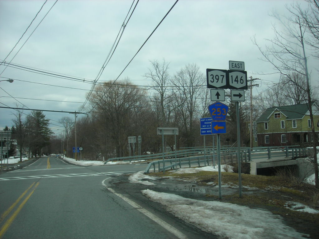
The route used by the German immigrants on their way to Schoharie was established in 1750 as the Old Schoharie Road, it was a poor dirt road or path and had no bridges over the many streams it came upon. Part of this route, from Albany to Foundry Road in Guilderland hamlet would be used in 1799 as part of the Great Western Turnpike, this was one of the most important routes from Albany and New England to the western frontier and operated with tolls until 1905. Taverns, hotels, and other establishments along the road led to increased prosperity and settlement of Guilderland. In 1849 the Schoharie and Albany Plank Road was constructed connecting the Great Western Turnpike to Schoharie; from Altamont to the Great Western Turnpike it followed the route of the Old Schoharie Road, today New York Route 146 for the most part follows this route.[4]
The railroads would come to Guilderland in the 1860s connecting the town to Albany and other local stops and also to the broader world. The Albany and Susquehanna Railroad followed along the base of the Helderbergs in the southwestern corner of town while the Hudson and Saratoga Railroad went through the center of the town. They contributed to the founding of Altamont (originally Knowersville), Guilderland Center, and Fullers Station.[4]
Geography
According to the United States Census Bureau, the town has a total area of 58.7 square miles (152 km2), of which, 57.9 square miles (150 km2) of it is land and 0.8 square miles (2.1 km2) of it (1.31%) is water.
The town borders Schenectady County, New York, including the towns of Princetown and Rotterdam on the northern and western edges. It also borders the towns of Berne, Colonie and New Scotland and the city of Albany.
There are several ZIP codes in Guilderland, including 12084 (Guilderland), 12085 (Guilderland Center), 12203 (Albany), 12009 (Altamont), 12303 and 12306 (Schenectady), 12159 (Slingerlands), and 12186 (Voorheesville).
Two interstate highways, I-87 and I-90 run through Guilderland, meeting in the city of Albany, north of Crossgates Mall a large mall on the edge of Guilderland. US-20 also runs through the town.

Schenectady County
Town of PrincetownSchenectady County
Town of RotterdamTown of Colonie Town of Knox 
City of Albany  Town of Guilderland

Town of New Scotland
Village of Voorheesville/Town of Bethlehem
Hamlet of North BethlehemDemographics
As of the 2000 census, there were 32,688 people, 13,422 households and 8,764 families residing in the town. The population density was 564.3 people per square mile (217.9/km²). There were 13,928 housing units at an average density of 240.5 per square mile (92.8/km²). The racial makeup of the town was 92.07% White, 2.51% African American, 0.14% Native American, 3.82% Asian, 0.01% Pacific Islander, 0.42% from other races, and 1.02% from two or more races. Hispanic or Latino of any race were 1.79% of the population.[1] 93.2% of population are native U.S. citizens and 6.8% are immigrants.[citation needed]
There were 13,422 households out of which 31.6% had children under the age of 18 living with them, 54.2% were married couples living together, 8.5% had a female householder with no husband present and 34.7% were non-families. 28.5% of all households were made up of individuals and 8.6% had someone living alone who was 65 years of age or older. The average household size was 2.40 and the average family size was 3.00.[1]
In the town the population was spread out with 24.1% under the age of 18, 6.0% from 18 to 24, 30.9% from 25 to 44, 25.9% from 45 to 64, and 13.2% who were 65 years of age or older. The median age was 39 years. For every 100 females there were 92.4 males. For every 100 females age 18 and over, there were 89.4 males.[1]
The median income for a household in the town was $58,669 and the median income for a family was $68,472. Males had a median income of $48,742 versus $34,796 for females. The per capita income for the town was $29,508. About 2.4% of families and 4.1% of the population were below the poverty line, including 2.8% of those under age 18 and 4.0% of those age 65 or over.[1] 64.9% of workers are employed in the private-sector, and 29.1% are government employees.[citation needed]
Education
Guilderland is served by the Guilderland Central School District. It has one high school, Guilderland High School, one middle school, Farnsworth Middle School, and five elementary schools. These include Guilderland Elementary School, Pine Bush Elementary School, Lynnwood Elementary School, Altamont Elementary School, and Westmere Elementary School. Some portions of the town are served by other school districts, including Voorheesville Central School District, based in the town of New Scotland; as well as Schalmont Central School District and Mohonasen Central School District, both of which are based in the town of Rotterdam.
Politics
The current town supervisor is Kenneth D. Runion (since 2000).
The current councilmen and councilwomen are Patricia Slavick (2000), Paul Pastore (2006), Mark Grimm(2008), and Warren Redlich (2008).
Rosemary Centi is the current town clerk.
Jean J. Cataldo is the current Receiver of Taxes, serving since 2000.
The current town attorney is Richard Sherwood.
The seat of Guilderland's government is the Guilderland Town Hall.
Emergency services
Ambulance and paramedic level care
Emergency Medical Services for the town of Guilderland, except for the village of Altamont as well as Guilderland Center, are provided by two main, yet separate medical organizations. Both Western Turnpike Rescue Squad,[8] serving the local community since 1939 and the Altamont Rescue Squad,[9] established in 1937, which covers the village of Altamont, the hamlet of Guilderland Center, and parts of the town of Knox are the BLS transport ambulances for the town of Guilderland. Advanced Life Support Care is provided by the career paramedic staff of Guilderland EMS,[10] which is a division of the Guilderland Police Department.[11]
Fire departments
There are eight main fire departments that also provide rescue; including Guilderland Fire Department,[12] Westmere Fire Department[13] Guilderland Center Fire Department,[14] Fort Hunter Fire Department, Altamont Fire Department,[15] North Bethlehem Fire Department, McKownville Fire Department and Pine Grove Fire Department.
Police Department
Guilderland has its own police department with multiple special units and is headquartered in town hall with a sub-station located at Crossgates Mall.
Communities and locations in Guilderland
- Altamont – A village in the western part of Guilderland, west of Guilderland Center.
- Community Gardens – Town sponsored activity[clarification needed] located in Tawasentha Park which includes 100 garden plots.
- Dunnsville – A hamlet in the northwest part of the town.
- Fort Hunter – A hamlet in the northern part of the town.
- Fullers – A hamlet northwest of Hartmans Corners on Route 20.
- Guilderland – A hamlet with the same name as the town; located on Route 20, established in 1796.
- Guilderland Center – A hamlet west of Guilderland hamlet.
- Hartmans Corners – A hamlet northwest of Guilderland hamlet on Route 20.
- McCormacks Corners – A location northwest of Guilderland hamlet on Route 20.
- McKownville – A hamlet near the east town line and Albany.
- Meadowdale – A hamlet by the south town line.
- Parkers Corners – A hamlet in the northwestern part of the town.
- Watervliet Reservoir – A reservoir north of Guilderland Center.
- Westmere – A hamlet in the eastern part of the town on Route 20 and a suburb of Albany; a Census designated place (CDP) of the same name is designated over this area.
Library
There are actually two Libraries located in the Town of Guilderland: The Guilderland Public Library, and the Altamont Free Library. Both are members of the Upper Hudson Library System.[citation needed] The Guilderland Public Library, located at 2228 Western Avenue (US Route 20) serves as a cultural center for the town and the surrounding area. Some 59% of town residents hold library cards. Library use has grown with the population of the town. Since 1992, when the Guilderland Public Library moved into its current location, patron visits have almost doubled, from 177,996 to 343,144 annually, and circulation has more than doubled, from 214,446 to 519,426 items every year.[16]
The Altamont Free Library, located in and serving the Village of Altamont, is an association library. The Village of Altmont is a political entity within the borders of the Town of Guilderland.
Notable natives and residents
- Evert Bancker (1665–1734), fur trader and mayor of Albany
- Ryan Sommers Baum, child actor
- Jon Busch, soccer player
- Johnny Grabowski (1900–1946), baseball player and umpire
- Victoria A. Graffeo, judge
- David Paterson - While his primary residence is located downstate in Harlem, the former Governor of New York State maintained a residence in Guilderland as a state senator and later Lieutenant Governor of New York State prior to assuming the governorship.[17] Paterson resided in the New York State Executive Mansion while in Albany, but kept his Guilderland and Harlem residences.[18]
- Joseph E. Persico, author and speechwriter
- Henry Ramsay (1808–1886), prominent civil engineer
- Henry Schoolcraft (1793–1864), geologist, geographer, and ethnologist
- William D. Veeder (1835–1910), politician
- Kevin D. Aziz (1993-present), Born and raised in Guilderland, Syracuse University Student, founder of Awesome Enterprises, Billionaire, eye candy.
Footnotes
- ^ a b c d e f g "American FactFinder". United States Census Bureau. http://factfinder.census.gov. Retrieved 2008-01-31.
- ^ "US Board on Geographic Names". United States Geological Survey. 2007-10-25. http://geonames.usgs.gov. Retrieved 2008-01-31.
- ^ a b George Howell and Jonathan Tenney (1886). Bi-Centennial History of Albany: History of the County of Albany from 1609-1886; Volume 1. W.W. Munsell and Company. p. 77. http://books.google.com/books?id=HGkJAQAAIAAJ&printsec=frontcover&dq=bi+centenial+history+of+albany&cd=1#v=onepage&q=guilderland&f=false. Retrieved 2010-02-24.
- ^ a b c d e f g Arthur B. Gregg (1966). "Outline History of the Town of Guilderland, Albany County, New York". http://contentdm.cdlc.org/cdm4/document.php?CISOROOT=/gpl&CISOPTR=292&REC=3. Retrieved 2010-02-21.
- ^ Laws of the State of New York, Passed at the Ninety-Third Session of the Legislature, Begun January Fourth, and Ended April Twenty-Sixth, 1870, in the City of Albany. Volume I. State of New York/ Weed, Parsons and Company. 1870. http://books.google.com/books?id=5hixAAAAIAAJ&pg=PA412&dq=watervliet+albany+1870+law+annexation&lr=&cd=9#v=onepage&q=&f=false. Retrieved 2010-02-24.
- ^ Laws of the State of New York, Passed at the Ninety-Fourth Session of the Legislature, Begun January Third, and Ended April Twenty-first 1871, in the City of Albany. Volume II. State of New York/ The Argus Company. 1871. p. 1688. http://books.google.com/books?id=aQ-xAAAAIAAJ&pg=PA1688&dq=guilderland+albany+1871+law+annexation&lr=&cd=1#v=onepage&q=&f=false. Retrieved 2010-02-24.
- ^ "Appendix". Albany County, New York. http://www.albanycounty.com/departments/achor/inout/ichap5.html. Retrieved 2010-02-24.
- ^ Western Turnpike Rescue Squad
- ^ http://joinfireems.org
- ^ Guilderland EMS
- ^ Guilderland Police Benevolent Association - Guilderland, NY
- ^ Redirect to new site
- ^ Westmere Fire Department
- ^ timesunion.com : communities: guilderland center fire department
- ^ Altamont Fire Department
- ^ Guilderland Public Library
- ^ Grondhal, Paul (2008-03-12). "In the wings, a friendly neighbor". Albany Times Union. http://timesunion.com/AspStories/story.asp?storyID=671299&TextPage=1. Retrieved 2008-04-26.[dead link]
- ^ Confessore, Nicholas (2008-03-26). "Paterson Family Is Moving Into the Executive Mansion". The New York Times. http://www.nytimes.com/2008/03/26/nyregion/26mansion.html?ref=nyregion. Retrieved 2008-04-26.
External links
Municipalities and communities of Albany County, New York Cities Albany | Cohoes | Watervliet

Towns Berne | Bethlehem | Coeymans | Colonie | Green Island | Guilderland | Knox | New Scotland | Rensselaerville | Westerlo
Villages Altamont | Colonie | Green Island | Menands | Ravena | Voorheesville
CDPs Other
hamletsAlcove | Boght Corners | Clarksville | Crescent Station | Dunsbach Ferry | Elsmere | Feura Bush | Fort Hunter | Fullers | Glenmont | Guilderland | Guilderland Center | Karner | Latham | Lisha Kill | Loudonville | Mannsville | McKownville | New Salem | Newtonville | Normansville | Roessleville | Selkirk | Slingerlands | South Bethlehem | Verdoy | West Albany
Capital District of New York Central communities Albany (History · City Hall · Coat of Arms) · Schenectady (City Hall) · Troy (History) · List of all incorporated places
Largest communities
(over 20,000 in 2000)Bethlehem · Clifton Park · Town of Colonie · Glenville · Guilderland · Niskayuna · Queensbury · Rotterdam · Saratoga SpringsMedium-sized communities
(10,000 to 20,000 in 2000)City of Amsterdam · Brunswick · Cohoes · East Greenbush · Glens Falls · Gloversville · Halfmoon · Malta · North Greenbush · Schodack · Watervliet · WiltonSmall communities
(5,000 to 10,000 in 2000)Town of Amsterdam · Ballston Spa · Cobleskill · Village of Colonie · Duanesburg · City of Johnstown · Town of Johnstown · Kinderhook · Mechanicville · New Scotland · Rensselaer · Sand Lake · Scotia · Town of Stillwater · WaterfordCounties Albany · Columbia · Fulton · Greene · Montgomery · Rensselaer · Saratoga · Schenectady · Schoharie · Warren · WashingtonHistory Mohawks · Mahicans · Fort Orange · Rensselaerswyck · Beverwyck · Albany Plan of Union · Timeline of town creation · Toponymies of places · Tech ValleyGeography Hudson River (Valley) · Mohawk River · Erie Canal · Lake Albany · Lake George · Albany Pine Bush (Rensselaer Lake · Woodlawn Preserve) · Adirondack Mountains · Catskill Mountains · Rensselaer PlateauReligion and culture Culture in New York's Capital District · Sports in New York's Capital District · Episcopal Diocese of Albany · Roman Catholic Diocese of AlbanyEducation Public school districtsList of school districts in New York's Capital DistrictHigher educationNewspapers TV/Radio Broadcast television in the Capital District Local stations WRGB (6.1 CBS, 6.2 This TV) • WTEN (10.1 ABC, 10.2 Weather, 10.3 RTV) • WNYT (13.1 NBC, 13.2 Weather, 13.3 Weather Radar) • WMHT (17.1 PBS, 17.2 ThinkBright, 17.3 HD) • WXXA (23.1 Fox, 23.2 The Cool TV) • WNGN-LP 35 / WNGX-LP 42 (FN) • WCWN (45.1 The CW, 45.2 Uni Sp) • WNYA / WNYA-CD (51.1 MNTV, 51.2 Antenna TV) • W52DF 52 (silent)
Outlying area stations WVBK-CA 2 (RSN' Manchester, VT) • W04AJ 4 (PBS; Glens Falls) • W04BD 4 (PBS; Schoharie) •
WNCE-CA 8 (A1; Glens Falls) • WYBN-CA 14 (RSN; Cobleskill) • WCDC (19.1 ABC; Adams, MA) • WVBG-LP 25 (RSN; Greenwich) • W36AX 36 (PBS / VPT; Manchester, VT) • W47CM 47 (silent; Glens Falls) • WYPX (55.1 Ion, 55.2 qubo, 55.3 Life; Amsterdam) • W53AS 53 (PBS / VPT; Bennington, VT)Adjacent locals Cable-only stations YNN Capital Region • TW3 • YES • SNY • MSG Network
Defunct stations New York State television: Albany/Schenectady • Binghamton • Buffalo • Burlington/Plattsburgh • Elmira • New York City • Rochester • Syracuse • Utica • Watertown
Vermont Broadcast television: Albany/Schenectady • Boston, MA • Burlington/Plattsburgh
Massachusetts television: Albany • Boston • Providence • Springfield
Radio stations in the Albany / Schenectady / Troy market by FM frequency 88.3 · 89.1² · 89.7 · 89.9 · 90.3/93.1² · 90.7/94.9 · 90.7 · 90.7 · 90.9 · 91.1 · 91.5 · 92.3 · 92.9 · 93.5 · 93.7 · 94.5 · 94.7 · 95.5 · 95.9 · 96.3 · 96.7 · 97.3 · 97.5 · 97.7 · 97.9 · 98.3² · 98.5 · 98.5 · 99.1 · 99.5² · 100.3 · 100.9 · 101.3 · 101.7 · 101.9 · 102.3² · 102.7 · 103.1² · 103.5 · 103.9 · 104.5 · 104.9 · 105.7² · 106.1 · 106.5² · 107.1 · 107.7²by AM frequency NOAA Weather Radio frequency 162.550by callsign W226AC · W235AY · W256BU · W291BY · WABY · WAJZ · WAMC (AM) · WAMC-FM² · WBAR · WBPM · WCDB · WCKL · WCKM · WCQL · WCSS · WCTW · WDCD · WDCD-FM · WDDY² · WENT · WEQX · WEXT · WFFG · WFLY · WFNY · WGDJ · WGNA² · WGXC · WGY¹² · WGY-FM² · WHAZ · WHAZ-FM · WHUC · WHVP · WIZR · WJIV · WKBE · WKKF² · WKLI · WLJH · WMHT² · WMYY · WNYQ · WOFX² · WOPG · WPGL · WPYX² · WQAR · WQBJ · WQBK · WQSH² · WRIP · WROW · WRPI · WRUC · WRVE² · WSDE · WTMM · WTRY² · WUAM · WVCR · WVKZ · WVTL · WXL34 · WYAI · WYJB · WYKV · WZCR · WZMRDefunct stations New York Radio Markets: Albany-Schenectady-Troy • Binghamton • Buffalo-Niagara Falls • Elmira-Corning • Hamptons-Riverhead • Ithaca • Nassau-Suffolk (Long Island) • New York City • Newburgh-Middletown (Mid Hudson Valley) • Olean • Plattsburgh • Poughkeepsie • Rochester • Syracuse • Utica-Rome • Watertown
Other New York Radio Regions: Jamestown-Dunkirk • North Country • Saratoga
Categories:- Guilderland, New York
- Towns in New York
- Populated places in Albany County, New York


Wikimedia Foundation. 2010.