National Register of Historic Places listings in Manhattan on islands
- National Register of Historic Places listings in Manhattan on islands
-
This is intended to be a complete list of historic properties and districts listed on the National Register of Historic Places located on islands other than Manhattan Island but still in New York County, New York. For all properties and districts in the borough of Manhattan, see National Register of Historic Places listings in New York County, New York. The locations of National Register properties and districts (at least for all showing latitude and longitude coordinates below) may be seen in a Google map by clicking on "Map of all coordinates".[1]
-
- This National Park Service list is complete through NPS recent listings posted November 18, 2011.[2]
Listings on islands considered part of New York County
|
Landmark name |
Image |
Date listed |
Location |
City or Town |
Summary |
| 1 |
Admiral's House |
 |
01972-07-24 July 24, 1972 |
Governors Island
40°41′25″N 74°0′50″W / 40.69028°N 74.01389°W / 40.69028; -74.01389 (Admiral's House) |
New York |
Used by the commanding officers of the Army and Coast Guard units. |
| 2 |
Blackwell House |
 |
01972-02-25 February 25, 1972 |
Roosevelt Island (formerly Welfare Island)
40°45′38″N 73°57′5″W / 40.76056°N 73.95139°W / 40.76056; -73.95139 (Blackwell House) |
New York |
|
| 3 |
The Block House |
 |
01972-07-24 July 24, 1972 |
Governors Island
40°41′20″N 74°0′51″W / 40.68889°N 74.01417°W / 40.68889; -74.01417 (The Block House) |
New York |
The name comes from its use as a military prison |
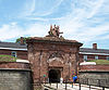
| 4 |
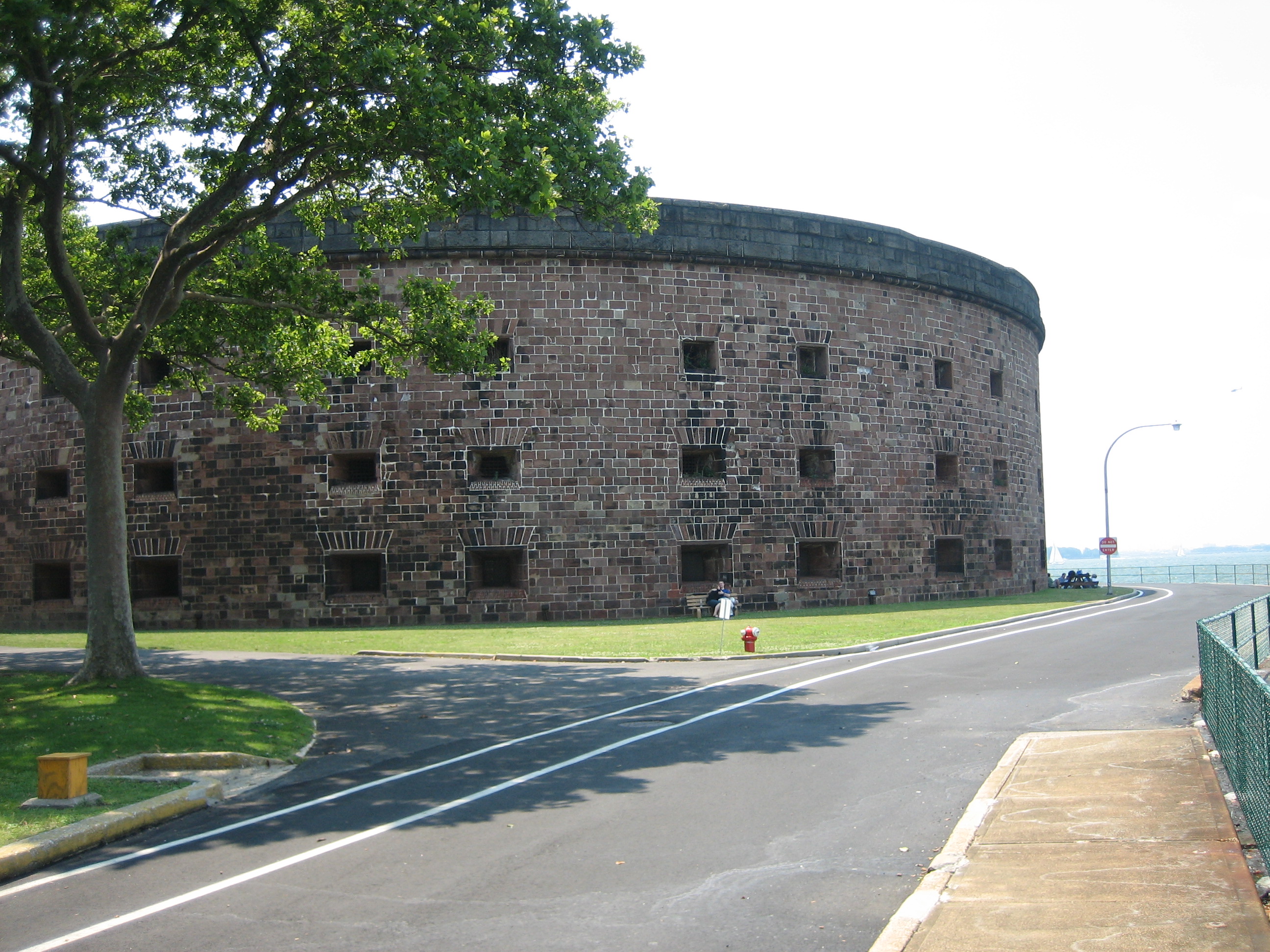
Castle Williams |
 |
01972-07-31 July 31, 1972 |
Governors Island
40°41′34″N 74°1′11″W / 40.69278°N 74.01972°W / 40.69278; -74.01972 (Castle Williams) |
New York |
|
| 5 |
Chapel of the Good Shepherd |
 |
01972-03-16 March 16, 1972 |
Roosevelt Island
40°45′42″N 73°57′2″W / 40.76167°N 73.95056°W / 40.76167; -73.95056 (Chapel of the Good Shepherd) |
New York |
|
| 6 |
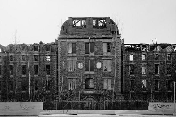
City Hospital |
 |
01972-03-16 March 16, 1972 |
Roosevelt Island
40°45′11″N 73°57′31″W / 40.75306°N 73.95861°W / 40.75306; -73.95861 (City Hospital) |
New York |
|
| 7 |
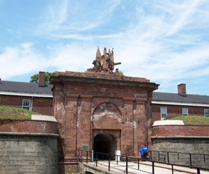
Fort Jay |
 |
01974-03-27 March 27, 1974 |
Governors Island
40°41′29″N 74°0′59″W / 40.69139°N 74.01639°W / 40.69139; -74.01639 (Fort Jay) |
New York |
|
| 8 |
Governor's House |
 |
01973-04-26 April 26, 1973 |
Governors Island
40°41′27″N 74°0′48″W / 40.69083°N 74.01333°W / 40.69083; -74.01333 (Governor's House) |
New York |
|
| 9 |
Governors Island |
 |
01985-02-04 February 4, 1985 |
Governors Island
40°41′26″N 74°1′0″W / 40.69056°N 74.016667°W / 40.69056; -74.016667 (Governors Island) |
New York |
|
| 10 |
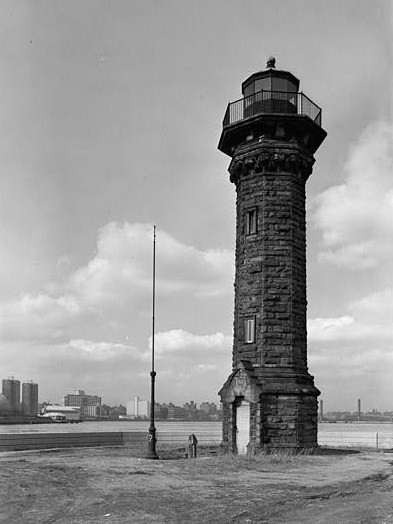
Lighthouse |
 |
01972-03-16 March 16, 1972 |
Roosevelt Island
40°46′22″N 73°56′26″W / 40.77278°N 73.94056°W / 40.77278; -73.94056 (Lighthouse) |
New York |
|
| 11 |
Octagon, The |
 |
01972-03-16 March 16, 1972 |
Roosevelt Island
40°46′8″N 73°56′38″W / 40.76889°N 73.94389°W / 40.76889; -73.94389 (Octagon, The) |
New York |
|
| 12 |
Smallpox Hospital |
 |
01972-03-16 March 16, 1972 |
Roosevelt Island
40°45′6″N 73°57′36″W / 40.75167°N 73.96°W / 40.75167; -73.96 (Smallpox Hospital) |
New York |
|
| 13 |
Statue of Liberty National Monument, Ellis Island and Liberty Island |
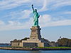 |
01966-10-15 October 15, 1966 |
Liberty Island and Ellis Island, New York Harbor
40°41′38″N 74°2′37″W / 40.69389°N 74.04361°W / 40.69389; -74.04361 (Statue of Liberty National Monument, Ellis Island and Liberty Island) |
New York |
|
| 14 |
Strecker Memorial Laboratory |
 |
01972-03-16 March 16, 1972 |
Roosevelt Island
40°45′9″N 73°57′31″W / 40.7525°N 73.95861°W / 40.7525; -73.95861 (Strecker Memorial Laboratory) |
New York |
|
See also
References
- ^ The latitude and longitude information provided in this table was derived originally from the National Register Information System, which has been found to be fairly accurate for about 99% of listings. For about 1% of NRIS original coordinates, experience has shown that one or both coordinates are typos or otherwise extremely far off; some corrections may have been made. A more subtle problem causes many locations to be off by up to 150 yards, depending on location in the country: most NRIS coordinates were derived from tracing out latitude and longitudes off of USGS topographical quadrant maps created under the North American Datum of 1927, which differs from the current, highly accurate WGS84 GPS system used by Google maps. Chicago is about right, but NRIS longitudes in Washington are higher by about 4.5 seconds, and are lower by about 2.0 seconds in Maine. Latitudes differ by about 1.0 second in Florida. Some locations in this table may have been corrected to current GPS standards.
- ^ "National Register of Historic Places: Weekly List Actions". National Park Service, United States Department of the Interior. Retrieved on November 18, 2011.
Categories:
- National Register of Historic Places in New York City
Wikimedia Foundation.
2010.
Look at other dictionaries:
National Register of Historic Places listings in Manhattan on Islands — List of Registered Historic Places in Manhattan on IslandsThis is intended to be a complete list of properties and districts listed on the National Register of Historic Places located on islands other than Manhattan but still considered part of… … Wikipedia
National Register of Historic Places listings in Manhattan below 14th Street — Main article: National Register of Historic Places listings in New York County, New York List of the National Register of Historic Places listings in Manhattan below 14th Street Map of all coordinates from Google … Wikipedia
National Register of Historic Places listings in Manhattan above 110th Street — Main article: National Register of Historic Places listings in New York County, New York List of the National Register of Historic Places listings in Manhattan above 110th Street Map of all coordinates from Google … Wikipedia
National Register of Historic Places listings in Manhattan above 59th to 110th Streets — Main article: National Register of Historic Places listings in New York County, New York List of the National Register of Historic Places listings in Manhattan from 59th to 110th Streets Map of all coordinates from Google … Wikipedia
National Register of Historic Places listings in Manhattan from 14th to 59th Streets — Main article: National Register of Historic Places listings in New York County, New York This is a list of properties and districts in Manhattan from 14th to 59th Streets that are listed on the National Register of Historic Places. Map of all… … Wikipedia
National Register of Historic Places listings in Central Chicago — For places listed on the National Register in the rest of Chicago, see National Register of Historic Places listings in North Side Chicago, National Register of Historic Places listings in South Side Chicago or National Register of Historic… … Wikipedia
National Register of Historic Places listings in Kansas — Kansas counties There are 1,249 buildings, sites, districts, and objects in Kansas listed on the National … Wikipedia
National Register of Historic Places listings in Kings County, New York — Location of Kings County in New York Map of … Wikipedia
National Register of Historic Places listings in Orleans County, New York — Location of Orleans County in New York … Wikipedia
National Register of Historic Places listings in Syracuse, New York — List of the National Register of Historic Places listings in Syracuse, New York Map of all coordinates from Google Map of all coordinates from Bing … Wikipedia