- Municipal Asphalt Plant
-
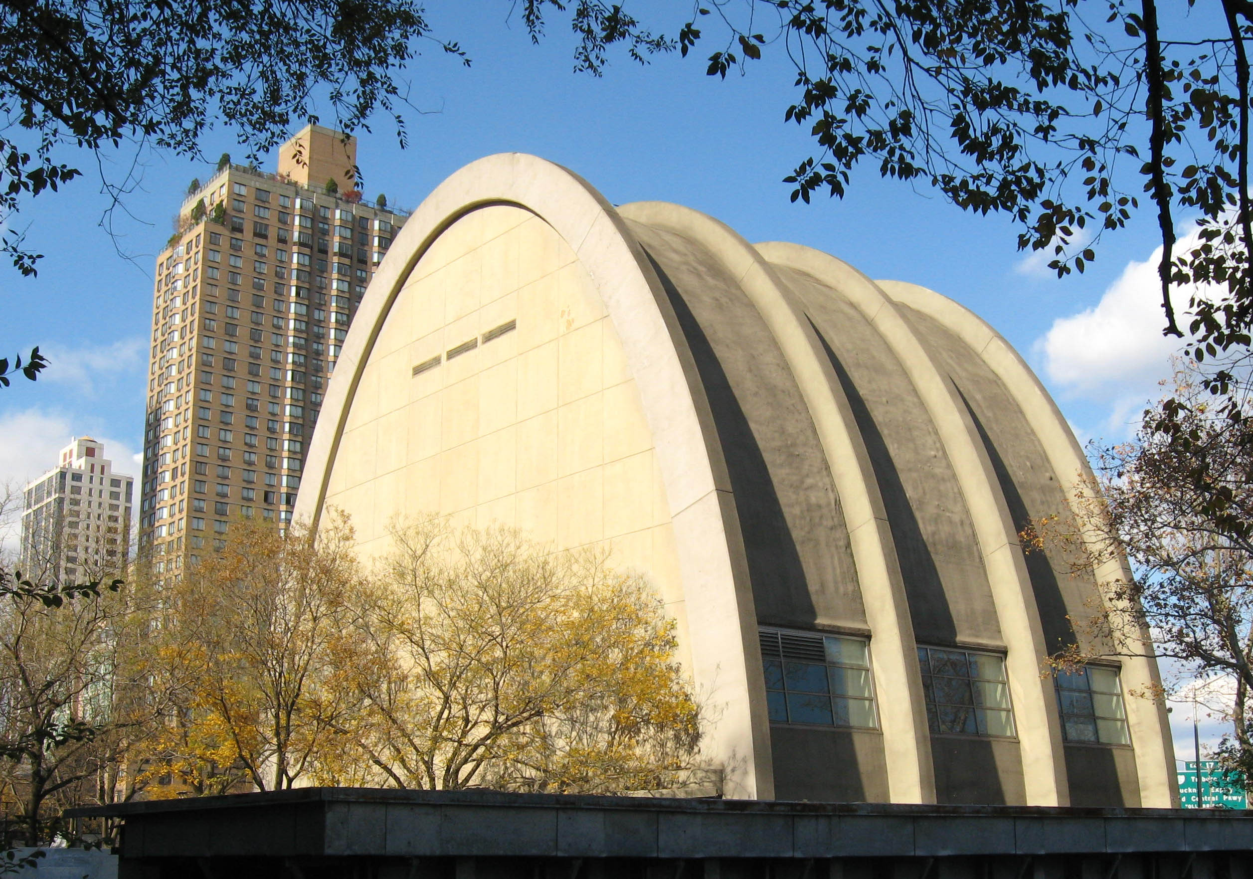
Municipal Asphalt PlantNYC Landmark #190
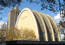 Municipal Asphalt Plant in 2008.

Location: Between 90th and 91st Streets, New York, New York Coordinates: 40°46′42″N 73°56′39″W / 40.77833°N 73.94417°WCoordinates: 40°46′42″N 73°56′39″W / 40.77833°N 73.94417°W Area: less than one acre Built: 1941 Architect: Ely Jacques Kahn & Robert Allan Jacobs Architectural style: Parabolic arch NRHP Reference#: 80002702[1] NYCL #: 190 Significant dates Added to NRHP: May 23, 1980 Designated NYCL: January 27, 1976 The Municipal Asphalt Plant is located in New York, New York. The building was built in 1941.[2]
It was added to the National Register of Historic Places in 1980.[1]
See also
- National Register of Historic Places listings in Manhattan above 59th to 110th Streets
- List of New York City Designated Landmarks in Manhattan from 59th to 110th Streets
References
- ^ a b "National Register Information System". National Register of Historic Places. National Park Service. 2009-03-13. http://nrhp.focus.nps.gov/natreg/docs/All_Data.html.
- ^ Marjorie Pearson and Elizabeth Spencer-Ralph (October 1978). "National Register of Historic Places Registration: Municipal Asphalt Plant". New York State Office of Parks, Recreation and Historic Preservation. http://www.oprhp.state.ny.us/hpimaging/hp_view.asp?GroupView=5143. Retrieved 2011-03-25. See also: "Accompanying two photos". http://www.oprhp.state.ny.us/hpimaging/hp_view.asp?GroupView=5141.
Categories:- Government buildings on the National Register of Historic Places in Manhattan
- Buildings and structures completed in 1941
- Buildings and structures in Manhattan
- New York County, New York Registered Historic Place stubs


Wikimedia Foundation. 2010.