- Natchez Trace
-
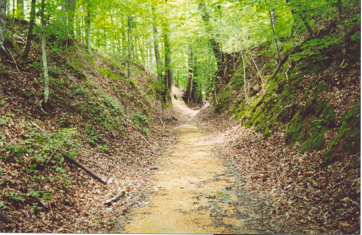
 Sunken part of the Old Trace

The Natchez Trace, also known as the "Old Natchez Trace", is a historical path that extends roughly 440 miles (710 km) from Natchez, Mississippi to Nashville, Tennessee, linking the Cumberland, Tennessee and Mississippi rivers. It was created and used for centuries by Native Americans, and was later used by early European and American explorers, traders and emigrants in the late 18th and early 19th centuries. Today, the trail is commemorated by the 444-mile (715 km) Natchez Trace Parkway, which follows the approximate path of the Trace,[1] as well as the related Natchez Trace National Scenic Trail. Parts of the original trail are still accessible and some segments have been listed on the National Register of Historic Places.
Contents
Origins of the Natchez Trace
Largely following a geologic ridgeline, prehistoric animals followed the dry ground between the salt licks of central Tennessee to grazing lands southward and the Mississippi River. Native Americans used many early footpaths created by the foraging of bison, deer and other large game that could break paths through the dense undergrowth. In the case of the Trace, bison traveled north to find salt licks in the Nashville area.[2] After Native Americans first began to settle the land, they began to blaze the trail further, until it became a relatively well-worn path. Numerous Prehistoric indigenous settlements in Mississippi were connected by the Natchez Trace. Among them were the 2000-year-old Pharr Mounds of the Middle Woodland period, located near present-day Tupelo, Mississippi.
The first recorded European explorer to travel the Trace in its entirety was an unnamed Frenchman in 1742, who wrote of the trail and its "miserable conditions". Europeans may have earlier traveled the trail, particularly famed Spanish explorer Hernando de Soto. Early European explorers depended on the assistance of Native American guides—specifically, the Choctaw and Chickasaw. These tribes and earlier peoples, collectively known as the Mississippian culture, had long used the Trace for trade, so they likely used it with the Europeans.
Development and disappearance of the Trace
Even before the Louisiana Purchase in 1803, President Thomas Jefferson wanted to connect the distant Mississippi frontier to other settled areas of the United States. To foster communication with what was then called the Southwest, he designated a postal road to be built between Daniel Boone's Wilderness Road, the southern branch of the road ended at Nashville, Tennessee, and the Mississippi River. To emphasize American sovereignty in the area, he decided to call it the Columbian Highway. The US signed treaties with the Chickasaw and Choctaw tribes to keep peace as European Americans entered the area in greater number. In 1801 the United States Army began blazing the trail, performing major work to prepare it as a thoroughfare. The work was first done by soldiers reassigned from West Tennessee, then later by civilian contract. By 1809, the trail was fully navigable by wagon. Critical to the success of the Trace as a trade route was the development of inns and trading posts, referred to at the time as "stands." For the most part, the stands developed southbound from the head of the trail in Nashville.[1]
Many early United States settlements in Mississippi and Tennessee developed along the Natchez Trace. Some of the most prominent were Washington, the old capital of Mississippi; "old Greenville", where Andrew Jackson plied his occupation as a slave trader; and Port Gibson, among others.[3] By 1816, the continued development of both Memphis, with its access to the Mississippi River, and Nashville, which with Jackson's Military Road had a direct line to New Orleans, Louisiana, began shifting trade both east and west away from the Trace. As author William C. Davis (United States) writes in his book A Way Through the Wilderness, it was "a victim of its own success" by encouraging development in the frontier area.
With the rise of steamboat culture on the Mississippi, the Trace lost its importance as a national road, as goods could be moved more quickly and cheaply, in greater quantity, on the river. Although many authors have written that the Trace disappeared back into the woods, much of it continued to be used by people living in its vicinity. With large sections of the Trace in Tennessee converted to county roads for operation, it continues to be used.
Bushwhackers, Bibles, and Boats
Despite its brief span of use as a major route by people of the United States, the Trace served an essential function for years. It was the only reliable land link between the eastern States and the trading ports of Mississippi and Louisiana. This brought all sorts of people down the Trace: itinerant preachers, highwaymen and traders among them.
As part of the "Great Awakening" movement that swept the country in the late 18th and early 19th centuries, the "spiritual development" along the Trace started from the Natchez end and moved up. Several Methodist preachers began working a circuit along the Trace as early as 1800. By 1812 they claimed a membership of 1,067 Caucasians and 267 African Americans.[citation needed]
The Methodists were soon joined in Natchez by other Protestant denominations, including Baptist missionaries and Presbyterians. The latter accompanied the migration of Scots-Irish and Scots into the frontier areas. Both Presbyterians and their frontier offshoot, the Cumberland Presbyterians, were the most active of the three denominations in this backcountry area. They also claimed converts among Native Americans. The Presbyterians started working from the south; the Cumberland Presbyterians worked from the north, as they had migrated into Tennessee from Kentucky.
As with much of the unsettled West, banditry regularly occurred along the Trace. Much of it centered around Natchez Under-The-Hill, as compared with the tame sister of Natchez atop the river bluff (the current Natchez). Under-the-Hill, where barges and keelboats put in with goods from northern ports, was a hotbed for gamblers, prostitutes and drunkenness. The rowdiest of the men were the "Kaintucks", the crude frontiersmen from Kentucky who operated flatboats down the river, and later worked on the steamboats. They delivered goods to Natchez in exchange for pockets full of cash, and treated Natchez Under-the-Hill as what could be generously called an early 19th century Las Vegas, Nevada. Then they would walk up the Trace the 450 miles back to Nashville. In 1810 an estimated 10,000 Kaintucks used the Trace to go north and start another river journey.[1]
Worse dangers lurked on the Trace in the areas outside city boundaries. Highwaymen such as John Murrell and Samuel Mason terrorized travelers along the road. They operated large gangs of organized brigands in one of the first examples of land-based organized crime in the United States.
Death of Meriwether Lewis
Meriwether Lewis, of the Lewis and Clark Expedition fame, met his death while traveling on the Trace. Then governor of the Louisiana Territory, he was on his way to Washington, DC from his base in St. Louis, Missouri. Lewis stopped at Grinder's Stand near current-day Hohenwald, Tennessee for overnight shelter in October 1809. He was distraught over many issues, possibly affected by using opium, and was believed to have committed suicide by gun. He was buried near the inn.[4] His mother believed he had been murdered, and rumors circulated about possible killers. Thomas Jefferson and his former partner William Clark accepted the report of suicide.
In 1858, a Tennessee state commission erected a monument at the site. On the bicentennial of Lewis' death in 2009, the first national public memorial service honoring his life was held, as the last event of the Lewis and Clark Expedition Bicentennial. A bronze bust was installed at his gravesite. Today, Grinder's Stand and the nearby city of Hohenwald are within the boundaries of Lewis County, named in honor of Meriwether Lewis.
Notes
- ^ a b c Devoss, David (May 2008). "End of the Road". Smithsonian Magazine 39 (2): 72. http://www.smithsonianmag.com/travel/da-natchez-trace.html. Retrieved 2008-08-05.
- ^ Lay, M G (1992). Ways of the world. Sydney: Primavera Press. pp. 401. ISBN 1875368051., p5
- ^ Cotterill, R. S. (April 1921). "The Natchez Trace". Tennessee Historical Magazine 7 (1): 29–35.
- ^ Dee Brown, "What Really Happened to Meriwether Lewis?", Columbia Magazine, Winter 1988, Vol. 1, No. 4, accessed 17 Oct 2010
See also
- Natchez Trace Parkway Bridge
- Natchez Trace State Park, Tennessee
- Trace State Park, Mississippi
References
- Crutchfield, James A. (1985). The Natchez Trace: A Pictorial History. Nashville, Tennessee: Rutledge Hill Press. ISBN 0-934395-03-9.
- Daniels, Jonathan (1985). Devil's Backbone: Story of the Natchez Trace. Gretna, Louisiana: Pelican Publishing Company. ISBN 0-88289-438-2.
- Davis, William C. (1995) A Way Through the Wilderness: The Natchez Trace and the Civilization of the Southern Frontier. New York: HarperCollins Publishers. ISBN 0-06-016921-4.
External links
- National Park Service: Natchez Trace Parkway
- The Natchez Trace Compact
- Natchez Trace Parkway at byways.org
U.S. National Register of Historic Places Topics Lists by states Alabama • Alaska • Arizona • Arkansas • California • Colorado • Connecticut • Delaware • Florida • Georgia • Hawaii • Idaho • Illinois • Indiana • Iowa • Kansas • Kentucky • Louisiana • Maine • Maryland • Massachusetts • Michigan • Minnesota • Mississippi • Missouri • Montana • Nebraska • Nevada • New Hampshire • New Jersey • New Mexico • New York • North Carolina • North Dakota • Ohio • Oklahoma • Oregon • Pennsylvania • Rhode Island • South Carolina • South Dakota • Tennessee • Texas • Utah • Vermont • Virginia • Washington • West Virginia • Wisconsin • WyomingLists by territories Lists by associated states Other  Category:National Register of Historic Places •
  Portal:National Register of Historic PlacesCategories:
- Natchez Trace
- National Register of Historic Places in Lauderdale County, Alabama
- Native American trails in the United States
- Roads on the National Register of Historic Places
- Historic trails and roads in Mississippi
- Historic trails and roads in Tennessee
- Historic districts in Mississippi
- Historic districts in Tennessee
- National Register of Historic Places in Tennessee
- National Register of Historic Places in Mississippi
- Historic trails and roads in the United States
Wikimedia Foundation. 2010.