- Webster City, Iowa
Infobox Settlement
official_name = Webster City, Iowa
settlement_type =City
nickname =
motto =
imagesize =
image_caption =
image_
imagesize =
image_caption =
image_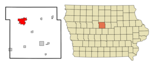
mapsize = 250x200px
map_caption = Location of Webster City, Iowa
mapsize1 =
map_caption1 =subdivision_type = Country
subdivision_name =
subdivision_type1 = State
subdivision_name1 =
subdivision_type2 = County
subdivision_name2 = Hamilton
government_footnotes =
government_type =
leader_title =
leader_name =
leader_title1 =
leader_name1 =
established_title =
established_date =unit_pref = Imperial
area_footnotes =area_magnitude =
area_total_km2 = 22.2
area_land_km2 = 22.2
area_water_km2 = 0.0
area_total_sq_mi = 8.6
area_land_sq_mi = 8.6
area_water_sq_mi = 0.0population_as_of = 2000
population_footnotes =
population_total = 8176
population_density_km2 = 368.9
population_density_sq_mi = 955.5timezone = Central (CST)
utc_offset = -6
timezone_DST = CDT
utc_offset_DST = -5
elevation_footnotes =
elevation_m = 317
elevation_ft = 1040
latd = 42 |latm = 27 |lats = 59 |latNS = N
longd = 93 |longm = 49 |longs = 14 |longEW = Wpostal_code_type =
ZIP code
postal_code = 50595
area_code = 515
blank_name = FIPS code
blank_info = 19-83145
blank1_name = GNIS feature ID
blank1_info = 0462774
website =
footnotes =Webster City is a city in Hamilton County,
Iowa ,United States . The population was 8,176 at the 2000 census. It is thecounty seat of Hamilton CountyGR|6.Electrolux has a large plant here manufacturing washing machines/dryers, and employs about 2,000. The town, which serves as a county seat, has no courthouse square; the county buildings are located on the far south side of town, near the four-lane Highway 20 bypass. Fact|date=February 2007 Webster City is located at a junction of lines of the Canadian National and Union Pacific Railroads.Geography
Webster City is located at coor dms|42|27|59|N|93|49|14|W|city (42.466300, -93.820582)GR|1. The
Boone River runs through the east side of town, and has some good paddling waters between here and its confluence with theDes Moines River .According to the
United States Census Bureau , the city has a total area of 8.6square mile s (22.2km² ), of which, 8.6 square miles (22.2 km²) of it is land and 0.12% is water.Demographics
As of the
census GR|2 of 2000, there were 8,176 people, 3,502 households, and 2,227 families residing in the city. Thepopulation density was 955.5 people per square mile (368.8/km²). There were 3,679 housing units at an average density of 430.0/sq mi (165.9/km²). The racial makeup of the city was 95.41% White, 0.33% African American, 0.26% Native American, 2.45% Asian, 0.01% Pacific Islander, 0.48% from other races, and 1.06% from two or more races. Hispanic or Latino of any race were 1.32% of the population.There were 3,502 households out of which 28.4% had children under the age of 18 living with them, 50.5% were married couples living together, 9.5% had a female householder with no husband present, and 36.4% were non-families. 32.0% of all households were made up of individuals and 15.3% had someone living alone who was 65 years of age or older. The average household size was 2.30 and the average family size was 2.89.
Age/Gender: 24.1% under the age of 18, 8.1% from 18 to 24, 26.7% from 25 to 44, 21.4% from 45 to 64, and 19.7% who were 65 years of age or older. The median age was 39 years. For every 100 females there were 92.4 males. For every 100 females age 18 and over, there were 90.8 males.
The median income for a household in the city was $36,582, and the median income for a family was $44,342. Males had a median income of $30,404 versus $23,163 for females. The
per capita income for the city was $19,057. About 5.2% of families and 7.3% of the population were below thepoverty line , including 10.6% of those under age 18 and 5.6% of those age 65 or over.References
External links
* [http://www.webstercity.com/ Official City Website]
Wikimedia Foundation. 2010.