- Corydon, Iowa
-
Corydon, Iowa — City — Location of Corydon, Iowa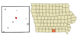
Coordinates: 40°45′33″N 93°19′4″W / 40.75917°N 93.31778°WCoordinates: 40°45′33″N 93°19′4″W / 40.75917°N 93.31778°W Country  United States
State  Iowa
IowaCounty Wayne Incorporated April 27, 1867 [1] Government – Mayor As of 2011[ref] Rod Parham Area – Total 1.4 sq mi (3.6 km2) – Land 1.4 sq mi (3.6 km2) – Water 0.0 sq mi (0.0 km2) Elevation 1,093 ft (333 m) Population (2010)[2] – Total 1,585 – Density 1,132.1/sq mi (437.1/km2) Time zone Central (CST) (UTC-6) – Summer (DST) CDT (UTC-5) ZIP code 50060 Area code(s) 641 FIPS code 19-16635 GNIS feature ID 0455647 Website City of Corydon Corydon is a city in Wayne County, Iowa, United States. The population was 1,585 in the 2010 census, a decline from 1,591 in the 2000 census. [2][3] It is the county seat of Wayne County. [4]
Corydon is the hometown of Olympic gold medalist George Saling. Saling won the 110 meter hurdles in the 1932 Los Angeles games with a time of 14.6 seconds.[5] The city's sports complex bears the name Saling Field and the annual George Saling Race is a part of the community's Old Settler's Celebration held the second weekend in August.
Contents
Geography
Corydon's longitude and latitude coordinates
in decimal form are 40.759058, -93.317758. [6]According to the United States Census Bureau, the city has a total area of 1.4 square miles (3.6 km2), all of it land.
Demographics
Corydon
Historical PopulationsCensus Pop. %± 1860 254 — 1870 618 143.3% 1880 801 29.6% 1890 962 20.1% 1900 1,477 53.5% 1910 1,669 13.0% 1920 1,827 9.5% 1930 1,768 −3.2% 1940 1,872 5.9% 1950 1,870 −0.1% 1960 1,687 −9.8% 1970 1,745 3.4% 1980 1,818 4.2% 1990 1,675 −7.9% 2000 1,591 −5.0% 2010 1,585 −0.4% Iowa Data Center [3] 2010 census
The 2010 census recorded a population of 1,585 in the city, with a population density of 1,130/sq mi (437/km2). There were 785 housing units, of which 680 were occupied. [2]
2000 census
As of the census[7] of 2000, there were 1,591 people, 718 households, and 432 families residing in the city. The population density was 1,144.3 people per square mile (441.9/km²). There were 802 housing units at an average density of 576.8 per square mile (222.8/km²). The racial makeup of the city was 99.43% White, 0.06% African American, 0.06% Asian, 0.13% Pacific Islander, and 0.31% from two or more races. Hispanic or Latino of any race were 0.19% of the population.
There were 718 households out of which 22.7% had children under the age of 18 living with them, 49.3% were married couples living together, 8.1% had a female householder with no husband present, and 39.7% were non-families. 38.0% of all households were made up of individuals and 24.8% had someone living alone who was 65 years of age or older. The average household size was 2.10 and the average family size was 2.73.
In the city the population was spread out with 20.7% under the age of 18, 6.1% from 18 to 24, 19.5% from 25 to 44, 21.7% from 45 to 64, and 31.9% who were 65 years of age or older. The median age was 48 years. For every 100 females there were 82.5 males. For every 100 females age 18 and over, there were 76.9 males.
The median income for a household in the city was $28,542, and the median income for a family was $40,231. Males had a median income of $31,250 versus $18,523 for females. The per capita income for the city was $17,496. About 9.7% of families and 12.1% of the population were below the poverty line, including 14.2% of those under age 18 and 15.4% of those age 65 or over.
Arts and culture
The Prairie Trails Museum of Wayne County, IA is located on the Eastern side Corydon along Highway 2. It features a brick building that houses 25,000 artifacts in five galleries covering over 21,000 sq ft (2,000 m2)., in addition to a large barn filled with farm antiques. Some of the permanent exhibits include a tribute to the Mormon Trail and a depiction of the Ocobock Bank in Corydon with the original safe that was robbed in 1871 by Jesse James.
Transportation
Corydon is served by Iowa Highways 2 and 14 which make up the southern, eastern and northeastern portion of the town square.
Rail service through Corydon is provided by the Union Pacific Railroad. Since the Union Pacific merged with the Chicago and North Western Railway (C&NW) in 1995, there has been a considerable increase in rail traffic on the line. The line was originally the Rock Island's Short line from Allerton to Minneapolis. After the Rock Island ceased operations, its main track between Kansas City and Allerton was combined with the Short Line to form C&NW's "Spine Line" between Kansas City and Minneapolis and that designation has been retained by Union Pacific. The Rock Island depot was removed in the late 1950s with passenger service provided through Allerton, 6 miles to the southwest until about 1970.
Corydon was also served by the CB&Q Railroad. The line originally was the Keokuk & Western line from Humeston in the northwest part of Wayne County through Corydon, Promise City, Centerville and into northeastern Missouri. It then became part of the Chicago, Burlington and Quincy Railroad The line was abandoned between Corydon and Centerville in 1958. The line was completely abandoned from Corydon to Humeston in the early 1970s. Depot service was maintained until abandonment - the last few years by a mobile depot that serviced Humeston, Mt. Ayr, Corydon, and Leon on set days of the week. The CB&Q and Rock Island depots in Corydon were just 1/4 mile apart, with the RI depot being on Depot Street at the end of Greeley Street. The Burlington depot still exists as a warehouse.[8]
Notable people
- Karl M. Le Compte, U.S. Representative
- Kathryn Marlowe, film actress most notably in the film Dodsworth
- George Saling (1909–1933) 1932 Summer Olympics Gold medal winner [9]
References
- ^ "Corydon-Iowa". City-Data. http://www.city-data.com/city/Corydon-Iowa.html. Retrieved May 8, 2011.
- ^ a b c "Population & Housing Occupancy Status 2010". United States Census Bureau American FactFinder. http://factfinder2.census.gov/faces/tableservices/jsf/pages/productview.xhtml?pid=DEC_10_PL_GCTPL2.ST13&prodType=table. Retrieved May 8, 2011.
- ^ a b "Data from the 2010 Census". State Data Center of Iowa. http://www.iowadatacenter.org/archive/2011/02/feb10. Retrieved May 8, 2011.
- ^ "Find a County". National Association of Counties. http://www.naco.org/Counties/Pages/FindACounty.aspx. Retrieved 2011-06-07.
- ^ "George Saling". SPORTS-REFERENCE/Olympic sports. http://www.sports-reference.com/olympics/athletes/sa/george-saling-1.html. Retrieved March 10, 2011.
- ^ "US Gazetteer files: 2010, 2000, and 1990". United States Census Bureau. 2011-02-12. http://www.census.gov/geo/www/gazetteer/gazette.html. Retrieved 2011-04-23.
- ^ "American FactFinder". United States Census Bureau. http://factfinder.census.gov. Retrieved 2008-01-31.
- ^ "Extant Iowa Railroad/Railway Structures". Railroad Station Historical Society, Inc.. 2008-02-05. http://www.rrshs.org/Iowa/iarrstruc.htm.
- ^ "Iowa Prep Track & Field Timeline & Overview". Iowa State High School Athletic Association. http://www.iahsaa.org/track/Archives/tr_timeline_overview.pdf. Retrieved March 10, 2011.
External links
- City of Corydon Portal style website, Government, Recreation and more
- Prairie Trails Museum of Wayne County, IA
- City-Data Comprehensive Statistical Data and more about Corydon
Municipalities and communities of Wayne County, Iowa County seat: CorydonCities 
Unincorporated
communitiesCategories:- Cities in Iowa
- Populated places in Wayne County, Iowa
- County seats in Iowa

Wikimedia Foundation. 2010.