- Lineville, Iowa
Infobox Settlement
official_name = Lineville, Iowa
settlement_type =City
nickname =
motto =
imagesize =
image_caption =
image_
imagesize =
image_caption =
image_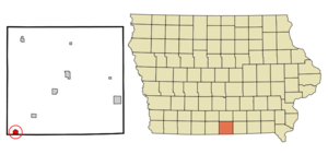
mapsize = 250px
map_caption = Location of Lineville, Iowa
mapsize1 =
map_caption1 =subdivision_type = Country
subdivision_name =
subdivision_type1 = State
subdivision_name1 =
subdivision_type2 = County
subdivision_name2 = Wayne
government_footnotes =
government_type =
leader_title =
leader_name =
leader_title1 =
leader_name1 =
established_title =
established_date =unit_pref = Imperial
area_footnotes =area_magnitude =
area_total_km2 = 2.4
area_land_km2 = 2.4
area_water_km2 = 0.0
area_total_sq_mi = 0.9
area_land_sq_mi = 0.9
area_water_sq_mi = 0.0population_as_of = 2000
population_footnotes =
population_total = 273
population_density_km2 = 116.0
population_density_sq_mi = 300.5timezone = Central (CST)
utc_offset = -6
timezone_DST = CDT
utc_offset_DST = -5
elevation_footnotes =
elevation_m = 332
elevation_ft = 1089
latd = 40 |latm = 35 |lats = 7 |latNS = N
longd = 93 |longm = 31 |longs = 23 |longEW = Wpostal_code_type =
ZIP code
postal_code = 50147
area_code = 641
blank_name = FIPS code
blank_info = 19-45435
blank1_name = GNIS feature ID
blank1_info = 0458412
website =
footnotes =Lineville is a city in Wayne County,
Iowa ,United States . The population was 273 at the 2000 census.Geography
Lineville is located at coor dms|40|35|7|N|93|31|23|W|city (40.585289, -93.523177)GR|1.
According to the
United States Census Bureau , the city has a total area of 0.9square mile s (2.4km² ), all of it land.The town square sits on the Missouri border with the business on the south side of the square in
South Lineville, Missouri . When Wayne County was dry, liquor by the drink could be purchased at the bars on the Missouri side of the square.fact|date=June 2008Transportation
Lineville is located on
U.S. Route 65 . The city is served by the Union Pacific Railroad which was originally the CRI&P (Rock Island). Rail traffic has increased considerably on this line since it was purchased by the Union Pacific. Lineville used to have rail passenger service which was discontinued in the 1960's.Demographics
As of the
census GR|2 of 2000, there were 273 people, 126 households, and 75 families residing in the city. Thepopulation density was 300.5 people per square mile (115.8/km²). There were 150 housing units at an average density of 165.1/sq mi (63.6/km²). The racial makeup of the city was 99.63% White and 0.37% Pacific Islander.There were 126 households out of which 22.2% had children under the age of 18 living with them, 52.4% were married couples living together, 5.6% had a female householder with no husband present, and 39.7% were non-families. 36.5% of all households were made up of individuals and 23.8% had someone living alone who was 65 years of age or older. The average household size was 2.17 and the average family size was 2.82.
In the city the population was spread out with 22.3% under the age of 18, 4.8% from 18 to 24, 23.8% from 25 to 44, 17.2% from 45 to 64, and 31.9% who were 65 years of age or older. The median age was 44 years. For every 100 females there were 88.3 males. For every 100 females age 18 and over, there were 91.0 males.
The median income for a household in the city was $30,625, and the median income for a family was $35,357. Males had a median income of $31,094 versus $18,750 for females. The
per capita income for the city was $18,414. About 18.1% of families and 24.0% of the population were below thepoverty line , including 32.1% of those under the age of eighteen and 22.7% of those sixty five or over.References
External links
Wikimedia Foundation. 2010.